Yantacaw Brook is a tributary of the Third River in Essex County, New Jersey, United States. The brook rises in Montclair and then continues into the Third River in Bloomfield, New Jersey and then into Belleville and Nutley, where it enters the Passaic River. Both Yantacaw Brook and the Third River were referred to by the Lenape people as Yantokah or Yantacaw.
Yanticaw Park
editYanticaw Park, through which the brook flows, is located in Nutley.
Yantacaw Brook Park
edit| Yantacaw Brook Park | |
|---|---|
.jpg) | |
 Interactive map of Yantacaw Brook Park | |
| Location | Montclair, New Jersey |
| Coordinates | 40°50′50″N 74°10′43″W / 40.847093°N 74.178658°W |
| Area | 11.5 acres (4.7 ha) |
| Operator | Montclair Parks and Recreation |
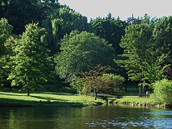
Yantacaw Brook Park is a town operated park located in Montclair. The park covers 11.5 acres (4.7 ha) of land.[1] It has a small pond fed by the stream.[2]
- Yantacaw Brook Park
 View of west end of the park where a small bridge goes over the Yantacaw Brook before flowing into the pond
 The dam which helps keep the pond full
 Edge of the pond


History
edit

Prior to its development as a public park, the land that now comprises Yantacaw Brook Park was part of the Upper Montclair Country Club golf course. The club was established in 1912. A 1927 course layout shows that present-day Yantacaw Pond served as the water feature for the club's 109-yard "Lake Hole" (No. 16). Historical accounts identify the location of the former clubhouse site near the present eastern end of Club Road, while the tee for Hole 17 stood near the present intersection of Club Road and Yantacaw Brook Road. Historical accounts describe Hole 17 as a 450-yard par-4 that played eastward toward Broad Street.[3]
A 1927 map of the Upper Montclair Country Club documents the original layout of the golf course and identifies several landscape features that survive within the modern park, including Yantacaw Pond.[4]
United States Geological Survey maps of the Orange quadrangle, depicting the area in 1947 and 1955, document subsequent changes to the former country club property and surrounding neighborhood.[5][6]
Portions of the former golf course were later developed into nearby streets, including Club Road and The Fairway.[7]
See also
editReferences
edit- ↑ "Update Blog – Info Update Terbaru". www.gotomontclairnj.com. Archived from the original on April 18, 2009.
- ↑ "About the park". Archived from the original on 2017-04-13. Retrieved 2018-01-14.
- ↑ "About Yantacaw Brook Park". Yantacaw Brook Park Conservancy. Retrieved 2026-06-10.
- ↑ "About Yantacaw Brook Park". Yantacaw Brook Park Conservancy. Retrieved 2026-06-10.
- ↑ Orange Quadrangle (Map). 1:24000. United States Geological Survey. 1947.
- ↑ Orange Quadrangle (Map). 1:24000. United States Geological Survey. 1955.
- ↑ "Street Names". Montclair History Center. Retrieved 2026-06-10.