Wikipedia:Featured pictures/Diagrams, drawings, and maps/Maps
|
Directory of featured pictures Animals · Artwork · Culture, entertainment, and lifestyle · Currency · Diagrams, drawings, and maps · Engineering and technology · Food and drink · Fungi · History · Natural phenomena · People · Photographic techniques, terms, and equipment · Places · Plants · Sciences · Space · Vehicles · Other lifeforms · Other | |
|
Diagrams, drawings, and maps: Diagrams · Drawings · Maps; see also: Earth seen from space |
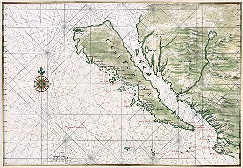
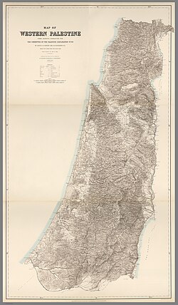 PEF Survey of Palestine map, by the Palestine Exploration Fund
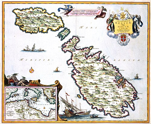 Map of Malta around 1680, by Nicolaes Visscher II
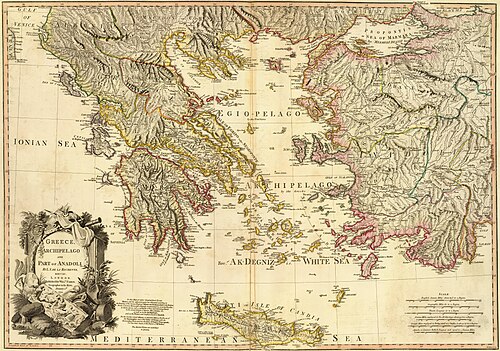 Map of Greece and Anatolia at William Faden, by Louis Stanislas d'Arcy Delarochette
 World map from Theatrum Orbis Terrarum, by Abraham Ortelius
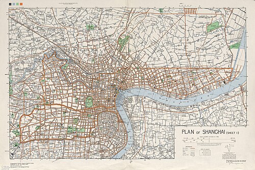 1935 map of Shanghai at Shanghai International Settlement, by the Army Map Service
 Map of the Exposition Universelle of 1900, by GTC


 Index to the Great Trigonometrical Survey, by the Government of India
 Three stages of Lake Estancia, by Guerillero
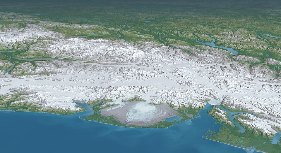 3D rendering of Saint Elias Mountains, by Tom Patterson
 Cases of the 1854 Broad Street cholera outbreak, by John Snow and the University of California, Los Angeles
 3D rendering of Mount Everest, by Tom Patterson
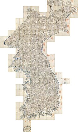
 Survey of Palestine map, by the Survey Department of Palestine (stitched by DutchTreat)
 United States postal route map of 1804 at United States Post Office Department, by Abraham Bradley Jr. and Aaron Arrowsmith
 North Cascades National Park, at and by Heinrich C. Berann
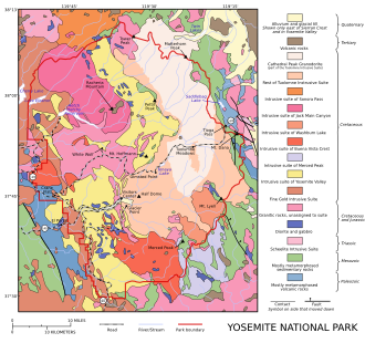
 Yosemite National Park, at and by Heinrich C. Berann
 Yellowstone National Park, at and by Heinrich C. Berann
 Denali National Park and Preserve, at and by Heinrich C. Berann
 Geopolitical world map, by the Central Intelligence Agency

 Turgot map of Paris, overview map, by Louis Bretez and Claude Lucas
 Turgot map of Paris, full map, by Louis Bretez and Claude Lucas
 Turgot map of Paris, sheet 1, by Louis Bretez and Claude Lucas
 Turgot map of Paris, sheet 2, by Louis Bretez and Claude Lucas
 Turgot map of Paris, sheet 3, by Louis Bretez and Claude Lucas
 Turgot map of Paris, sheet 4, by Louis Bretez and Claude Lucas
 Turgot map of Paris, sheet 5, by Louis Bretez and Claude Lucas
 Turgot map of Paris, sheet 6, by Louis Bretez and Claude Lucas
 Turgot map of Paris, sheet 7, by Louis Bretez and Claude Lucas
 Turgot map of Paris, sheet 8, by Louis Bretez and Claude Lucas
 Turgot map of Paris, sheet 9, by Louis Bretez and Claude Lucas
 Turgot map of Paris, sheet 10, by Louis Bretez and Claude Lucas
 Turgot map of Paris, sheet 11, by Louis Bretez and Claude Lucas
 Turgot map of Paris, sheet 12, by Louis Bretez and Claude Lucas
 Turgot map of Paris, sheet 13, by Louis Bretez and Claude Lucas
 Turgot map of Paris, sheet 14, by Louis Bretez and Claude Lucas
 Turgot map of Paris, sheet 15, by Louis Bretez and Claude Lucas
 Turgot map of Paris, sheet 16, by Louis Bretez and Claude Lucas
 Turgot map of Paris, sheet 17, by Louis Bretez and Claude Lucas
 Turgot map of Paris, sheets 18-19, by Louis Bretez and Claude Lucas
 Turgot map of Paris, sheet 20, by Louis Bretez and Claude Lucas
 Map of the County Palatine of Lancaster, by Jodocus Hondius and John Speed (restored by Adam Cuerden)
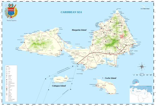 Map of Isla Margarita, by The Photographer
 Map of Iran and Turan, by Adolf Stieler
 Homann Map of Scandinavia, Norway, Sweden, Denmark, Finland and the Baltics at History of Scandinavia, by Johann Homann

 Map of the Kingdom of Armenia, by Cplakidas
 1888 map of Gothenburg, by Ludvig Simon
 Map of Vatican City at Geography of Vatican City, by Thoroe
 Map of the Battle of the Somme, by Grandiose
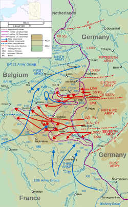


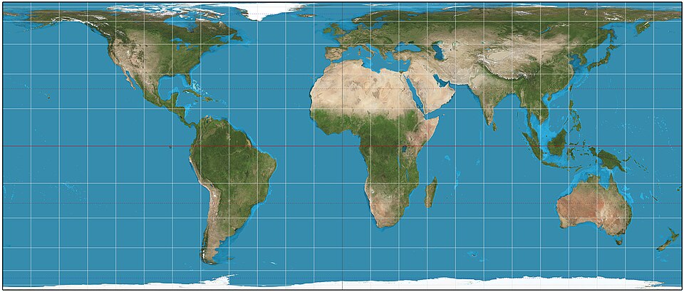


 Hammer retroazimuthal projection, front, by Strebe
 Hammer retroazimuthal projection, back, by Strebe


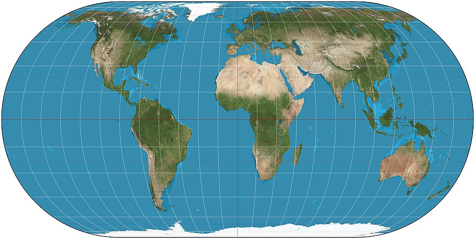
 American Polyconic projection, by Strebe


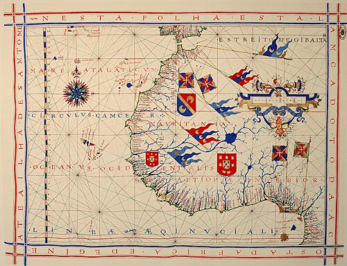
 Cantino planisphere, unknown author
 Map of Lake Bonneville, by Fallschirmjäger
 1924 map of the United States Naval Academy, by C.E. Miller (edited by A Texas Historian)
 Map of the Battle of Jutland, by Grandiose
 Flat Earth map, by Orlando Ferguson (edited by Fallschirmjäger)
 Chernobyl Exclusion Zone, by the Central Intelligence Agency (vectorized by Eric Gaba; edited by Matt Truch and Makeemlighter)
 Painted turtle native range, by Fallschirmjäger
 Castello Plan, by John Wolcott Adams and Isaac Newton Phelps Stokes
 Portolan chart, by Jorge de Aguiar
 Map of Madrid Metro, by Javitomad
 Mitchell Map, by John Mitchell
 1639 nautical chart of the Delaware Bay, by Johannes Vingboons (edited by Durova, NW, and Adam Cuerden)
 Map of the New York City Subway, by countZ
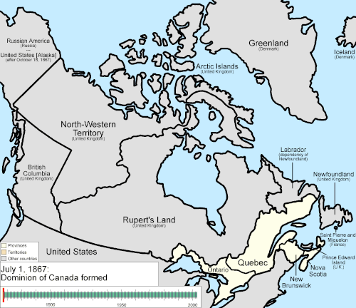 Evolution of the provinces and territories of Canada, by Golbez
 Map of the Ancient Egypt, by Jeff Dahl
 Map of the Russo-Georgian War, by ArdadN
 Map of Germany at List of twin towns and sister cities in Germany, by NordNordWest
 Portolan chart of the Mediterranean, unknown author (edited by Durova)
 Map of the Dublin Rail Network, by Stabilo boss


 1871 map of Yellowstone National Park, by F.V. Hayden (edited by Durova)
 Map of the Antelope Island State Park, by Justinmorris
 Map of Arches National Park, by Justinmorris
 1628 map of the Acapulco Bay, author unknown


 Map of the Olmec heartland, by Madman2001
 Map of Kamianets-Podilskyi, by Nicolas de Fer
 Vinland map, author unknown
 Antique map of the Iberian Peninsula, by Robert Wilkinson
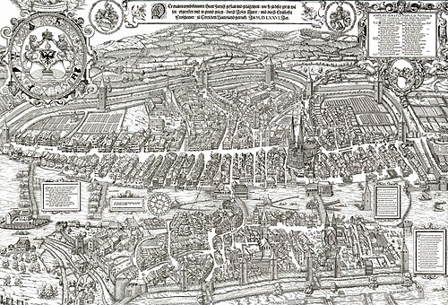
 Topographic map of the Falkland Islands, by Sting
 Evolution of the states of Mexico at Administrative divisions of Mexico, by Golbez


 Major highways in Indian road network, by PlaneMad
 Giza pyramid complex at Giza Necropolis, by MesserWoland
 Indigenous language families of North America at Indigenous languages of the Americas, by ishwar (edited by Mahahahaneapneap and Malus Catulus)
 Map of Area 51, by Finlay McWalter
 Map of Senufo languages, by Mark Dingemanse
 Varying age of bedrock underlying North America at Geography of North America, by United States Geological Survey
 Downtown Chicago plan at Multilevel streets in Chicago, by SPUI


.jpg)


_-_Geographicus_-_EastIndies-cary-1801.jpg)


.jpg)


.svg)

.svg)


3.png)


.svg)


