Out and about
editRedcliffe City, Queensland
edit Entrance to the Scarborough Central Business District along Landsborough Parade
 Scarborough Beach
 Scarborough Boat Harbour in the afternoon sun
 Settlement Cove lagoon in Redcliffe
 Redcliffe Jetty, Redcliffe
 Redcliffe central business district
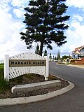 Entrance to Margate Beach, Margate
 Humpybong Creek, Redcliffe
 Evening traffic into Clontarf


Pine Rivers Shire, Queensland
edit North Pine Dam at the precariously low level of 27%

Things
editAnimal
edit Pelican on a Houghton Highway light pole

Art and culture
edit The Arts Centre spire, a Melbourne landmark
 Wooden Yowie statue in Kilcoy, Queensland


Commerce and industry
edit Caltex Woolworths service station in Margate, Queensland
 Coles Express service station in Clontarf, Queensland
- Typical fuel discount vouchers for use at Coles Express


Film and television
edit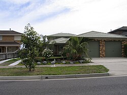 The Kath & Kim family home at Patterson Lakes, Victoria

Food stuffs
edit- Cans of the former formulation of Mother energy drink produced by Coca-Cola Amatil
Infrastructure
edit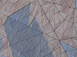 Federation Square's unmistakable sandstone building façade
 Houghton Highway in Queensland, Australia
 Houghton Highway tidal flow system
 Daddi Long Legs bird deterrent on a Houghton Highway light pole


Transport
edit Memorial cairn to commemorate the Camp Mountain train disaster, northwest of Brisbane
 The abandoned Bunour railway station in 2007
 Sign of the then times (1993) at the abandoned Meeandah railway station in 2007
 The abandoned Meeandah railway station in 2007
 A platform shot of disused Pinkenba railway station in 2007
 Disused Pinkenba railway station in 2007, just 9 km from the Brisbane CBD
 Grandchester railway station, home of the world's first narrow gauge mainline railway


Mapping
editLocation
edit
 Suburb map of Woody Point, in the south-east of the Redcliffe peninsula
 Suburb map of Margate, in the east of the Redcliffe peninsula
 Suburb map of Clontarf, in the south-west of the Redcliffe peninsula
 Suburb map of Rothwell, in the west of the Redcliffe peninsula
 Suburb map of Kippa-Ring, at the center of the Redcliffe peninsula
 Suburb map of Redcliffe, in the north-east of the Redcliffe peninsula
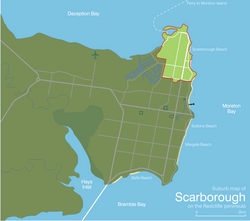 Suburb map of Scarborough, at the northernmost of the Redcliffe peninsula
 Suburb map of Newport, in the north of the Redcliffe peninsula


Transport
edit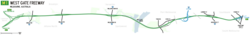 Map of the West Gate Freeway, west of Melbourne
 Map of the Eastern Freeway, east of Melbourne
 Map of the South-East Busway, Brisbane
 Map of the Granville railway disaster, west of Sydney
 Map of the Camp Mountain train disaster, north-west of Brisbane
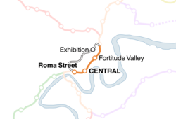 Map of the Exhibition railway line, Brisbane
 Map of the Rosewood railway line, Queensland
 Map of the proposed Springfield railway line, Brisbane
 Map of the proposed Maroochydore railway line, Queensland
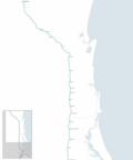
 Map of the Gold Coast railway line, Queensland
 Map of the Beenleigh railway line, Brisbane
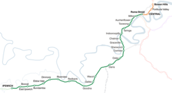 Map of the Ipswich railway line, Brisbane
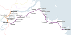 Map of the Cleveland railway line, Brisbane
 Map of the Doomben railway line, Brisbane
 Map of the Airport railway line, Brisbane
 Map of the Caboolture railway line, Brisbane
 Map of the Ferny Grove railway line, Brisbane
 Map of the Shorncliffe railway line, Brisbane
 Map of the Citytrain network spanning South East Queensland


