This article needs additional citations for verification. (February 2024) |
Posterstein is a German municipality in the Thuringian Landkreis of Altenburger Land.
Posterstein | |
|---|---|
 | |
Location of Posterstein
within Altenburger Land district 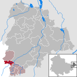 | |
 Location of Posterstein | |
 Posterstein  Posterstein | |
| Coordinates: 50°51′50″N 12°15′27″E / 50.86389°N 12.25750°E | |
| Country | Germany |
| State | Thuringia |
| District | Altenburger Land |
| Municipal assoc. | Oberes Sprottental |
| Subdivisions | 2 |
| Government | |
| • Mayor (2022–28) | Stefan Jakubek[1] |
| Area | |
• Total | 5.53 km2 (2.14 sq mi) |
| Highest elevation | 314 m (1,030 ft) |
| Lowest elevation | 244 m (801 ft) |
| Population (2024-12-31)[2] | |
• Total | 441 |
| • Density | 79.7/km2 (207/sq mi) |
| Time zone | UTC+01:00 (CET) |
| • Summer (DST) | UTC+02:00 (CEST) |
| Postal codes | 04626 |
| Dialling codes | 034496 |
| Vehicle registration | ABG |
| Website | www.posterstein.de |
Geography
editNeighboring municipalities
editMunicipalities near Posterstein are Heukewalde, Löbichau, Nöbdenitz, and Vollmershain in the district of Altenburger Land; as well as Paitzdorf and the city of Ronneburg in the district of Greiz.
Municipal arrangement
editStolzenberg is Posterstein's only subdivision.
History
editWithin the German Empire (1871–1918), Posterstein was part of the Duchy of Saxe-Altenburg.
Culture and landmarks
editThe Postersteiner Burg, which is lit up at night, is the most important building in the town. It is also visible north of the community from the Bundesautobahn 4.
Business and transportation
editThe next train station on the rail line from Posterstein is in Nöbdenitz.
External links
edit- (in German) Burg Posterstein
References
edit- ↑ Gewählte Bürgermeister - aktuelle Landesübersicht, Freistaat Thüringen, accessed 10 November 2022.
- ↑ "Bevölkerung der Gemeinden vom Thüringer Landesamt für Statistik" (in German). Thüringer Landesamt für Statistik.
This Altenburger Land location article is a stub. You can help Wikipedia by adding missing information. |