Selected pictures 1
Portal:Western Sahara/Selected pictures/1
 Satellite overview of Western Sahara

Selected pictures 2

Selected pictures 3

Selected pictures 4
Portal:Western Sahara/Selected pictures/4
 Tribal map of Sahrawi peoples

Selected pictures 5
Portal:Western Sahara/Selected pictures/5
 A warning sign for mines

Selected pictures 6
Portal:Western Sahara/Selected pictures/6
 Isidro López-Aparicio performing the piece: isolation in the Western Sahara desert (Tifariti), denouncing the isolation suffered by the Sahrawi people in the refugee camps of Tindouf since 1975.

Selected pictures 7
Portal:Western Sahara/Selected pictures/7
 Camping in the desert

Selected pictures 8

Selected pictures 9
Portal:Western Sahara/Selected pictures/9
 A rare body of water

Selected pictures 10
Portal:Western Sahara/Selected pictures/10
 Tea in the desert

Selected pictures 11
Portal:Western Sahara/Selected pictures/11
 A NASA Landsat image of the Bou Craa phosphate mine

Selected pictures 12
Portal:Western Sahara/Selected pictures/12
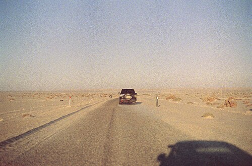 Highway N1, close to the Golfe de Cintra. N1 highway is a major roadway traversing along the Atlantic coastline of the country.

Selected pictures 13
Portal:Western Sahara/Selected pictures/13
 A Dunn's Lark, Aousserd road, Western Sahara

Selected pictures 14
Portal:Western Sahara/Selected pictures/14
 One of the first pictures of the monk seal colony found by Eugenio Morales Agacino on Ras Nouadhibou, Western Sahara (December 26, 1945).
.jpg)
Selected pictures 15
Portal:Western Sahara/Selected pictures/15
 A view of Smara, a city in the Moroccan-controlled part of Western Sahara, with a population of 57,035 recorded in the 2014 Moroccan census.[1]

- ↑ "POPULATION LÉGALE DES RÉGIONS, PROVINCES, PRÉFECTURES, MUNICIPALITÉS, ARRONDISSEMENTS ET COMMUNES DU ROYAUME D'APRÈS LES RÉSULTATS DU RGPH 2014" (in Arabic and French). High Commission for Planning, Morocco. 8 April 2015. Retrieved 29 September 2017.