This article needs more citations. (February 2013) |
Plavecké Podhradie (Hungarian: Detrekőváralja) is a village and municipality in western Slovakia in the Malacky District in the Bratislava region.
Plavecké Podhradie
Detrekőváralja | |
|---|---|
 | |
 Flag  Coat of arms | |
 Plavecké Podhradie Location of Plavecké Podhradie in the Bratislava Region  Plavecké Podhradie Location of Plavecké Podhradie in Slovakia | |
| Coordinates: 48°29′N 17°16′E / 48.48°N 17.27°E | |
| Country | |
| Region | |
| District | Malacky District |
| First mentioned | 1247 |
| Area | |
• Total | 21.18 km2 (8.18 sq mi) |
| Elevation | 218 m (715 ft) |
| Population | |
• Total | 735 |
| Time zone | UTC+1 (CET) |
| • Summer (DST) | UTC+2 (CEST) |
| Postal code | 906 36[2] |
| Area code | +421 34[2] |
| Vehicle registration plate (until 2022) | MA |
| Website | www |
History
editIn historical records the village was first mentioned in 1247 AD.
Geography
editThe municipality lies at an altitude of 218 metres (715 ft)[2] and covers an area of 21.18 km2 (8.18 sq mi) (2025).[4]
Population
edit| Year | 1995 | 2005 | 2015 | 2025 |
|---|---|---|---|---|
| Count | 696 | 695 | 672 | 735 |
| Difference | −0.14% | −3.30% | +9.37% |
| Year | 2024 | 2025 |
|---|---|---|
| Count | 727 | 735 |
| Difference | +1.10% |
It has a population of 735 people (31 December 2025).[6]
Ethnicity
edit| Ethnicity | Number | Fraction |
|---|---|---|
| Slovak | 678 | 97.13% |
| Czech | 14 | 2% |
| Not found out | 10 | 1.43% |
| Other | 7 | 1% |
| Total | 698 |
In year 2021 was 698 people by ethnicity 678 as Slovak, 14 as Czech, 10 as Not found out, 7 as Other, 4 as Rusyn, 2 as Hungarian and 1 as Austrian.
Note on population: The difference values of population numbers in the table "Population statistic" and in the sections "Ethnicity" & "Religion" is caused by the use of various statistical methods.
Religion
edit| Religion | Number | Fraction |
|---|---|---|
| Roman Catholic Church | 493 | 70.63% |
| None | 170 | 24.36% |
| Not found out | 9 | 1.29% |
| Total | 698 |
In year 2021 was 698 people by religion 493 from Roman Catholic Church, 170 from None, 9 from Not found out, 6 from Ad hoc movements, 5 from Evangelical Church, 4 from Greek Catholic Church, 3 from Calvinist Church, 3 from New Apostolic Church, 3 from Buddhism, 1 from Jewish community and 1 from Other.
Infrastructure
editPlavecké Podhradie lies on the street from Lozorno and Jablonica. It can be reached by train from Zohor, seasonally also by trains starting in Záhorská Ves on the border to Austria.
Sights
editPlavecký Castle and few caves in the Little Carpathians are located near the village. There is also an old Celtic oppidum, renaissance chateau of Pálffy family, and ruins of a medieval monastery.
Plavecky castle (remains)
editThe original castle was built in the 13th century. The middle part consisted of a Gothic castle with rectangular tower and the palace. In the 16th century it was expensively rebuilt into renaissance fortress with low courtyards. It was continually fortified and maintained during the 17th century, when new cannon bastions were built. In 1706 it was damaged by the army and so became dilapidated in the 18th century. The remains are visible from surrounding environment, part of Zahorie district can be seen from the remains. Water font is located near the remains.
Gallery
edit Cave PP1
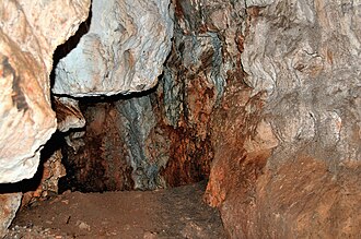 Cave Pri Kríži
 Celtic site Pohanská
 Plavecky castle
 Ruins of monastery church


References
edit- ↑ "Hustota obyvateľstva - obce [om7014rr_obc=AREAS_SK, v_om7014rr_ukaz=Rozloha (Štvorcový meter)]". Statistical Office of the Slovak Republic. March 31, 2026. Retrieved March 31, 2026.
- 1 2 3 4 "Základná charakteristika". www.statistics.sk (in Slovak). Statistical Office of the Slovak Republic. April 17, 2015. Retrieved March 31, 2022.
- ↑ "Počet obyvateľov podľa pohlavia - obce (ročne) [om7101rr_obce=AREAS_SK]". Statistical Office of the Slovak Republic. March 31, 2026. Retrieved March 31, 2026.
- ↑ "Hustota obyvateľstva - obce [om7014rr_obc=AREAS_SK, v_om7014rr_ukaz=Rozloha (Štvorcový meter)]". Statistical Office of the Slovak Republic. March 31, 2026. Retrieved March 31, 2026.
- 1 2 "Počet obyvateľov podľa pohlavia - obce (ročne) [om7101rr_obce=AREAS_SK]". Statistical Office of the Slovak Republic. March 31, 2026. Retrieved March 31, 2026.
- ↑ "Počet obyvateľov podľa pohlavia - obce (ročne) [om7101rr_obce=AREAS_SK]". Statistical Office of the Slovak Republic. March 31, 2026. Retrieved March 31, 2026.
- ↑ "Population - Basic results". www.scitanie.sk. Statistical Office of the Slovak republic. Retrieved November 3, 2025.
- ↑ "Population - Basic results". www.scitanie.sk. Statistical Office of the Slovak republic. Retrieved November 3, 2025.
- ↑ "Population - Basic results". www.scitanie.sk. Statistical Office of the Slovak republic. Retrieved November 3, 2025.
External links
edit![]() Media related to Plavecké Podhradie at Wikimedia Commons
Media related to Plavecké Podhradie at Wikimedia Commons
This article relies largely or entirely on a single source. (November 2007) |
This Bratislava location article is a stub. You can help Wikipedia by adding missing information. |