Khalkhgol (Mongolian: Халхгол, meaning Khalkha river) is a sum (district) of Dornod Province in eastern Mongolia. There are 3,203 people in the sum, including 1,756 in the sum center. The area of the sum is 28,093 km2, with a population density of 0.11 people/km2.[1]
Khalkhgol District
Халхгол сум ᠬᠠᠯᠬᠠᠭᠣᠣᠯᠰᠤᠮᠤ | |
|---|---|
 Khalkhgol District in Dornod Province | |
| Coordinates: 47°37′53″N 118°37′3″E / 47.63139°N 118.61750°E | |
| Country | Mongolia |
| Province | Dornod Province |
| Sum Center | Tsagaanbulag |
| Area | |
• Total | 28,093 km2 (10,847 sq mi) |
| Population | |
• Total | 3,203 |
| • Density | 0.11/km2 (0.28/sq mi) |
| Time zone | UTC+8 (UTC + 8) |
| Postal code | 21010 |
History
editGeography
editKhalkhgol is the largest district in Mongolia by land area. It is the easternmost district in both Dornod Province, and Mongolia as a whole.
Geology
editClimate
editKhalkhgol has a continental climate (Köppen climate classification Dwb) with warm summers and severely cold winters. Most precipitation falls in the summer as rain, with some snow in autumn and spring. Winters are quite dry, with occasional light snow.
| Climate data for Khalkhgol, elevation 688 m (2,257 ft), (1991–2020 normals, extremes 1961–1990, 2002–2023) | |||||||||||||
|---|---|---|---|---|---|---|---|---|---|---|---|---|---|
| Month | Jan | Feb | Mar | Apr | May | Jun | Jul | Aug | Sep | Oct | Nov | Dec | Year |
| Record high °C (°F) | −0.6 (30.9) |
5.1 (41.2) |
21.6 (70.9) |
29.5 (85.1) |
38.0 (100.4) |
40.6 (105.1) |
40.4 (104.7) |
41.7 (107.1) |
34.5 (94.1) |
32.1 (89.8) |
16.8 (62.2) |
5.8 (42.4) |
41.7 (107.1) |
| Mean daily maximum °C (°F) | −17.2 (1.0) |
−12.1 (10.2) |
−1.7 (28.9) |
10.1 (50.2) |
19.5 (67.1) |
25.6 (78.1) |
27.5 (81.5) |
25.6 (78.1) |
19.4 (66.9) |
9.3 (48.7) |
−4.1 (24.6) |
−15.2 (4.6) |
7.2 (45.0) |
| Daily mean °C (°F) | −23.5 (−10.3) |
−19.3 (−2.7) |
−8.7 (16.3) |
3.6 (38.5) |
12.2 (54.0) |
18.7 (65.7) |
21.2 (70.2) |
19.0 (66.2) |
12.0 (53.6) |
2.1 (35.8) |
−10.6 (12.9) |
−20.8 (−5.4) |
0.5 (32.9) |
| Mean daily minimum °C (°F) | −29.8 (−21.6) |
−26.6 (−15.9) |
−16.0 (3.2) |
−3.5 (25.7) |
4.4 (39.9) |
11.3 (52.3) |
15.1 (59.2) |
12.8 (55.0) |
4.9 (40.8) |
−4.4 (24.1) |
−16.5 (2.3) |
−27.0 (−16.6) |
−6.3 (20.7) |
| Record low °C (°F) | −46.7 (−52.1) |
−46.0 (−50.8) |
−40.5 (−40.9) |
−24.1 (−11.4) |
−10.3 (13.5) |
−3.9 (25.0) |
2.0 (35.6) |
0.9 (33.6) |
−11.9 (10.6) |
−24.9 (−12.8) |
−38.5 (−37.3) |
−45.9 (−50.6) |
−46.7 (−52.1) |
| Average precipitation mm (inches) | 2.4 (0.09) |
2.6 (0.10) |
3.8 (0.15) |
10.5 (0.41) |
15.0 (0.59) |
40.2 (1.58) |
95.3 (3.75) |
61.1 (2.41) |
31.0 (1.22) |
11.0 (0.43) |
5.0 (0.20) |
3.2 (0.13) |
281.1 (11.06) |
| Average precipitation days (≥ 1.0 mm) | 0.8 | 0.8 | 1.2 | 1.9 | 3.5 | 8.5 | 14.4 | 10.9 | 6.8 | 2.8 | 1.3 | 0.8 | 53.7 |
| Mean monthly sunshine hours | 191.5 | 208.8 | 261.7 | 260.4 | 292.2 | 294.4 | 287.1 | 286.4 | 245.7 | 335.0 | 185.1 | 162.7 | 3,011 |
| Source 1: NOAA (precipitation and sun 1961–1990) [4] | |||||||||||||
| Source 2: Starlings Roost Weather[5] | |||||||||||||
Administrative divisions
editMaps
edit Tamsag Bulag (1955)
 Lamaiin Süme (1955)


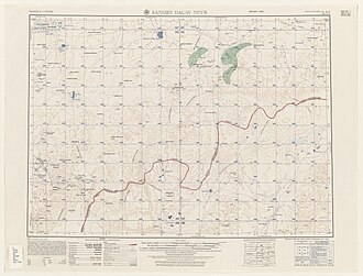 Sangiin Dalay Nurr (1955)
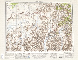 Sabha Horoo (1950)


Tourist attractions
editReferences
edit- ↑ "2009 Annual Report". Dornod Aimag Statistical Office. Archived from the original on 29 April 2012. Retrieved 14 January 2013.
- ↑ B., Misheel (3 October 2018). "Rosneft to donate EUR 8 million to redevelopment of Khalkhgol soum". Mongolian National News Agency. Retrieved 15 February 2025.
- ↑ T., Baljmaa (5 September 2019). "Khalkhgol soum newly developed for 80th anniversary of the Khakhiin Gol Battles". Mongolian National News Agency. Retrieved 15 February 2025.
- ↑ "Khalkhgol Climate Normals 1961-1990". National Oceanic and Atmospheric Administration (FTP). Retrieved January 14, 2013. (To view documents see Help:FTP)
- ↑ "KHALKH-GOL Climate: 1991–2020". Starlings Roost Weather. Retrieved 3 January 2025.
- ↑ "Resident Population in Mongolia, by Bag/Khoroo". Mongolian Statistical Information Service. Archived from the original on 31 August 2025. Retrieved 28 February 2025.