Chouteau Township is a township in Clay County, Missouri, United States.[2] At the 2020 census, its population was 61,255.[3]
Chouteau Township | |
|---|---|
 Interactive map of Chouteau Township | |
| Coordinates: 39°12′47″N 94°30′06″W / 39.2130582°N 94.5018016°W | |
| Country | |
| State | |
| County | Clay |
| Area | |
• Total | 52.85 sq mi (136.9 km2) |
| • Land | 51.94 sq mi (134.5 km2) |
| • Water | 0.91 sq mi (2.4 km2) 1.72% |
| Elevation | 856 ft (261 m) |
| Population | |
• Total | 61,255 |
| • Density | 1,179/sq mi (455/km2) |
| FIPS code | 29-04713780[1] |
| GNIS feature ID | 766504[2] |
Gallatin Township was established in the early 1820s, taking its name from Albert Gallatin.[4]
Settlements
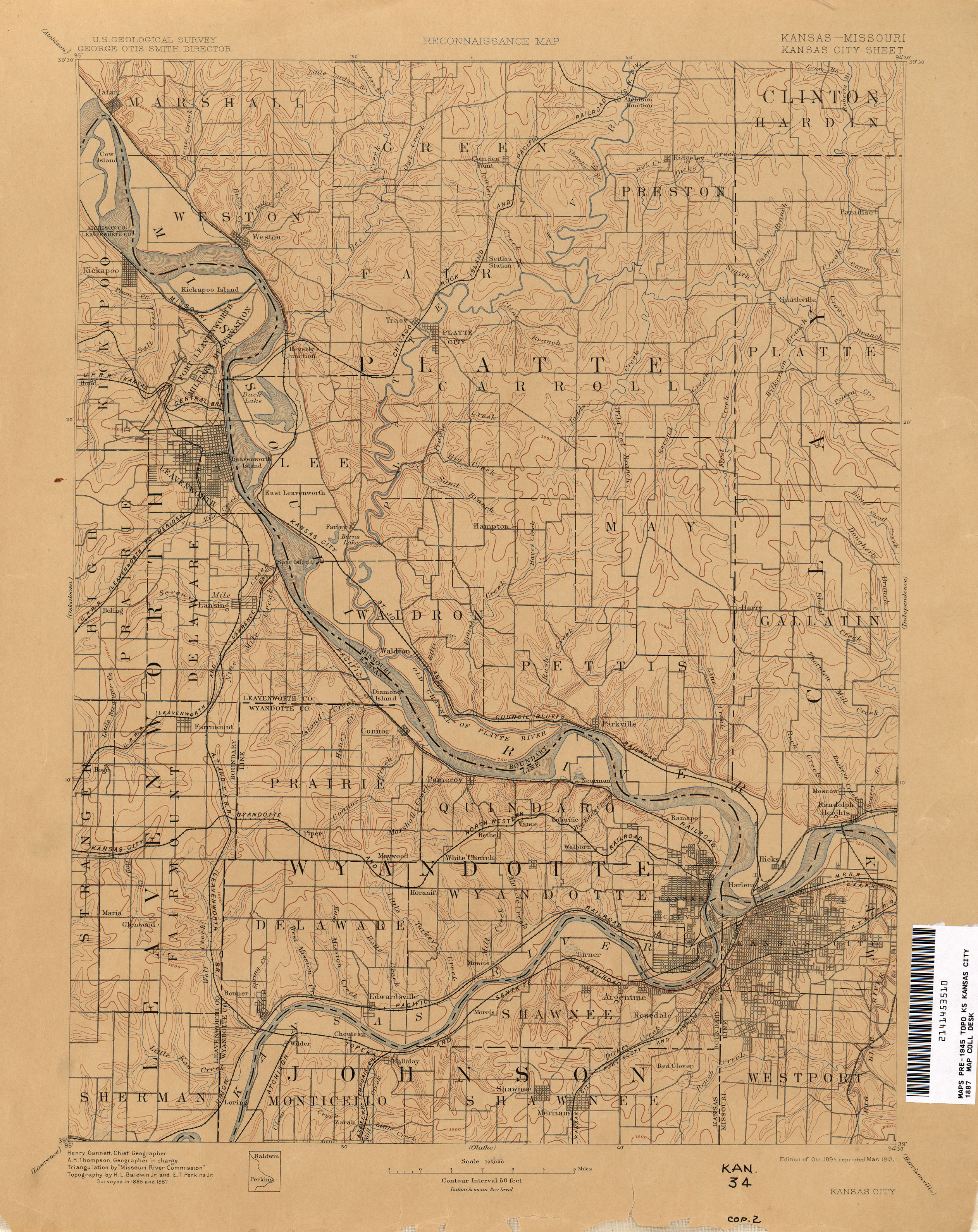
editHarlem[5] was a small settlement on the Kansas River Bend of the Missouri River. The Kansas City, St. Joseph, and Council Bluffs Railroad passed through the town and crossed the river just north of Kansas City, Missouri.[6] Today Harlem is a small industrial neighborhood in the southern portion of the Northland region in Kansas City.
Hicks was a small settlement just northeast of Harlem located where North Kansas City, Missouri is today.[6]
References
edit- 1 2 "MO TIGER County Subdivisions". Missouri Spatial Data Information Service. United States Census Bureau. Retrieved April 21, 2025.
- 1 2 3 U.S. Geological Survey Geographic Names Information System: Gallatin Township, Clay County, Missouri
- 1 2 "Census 2020 DHC Extract Assistance". Missouri Census Data Center. Retrieved April 21, 2025.
- ↑ "Clay County Place Names, 1928–1945 (archived)". The State Historical Society of Missouri. Archived from the original on June 24, 2016. Retrieved September 21, 2016.
{{cite web}}: CS1 maint: bot: original URL status unknown (link) - ↑ U.S. Geological Survey Geographic Names Information System: Gallatin Township, Clay County, Missouri
- 1 2 "Kansas City - 1887". The University of Texas at Austin. USGS. Retrieved August 25, 2025.
This Clay County, Missouri state location article is a stub. You can help Wikipedia by adding missing information. |