Mitrovica District (Albanian: Rajoni i Mitrovicës; Serbian Cyrillic: Косовскомитровачки округ) is one of the seven districts of Kosovo. Its administrative center and largest city is Mitrovica. The district borders on the District of Peja to the south-west, the District of Pristina to the south and east, and Serbia to the north and northwest.
District of Mitrovica
| |
|---|---|
.svg) Location of Mitrovica District in Kosovo | |
| Country | |
| Capital | Mitrovica |
| Area | |
• Total | 2,077 km2 (802 sq mi) |
| Population (2024)[1] | |
• Total | 190,591 |
| • Rank | 3rd |
| • Density | 91.76/km2 (237.7/sq mi) |
| Postal code | 40000 |
| Vehicle registration | 02 |
| Municipalities | 7 |
| Settlements[2] | 267 |
| HDI (2023) | 0.802 very high · 2nd |
History
editAntiquity
editThe first human habitations here can be traced back to the Prehistoric period. Some Neolithic sites have been discovered in the Mitrovica District, such as in Runik, Žitkovac-Karagaç, Vallaç and Fafos. This region was populated by Dardanians, an Illyrian tribe that lived in the territory of modern-day Kosovo.


By the end of the 1st century BC, the Romans invaded the region. At the time, one of the most important centres in the region was Municipium Dardanorum, located in Sočanica, Leposavić. Archeological sites from the Roman period were also found in the territory of Vushtrri (Viciana), for example the ruins in Pestova and the Rashan Fortress.
Following the fall of the Roman Empire, the Mitrovica was fell into the Byzantine Empire. During the Justinian I period (527-565AD), the Old Fortress in Vushtrri was built, which remains the city center today.[3][4]
Middle Ages
edit
By the end of the 9th century, the region of Mitrovica became part of the Bulgarian state of Samuel.[5][6] The area was conquered by the Nemanjić dynasty in 1185. During Serbian rule, the region and Kosovo in general became a political and spiritual centre of the kingdom. The Ottomans later conquered the region in the 14th century and stayed until the 17th century. During this Ottoman period, Islam spread and many mosques, Turkish baths, madrasah, bridges and Ottoman houses were built. The cities of Vushtrri, Mitrovica and Zvečan became some of the largest cities in the region, and some of the most important in the Ottoman Empire.
20th century
editIn 1912, after the Ottoman capitulation, Serbia acquired the territory of Kosovo. In the first World War, the region was part of the Austro-Hungarian Empire (1915–18), then part of the Kingdom of Serbs, Croats and Slovenes. In World War II, Germany conquered most of the territory in the region, while other areas fell to the Italians. After World War II, the economy grew in the region under Yugoslavia.
Geography
editRelief
edit
The terrain of the Mitrovica District is rugged and mountainous, comprising the south portion of Kopaonik mountain on the north-east, with the highest point Pančić's Peak 2,017 meters above sea level (the northernmost extremity of Kosovo). The mountain ranges of Rogozna and Mokra Gora extend on the north-west by Zubin Potok with the peak of Berim, 1,731 meters (5,679 ft). The northern part of Drenica and Qyqavica mountain occupies the south-west part of region, while in the south east the boundary extends on the Plain of Kosovo. In the center of the region is the Ibar valley, where Mitrovica lies.
Hydrography
edit
Regarding hydrography, Mitrovica District constitutes one of the richest regions in Kosovo. While a mountainous area, there are many small river sources in the region, and two of the most important rivers in Kosovo, Ibar and Sitnica, flow here.
Ibar originates in Rožaje, eastern Montenegro, passes through Sandžak and enters Kosovo by the town of Zubin Potok. Near this town, the river is dammed by the Gazivoda Dam, creating the artificial Lake Gazivode.

As the largest lake in Kosovo (area 11.9 km2 or 4.6 sq mi, altitude 693 m or 2,274 ft, depth 105 m or 344 ft), Gazivoda Lake represents one of the most important assets of Kosovo's economy. Below Gazivode, another reservoir is created, Lake Pridvorice. In Mitrovica, the Ibar receives Lushta river and Sitnica, which consist of the longest river in Kosovo. Sitnica passes through the town of Vushtrri what makes an important element for agriculture in this area. In Mitrovica it receives Trepça river which originates from Bajgora mountains, of Kopaonik range.
Demographics
editPopulation
editAccording to the official census of 2024 by the Kosovo Agency of Statistics, the district of Mitrovica has a population of 190,591. The majority of the population is concentrated in the municipalities of Mitrovica, Vushtrri and Skenderaj. The largest municipality is Mitrovica (64,742 inhabitants) and the smallest Zveçan (2,867 inhabitants).[1]
| Municipality | Population (2024)[1] | Area (km2) |
|---|---|---|
| Mitrovica | 64,742 | 350 |
| Vushtrri | 61,528 | 344 |
| Skenderaj | 40,664 | 378 |
| Leposavić | 9,485 | 539 |
| North Mitrovica | 7,920 | 11 |
| Zubin Potok | 3,385 | 333 |
| Zvečan | 2,867 | 122 |
| Mitrovica District | 190,591 | 2,077 |
Ethnicities
editThe municipalities of Mitrovica, Vushtrri and Skenderaj have an Albanian majority, whilst the municipalities of North Mitrovica, Zubin Potok, Zvečan and Leposavić have an ethnic Serb majority.
| Municipality | Total | Ethnicity[1] | |||||||||
|---|---|---|---|---|---|---|---|---|---|---|---|
| Albanians | Serbs | Turks | Bosniaks | Romani | Ashkali | Egyptians | Gorani | Others | Prefer not to Answer | ||
| Mitrovica | 64,742 | 62,693 | 18 | 257 | 278 | 372 | 1 012 | 47 | 10 | 43 | 12 |
| Vushtrri | 61,528 | 60,847 | 207 | 230 | 22 | 129 | 45 | 0 | 0 | 32 | 16 |
| Skenderaj | 40,664 | 40 389 | 223 | 5 | 15 | 2 | 3 | 8 | 0 | 11 | 8 |
| Leposavić | 9,485 | 178 | 8,648 | 3 | 344 | 0 | 0 | 0 | 0 | 156 | 156 |
| North Mitrovica | 7,920 | 1,489 | 5,594 | 85 | 360 | 1 | 29 | 0 | 104 | 221 | 37 |
| Zubin Potok | 3,385 | 682 | 2,702 | 0 | 0 | 0 | 0 | 0 | 1 | 0 | 0 |
| Zvečan | 2,867 | 360 | 2,505 | 0 | 2 | 0 | 0 | 0 | 0 | 0 | 0 |
Official languages
editAdministrative divisions
editMunicipalities
editUntil 2012 the district of Mitrovica was divided into six municipalities. In 2013, after November elections in Kosovo, North Mitrovica officially became a separate municipality.

Settlements in Mitrovica District
editThis is the list of 48 settlements in the municipality of Mitrovica.
|
|
This is the list of 67 settlements in the municipality of Vushtrri.
|
|
|
|
Gallery
edit Landscape near Vushtrri
 Hotel Jadran building in Mitrovica
 Orthodox Church and Zvecan lead smelter chimney
 Ibar River in Mitrovica
 City of Vushtrri
 Hotel Jadran building in Mitrovica
 Cerajë village
 City of Vushtrri at night
 "Adem Jashari" square in Skenderaj
 Adem Jashari memorial in Prekaz i Epërm
 Adem Jashari memorial in Prekaz
 The fortress of Vushtrri
 Old Stone Bridge in Vushtrri
 Forests near Vushtrri
 Old Hamam in Vushtrri
 City of Vushtrri
 The Building of the Old Hamam in Mitrovica
 Holy Trinity Church, Zubin Potok
 Sitnica river from the bridge
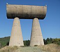 The miners monument in Northern Mitrovica
 The main bridge above Ibar River in Mitrovica
 Bayram Paşa Mosque in the center of Mitrovica


.jpg)
.jpg)


See also
editReferences
edit- 1 2 3 4 "Popullsia sipas gjinisë, etnicitetit dhe vendbanimit" [Population by gender, ethnicity, and place of residence] (PDF) (in Albanian). Prishtinë: Kosovo Agency of Statistics. July 2025.
{{cite web}}: CS1 maint: url-status (link) - ↑ "Komunat në rajonin e Mitrovicës". Archived from the original on 2020-09-01. Retrieved 2015-01-10.
- ↑ "How to Navigate the Process of Obtaining Police Checks in Australia" (PDF). Invest KS. Archived from the original on March 3, 2016.
- ↑ "Kalaja e Vushtrrisė - Atraksione - Kosova - KosovoGuide". Archived from the original on 2016-03-04. Retrieved 2014-03-02.
- ↑ "Komuna Mitrovice - Histori". Archived from the original on 2014-08-15. Retrieved 2014-03-02.
- ↑ "Archived copy". Retrieved 2014-03-02.
{{cite web}}: CS1 maint: deprecated archival service (link) - ↑ "Implementation of the Law on the Use of Languages by Kosovo Municipalities".