This article needs additional citations for verification. (August 2022) |
Havelland (German pronunciation: [ˈhaːfəlˌlant]) is a district or county in Brandenburg, Germany. It is bounded by (from the north and clockwise) the districts of Ostprignitz-Ruppin and Oberhavel, the city-state of Berlin, the district of Potsdam-Mittelmark, the city of Brandenburg and the state of Saxony-Anhalt (districts of Jerichower Land and Stendal).
Havelland | |
|---|---|
 Flag  Coat of arms | |
 | |
| Country | Germany |
| State | Brandenburg |
| Capital | Rathenow |
| Government | |
| • District admin. | Roger Lewandowski (CDU) |
| Area | |
• Total | 1,717 km2 (663 sq mi) |
| Population (31 December 2024)[1] | |
• Total | 170,834 |
| • Density | 99.50/km2 (257.7/sq mi) |
| Time zone | UTC+01:00 (CET) |
| • Summer (DST) | UTC+02:00 (CEST) |
| Vehicle registration | HVL, NAU, RN |
| Website | http://www.havelland.de |

brown = more than 45 m above sea level,
green = forests, mostly more than 45 m above sea level
History
editThe district was established in 1993 by merging the former districts of Nauen and Rathenow.
Demography
edit Development of Population since 1875 within the Current Boundaries (Blue Line: Population; Dotted Line: Comparison to Population Development of Brandenburg state)
 Recent Population Development and Projections (Population Development before Census 2011 (blue line); Recent Population Development according to the Census in Germany in 2011 (blue bordered line); Official projections for 2005-2030 (yellow line); for 2014-2030 (red line); for 2017-2030 (scarlet line)
Landkreis Havelland: Population development within the current boundaries (2017)[2] | ||||||||||||||||||||||||||||||||||||||||||||||||||||||||||||||||||||||||||||||||||||||||||||||||||||||||||||||||||||||||||||||||||||||||||||
|
|
| ||||||||||||||||||||||||||||||||||||||||||||||||||||||||||||||||||||||||||||||||||||||||||||||||||||||||||||||||||||||||||||||||||||||||||
Geography
editCoat of arms
edit
The red eagle is the heraldic animal of Brandenburg. The head of the eagle is part of the coat of arms of Rathenow. The swan is often used as a symbol for the Havelland region.
Towns and municipalities
edit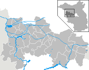
| Amt-free towns | Ämter | |
|---|---|---|
|
|
1. Friesack 2. Nennhausen |
3. Rhinow |
| 1seat of the Amt; 2town | ||
References
edit- ↑ "Bevölkerungsstand im Land Brandenburg Dezember 2024 (Fortgeschriebene amtliche Einwohnerzahlen, basierend auf dem Zensus 2023)" (XLS). Amt für Statistik Berlin-Brandenburg (in German).
- ↑ Detailed data sources are to be found in the Wikimedia Commons.Population Projection Brandenburg at Wikimedia Commons
External links
editWikimedia Commons has media related to Havelland.
- Official website (German)
- tourist website (German, English)