The Flagstaff Gardens is a 7.2-hectare (18-acre) urban park located in the city centre of Melbourne, in Victoria, Australia. Established in 1862, and formally reserved in 1873,[1]: 5 the gardens are the oldest public park[2] and are one of the most visited parks in the city, accessed by residents, nearby office workers, and tourists.
| Flagstaff Gardens | |
|---|---|
 The gardens in 2010 | |
 Location of the gardens in Melbourne | |
 Interactive map of Flagstaff Gardens | |
| Type | Urban park |
| Location | Melbourne, Victoria, Australia |
| Coordinates | 37°48′38″S 144°57′16″E / 37.8105°S 144.9544°E |
| Area | 7.2 ha (18 acres) |
| Designated | 1873 (as a reserve) |
| Opened | 1862 |
| Designer |
|
| Owner | Government of Victoria (as Crown land) |
| Operator | City of Melbourne |
| Visitors | c. 1.64 million (in 2000)[1] |
| Open | All year |
| Status | Open |
| Paths | Sealed |
| Terrain | Flat |
| Vegetation |
|
| Species | |
Public transit |
|
| Landmarks |
|
| Facilities |
|
| Website | melbourne.vic.gov.au |
Official name | Flagstaff Gardens |
| Type | Registered place |
| Designated | 25 March 2004 |
| Reference no. | H2041 |
| HO793 | |
Categories |
|
Official name | Flagstaff Gardens |
| Type | Defunct register |
| Designated | undated |
| Reference no. | 100528 |
The gardens are located on the traditional lands of the Boonwurrung and Woiwurrung people, managed as Crown land by the City of Melbourne, bounded by William, La Trobe, King and Dudley streets. On the southeast corner opposite is the entrance to the eponymous Flagstaff railway station. Diagonally opposite stands the Victorian branch of the Royal Mint and on the northeast corner over William Street, is the Queen Victoria Market.
The gardens were added to the Victorian Heritage Register on 25 March 2004 in recognition of their archaeological, horticultural, historical and social significance;[3] and, on unknown dates, were added to the now defunct Register of the National Estate[4] and to a non-statutory list by the Victorian branch of the National Trust.[5]
Description
editThe park contains extensive lawns with a variety of mature trees, flowerbeds and wild animals including possums. The southern end is characterised by deciduous trees, while the northern end contains mature eucalypts. Avenues of elms shade pathways along with several large Moreton Bay fig trees. The north corner contains a bowling lawn, rose beds, flower and shrub beds. Along William Street there are tennis courts, which also double as volleyball, handball and netball courts. Electric barbecues nearby provides a popular site for office parties in December. Scattered about the lawns and gardens are memorials and sculptures that illuminate some of the social significance of the area.
At the listing ceremony by the Victorian Heritage Council in April 2004, Council Chair Chris Gallagher stated,[3]
"This listing ensures the much loved trees, landscaping and other individual features are conserved and protected. But it also means the whole site is recognised as an important place for gaining an insight into our historical, archaeological, aesthetic, horticultural and social heritage."
History
editThe high ground between William and King Streets was known as Brejerrenywun to the Boonwurrung and Woiwurrung.[6]
With the establishment of Melbourne in 1835, the first deaths in the colony were there buried, in what became colloquially known as Burial Hill,[7] with panoramic views over the Yarra River and Port Phillip. By 1838, the Melbourne cemetery was marked out in what is now the Queen Victoria Market, and burials continued at that location.[8]
The following year, Superintendent Charles La Trobe first included the site as part of the green belt encircling Melbourne which included Batman's Hill, Carlton Gardens, Fitzroy Gardens, Treasury Gardens and the Kings Domain. A flagstaff was erected on the hill in 1840 as part of a signalling system between the town and ships in the Port of Melbourne. The flagstaff proved too small and the following year a 50-foot (15 m) flagstaff was erected. The site was the location for the announcement of the establishment of the Colony of Victoria on 11 November 1850, being its separation from the Colony of New South Wales, resulting in celebrations with a huge bonfire with approximately 5,000 townspeople in attendance. By 1857, the Melbourne cemetery was established and a cutting was excavated to ease the gradient of King Street and created a bluestone retaining wall of the high bank along the western boundary.[3]
Between 1857 and 1863, the site was the location for an observatory and weather station, under the direction of Georg von Neumayer and later, William John Wills, before his appointment to the Burke & Wills expedition. The observatory moved to the Kings Domain when the Melbourne Observatory was established, as iron in the buildings surrounding Flagstaff Hill were affecting Neumayer's magnetic observations. During the 1860s, signalling by flags was superseded by the electrical telegraph, making the flagstaff redundant. Local residents petitioned for the hill to be converted into public gardens or a recreation reserve; proclaimed in 1862.[3]
Clement Hodgkinson prepared a plan for the gardens and directed its implementation; also designing several other gardens and parks adjacent to the Melbourne city centre. A memorial to Melbourne's pioneers erected in 1871 and, under the direction of John Guilfoyle, during the 1890s, a more formal network of paths, lawns, trees and flowerbeds was established.[3]
On 9 October 1917 the City of Melbourne was appointed responsible for the Flagstaff Gardens and one of Melbourne's first children's playgrounds was created in the subsequent year. A monument was built in 1950 on the site of the old flagstaff to mark Victoria's centenary of self-government.[9] On 22 January 2026, the memorial to Melbourne's pioneers was destroyed in the lead-up to Australia Day. The smashed monument was daubed with the words “land back” and “death to Australia” in red paint, along with an inverted red triangle, a symbol associated with the designated terrorist organisation Hamas.[10][11]
Gallery
edit
 Facing north east in the gardens
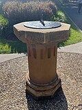 Sundial in the gardens
 A statue by Paul Raphael Montford
 Jacaranda, Summer, 2019
 Autumn, 2015


See also
editReferences
edit- 1 2 "Flagstaff Gardens Master Plan" (PDF). City of Melbourne. December 2000. Retrieved 31 May 2026.
- ↑ "Victorian Branch: Special walk & talk at Flagstaff Gardens, West Melbourne". Australian Garden History Society. 11 December 2025. Retrieved 31 May 2026.
- 1 2 3 4 5 "Flagstaff Gardens, Victorian Heritage Register (VHR) Number H2041, Heritage Overlay HO793". Victorian Heritage Database. Heritage Victoria. Retrieved 31 May 2026.
- ↑ "Flagstaff Gardens (Place ID 100528)". Australian Heritage Database. Australian Government. n.d. Retrieved 31 May 2026.
- ↑ "Flagstaff Gardens, Victorian Heritage Register (VHR) Number H2041". Victorian Heritage Database. Heritage Victoria. Retrieved 31 May 2026.
- ↑ Clark, Ian D. (2002). Dictionary of Aboriginal placenames of Melbourne and Central Victoria. Melbourne: Victorian Aboriginal Corp. for Languages. p. 62. ISBN 0957936052.
- ↑ "BURIAL HILL TO FLAGSTAFF GARDENS". The Argus. Melbourne. 10 November 1934. p. 8. Retrieved 23 June 2013 – via Trove. National Library of Australia.
- ↑ "Flagstaff Gardens". City of Melbourne. Retrieved 31 May 2026.
- ↑ Whitehead, Georgina (July 2008). "Flagstaff Gardens". eMelbourne.net.au. School of Historical & Philosophical Studies, The University of Melbourne. Retrieved 31 May 2026.
- ↑ "Colonial monuments vandalised, graffitied in Melbourne gardens". ABC News. Australia. 21 January 2026. Retrieved 22 January 2026.
- ↑ Convery, Stephanie (22 January 2026). "'Land back': colonial monuments destroyed and vandalised in Melbourne's Flagstaff gardens". Guardian Australia. ISSN 0261-3077. Retrieved 22 January 2026.
Firther reading
edit- Whitehead, Georgina (October 1990). A History of the Flagstaff Gardens.
External links
edit- "Flagstaff Gardens". City of Melbourne. Retrieved 31 May 2026.
- "Flagstaff Gardens Master Plan" (PDF). City of Melbourne. December 2000. Retrieved 31 May 2026.