
Commons is a freely licensed media file repository. You can help.
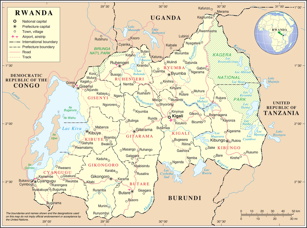
| Description | United Nations Map showing Rwanda prior to the reform of its subdivision in 2006 | |||
| Source | ||||
| Author | United Nations Cartographic Section | |||
| Permission (Reusing this file) |
|

File history
Click on a date/time to view the file as it appeared at that time.
| Date/Time | Thumbnail | Dimensions | User | Comment | |
|---|---|---|---|---|---|
| current | 02:11, 24 October 2007 | | 3,038 × 2,258 (1.43 MB) | Renamed user 73876485f2f7c42af5f2a33994cf3cb0 | {{UN map}} Category:Maps of Rwanda |
File usage
The following 3 pages use this file:
Global file usage
The following other wikis use this file:
- Usage on avk.wikipedia.org
- Usage on ca.wikipedia.org
- Usage on ckb.wikipedia.org
- Usage on fa.wikipedia.org
- Usage on fr.wikipedia.org
- Usage on ha.wikipedia.org
- Usage on id.wikipedia.org
- Usage on ja.wikipedia.org
- Usage on ka.wikipedia.org
- Usage on ko.wikipedia.org
- Usage on mg.wikipedia.org
- Usage on mk.wikipedia.org
- Usage on mzn.wikipedia.org
- Usage on nl.wikipedia.org
- Usage on no.wikipedia.org
- Usage on pl.wiktionary.org
- Usage on ru.wikipedia.org
- Usage on rw.wikipedia.org
- Usage on sl.wikipedia.org
- Usage on uk.wikipedia.org
- Usage on wa.wikipedia.org
- Usage on www.wikidata.org