
Size of this preview: 960 × 1,074 pixels. Other resolutions: 250 × 280 pixels | 500 × 559 pixels | 960 × 1,074 pixels | 1,920 × 2,147 pixels | 3,840 × 4,295 pixels.
Original file (4,949 × 5,535 pixels, file size: 6.85 MB, MIME type: image/jpeg)
This is a file from the Wikimedia Commons. Information from its description page there is shown below.
Commons is a freely licensed media file repository. You can help.
Commons is a freely licensed media file repository. You can help.
Summary
| Description |
English: NJ 43 Su-fu [U.S.S.R., China, Afghanistan, Pakistan, State of Jammu and Kashmir] Series 1301, Edition 5-AMS, Map from the International Map of the World 1:1,000,000 |
| Date |
Compiled: 1966 Printed: March 1967 Scanned: 2007-06-25 10:10:38 |
| Source | Courtesy of the University of Texas Libraries, The University of Texas at Austin. ([1]) |
| Author | Army Map Service, US Federal Government |
-
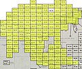 Index Map

![[1]](http://legacy.lib.utexas.edu/maps/imw/txu-oclc-6654394-nj-43-5th-ed.jpg)
Licensing
This image or file is a work of a U.S. Army Corps of Engineers soldier or employee, taken or made as part of that person's official duties. As a work of the U.S. federal government, the image is in the public domain.
|
File history
Click on a date/time to view the file as it appeared at that time.
| Date/Time | Thumbnail | Dimensions | User | Comment | |
|---|---|---|---|---|---|
| current | 05:15, 7 December 2019 | | 4,949 × 5,535 (6.85 MB) | Geographyinitiative | User created page with UploadWizard |
File usage
The following 25 pages use this file:
- Afghanistan–China border
- Afghanistan–Tajikistan border
- Artush
- Beyik Pass
- China–Kyrgyzstan border
- China–Pakistan border
- China–Tajikistan border
- Dafdar
- Erkeshtam
- History of Kashgar
- Kargilik County
- Kashgar Prefecture
- Kiziloy
- Kokyar
- Kulma Pass
- Kyrgyzstan–Tajikistan border
- Makit County
- Nezatash Pass
- Payzawat County
- Poskam County, Xinjiang
- Shule County
- Yarkand River
- Yarkant County
- Yengisar County
- Yopurga County
Global file usage
The following other wikis use this file:
- Usage on az.wikipedia.org
- Usage on en.wiktionary.org
- Usage on es.wikipedia.org
- Usage on fr.wikipedia.org
- Usage on hr.wikipedia.org
- Usage on it.wikipedia.org
- Usage on ja.wikipedia.org
- Usage on kaa.wikipedia.org
- Usage on ko.wikipedia.org
- Usage on ro.wikipedia.org
- Usage on ru.wikipedia.org
- Usage on tg.wikipedia.org
- Usage on tr.wikipedia.org
- Usage on uz.wikipedia.org
- Usage on zh.wikipedia.org