Size of this preview: 705 × 599 pixels. Other resolutions: 282 × 240 pixels | 565 × 480 pixels | 1,000 × 850 pixels.
Original file (1,000 × 850 pixels, file size: 256 KB, MIME type: image/png)
This is a file from the Wikimedia Commons. Information from its description page there is shown below.
Commons is a freely licensed media file repository. You can help.
Commons is a freely licensed media file repository. You can help.
Summary
| Description |
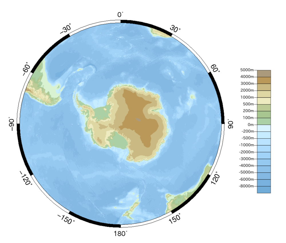
English: The topographic map of Antarctica in orthographic projection, based on ETOPO2v2. |
| Date | |
| Source | Own work |
| Author | Jugger90 |
Licensing
| I, the copyright holder of this work, release this work into the public domain. This applies worldwide. In some countries this may not be legally possible; if so: I grant anyone the right to use this work for any purpose, without any conditions, unless such conditions are required by law. |
File history
Click on a date/time to view the file as it appeared at that time.
| Date/Time | Thumbnail | Dimensions | User | Comment | |
|---|---|---|---|---|---|
| current | 02:07, 6 February 2011 | | 1,000 × 850 (256 KB) | Jugger90 | size adjustment |
| 18:25, 5 February 2011 |  | 1,050 × 900 (282 KB) | Jugger90 | {{Information |Description ={{en|1=topographic map of antarctica in orthographic projection. based on ETOPO2v2}} |Source ={{own}} |Author =Jugger90 |Date =2011-02-05 |Permission = |other_versions = }} [[ |
File usage
The following page uses this file: