Size of this preview: 450 × 600 pixels. Other resolutions: 180 × 240 pixels | 360 × 480 pixels | 576 × 768 pixels | 1,200 × 1,600 pixels.
Original file (1,200 × 1,600 pixels, file size: 480 KB, MIME type: image/jpeg)
This is a file from the Wikimedia Commons. Information from its description page there is shown below.
Commons is a freely licensed media file repository. You can help.
Commons is a freely licensed media file repository. You can help.
Summary
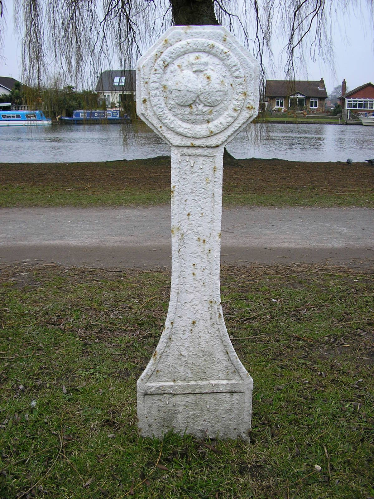
| Description | A boundary marker of the Thames Conservancy at grid reference TQ 092 664 about 100 metres upstream from the bridge at e. If it had been there when Canaletto painted this picture, it would have been seen on the far bank and directly below the centre of the bridge. |
| Date | Taken on 14 March 2006 |
| Source | Own work by the original uploader |
| Author | Roger W Haworth (talk · contribs) |
| Permission (Reusing this file) |
See below |
| Object location | | View this and other nearby images on: OpenStreetMap |
|---|
Licensing
Roger W Haworth, the copyright holder of this work, hereby publishes it under the following license:

|
Permission is granted to copy, distribute and/or modify this document under the terms of the GNU Free Documentation License, Version 1.2 or any later version published by the Free Software Foundation; with no Invariant Sections, no Front-Cover Texts, and no Back-Cover Texts. A copy of the license is included in the section entitled GNU Free Documentation License. |
| This file is licensed under the Creative Commons Attribution-Share Alike 3.0 Unported license. | ||
Attribution:
| ||
| ||
| This licensing tag was added to this file as part of the GFDL licensing update. |
File history
Click on a date/time to view the file as it appeared at that time.
| Date/Time | Thumbnail | Dimensions | User | Comment | |
|---|---|---|---|---|---|
| current | 02:39, 14 February 2007 | | 1,200 × 1,600 (480 KB) | RHaworth |
File usage
The following 2 pages use this file:
Global file usage
The following other wikis use this file:
- Usage on de.wikipedia.org
- Usage on www.wikidata.org