Size of this preview: 800 × 505 pixels. Other resolutions: 320 × 202 pixels | 640 × 404 pixels | 1,024 × 647 pixels | 1,280 × 808 pixels | 2,995 × 1,891 pixels.
Original file (2,995 × 1,891 pixels, file size: 1.7 MB, MIME type: image/jpeg)
This is a file from the Wikimedia Commons. Information from its description page there is shown below.
Commons is a freely licensed media file repository. You can help.
Commons is a freely licensed media file repository. You can help.
Summary
| Description |
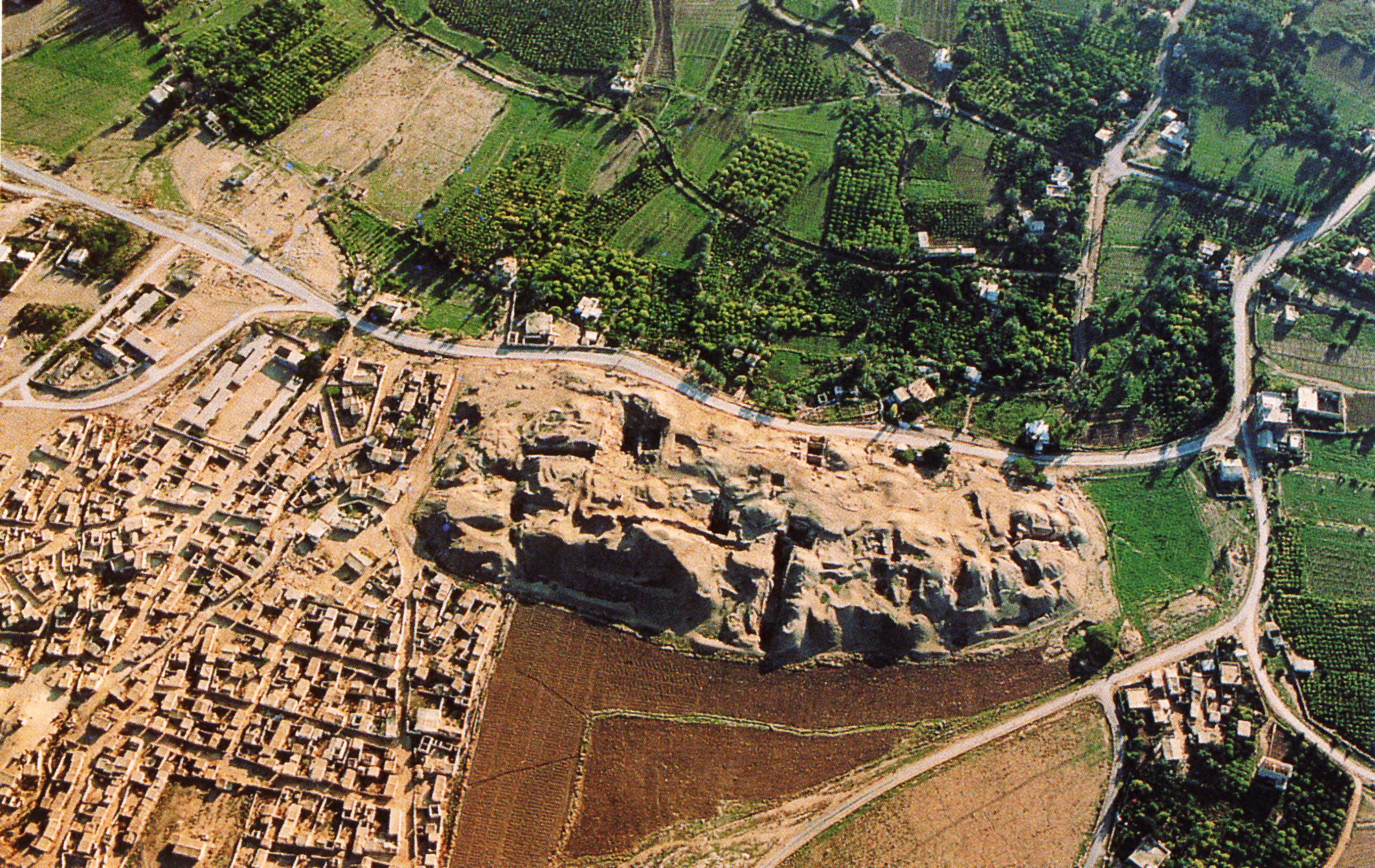
العربية: موقع تل السلطان الأثري في أريحا، فلسطين English: Aerial view of the archaeological area of Jericho, specifically showing Tell es-Sultan. The top and right parts of the image show trees, green crop fields, and other vegetation. On the bottom left of the image, you can see houses and other structures which are brown. White buildings, which are noticeably younger than than the ones on the bottom left, can be seen in the green area. Two large, uncultivated pieces of land can be seen in the middle of the bottom of the image. The top uncultivated field is dark brown, while the bottom one is sand in color. These two fields are separated by a road. Roads also run through the middle and right of the picture. The focus is a large sandy mound in the middle, which is presumably where the archeological unearthings are taking place. Italiano: veduta aerea dell'area archeologica di Gerico |
| Date | 5 March 2008 (original upload date) |
| Source | Transferred from it.wikipedia to Commons. |
| Author | Fullo88 at Italian Wikipedia |
Licensing
| This work has been released into the public domain by its author, Fullo88 at Italian Wikipedia. This applies worldwide. In some countries this may not be legally possible; if so: Fullo88 grants anyone the right to use this work for any purpose, without any conditions, unless such conditions are required by law. |
Original upload log
The original description page was here. All following user names refer to it.wikipedia.
- 2008-03-05 17:11 Fullo88 3132×2016×8 (4449730 bytes) veduta aerea dell'area archeologica di Gerico
File history
Click on a date/time to view the file as it appeared at that time.
| Date/Time | Thumbnail | Dimensions | User | Comment | |
|---|---|---|---|---|---|
| current | 09:09, 30 January 2017 | | 2,995 × 1,891 (1.7 MB) | Tmtriumph | Rasterung verringert |
| 11:18, 24 May 2013 |  | 2,995 × 1,891 (3.6 MB) | 32X | lossless crop | |
| 13:41, 6 March 2008 |  | 3,132 × 2,016 (4.24 MB) | File Upload Bot (Magnus Manske) | {{BotMoveToCommons|it.wikipedia}} {{Information |Description={{it|veduta aerea dell'area archeologica di Gerico}} |Source=Transferred from [http://it.wikipedia.org it.wikipedia] |Date=2008-03-05 (original upload date) |Author=Original uploader was [[:it: |
File usage
The following 5 pages use this file:
Global file usage
The following other wikis use this file:
- Usage on ar.wikipedia.org
- Usage on arz.wikipedia.org
- Usage on bg.wikipedia.org
- Usage on bs.wikipedia.org
- Usage on ca.wikipedia.org
- Usage on da.wikipedia.org
- Usage on de.wikipedia.org
- Usage on de.wikivoyage.org
- Usage on en.wikivoyage.org
- Usage on es.wikipedia.org
- Usage on eu.wikipedia.org
- Usage on fa.wikipedia.org
- Usage on fr.wikipedia.org
- Usage on gl.wikipedia.org
- Usage on he.wikipedia.org
- Usage on he.wikivoyage.org
- Usage on hr.wikipedia.org
- Usage on hu.wikipedia.org
- Usage on hy.wikipedia.org
- Usage on id.wikipedia.org
- Usage on it.wikipedia.org
- Usage on it.wikiquote.org
- Usage on it.wikivoyage.org
View more global usage of this file.