Size of this preview: 364 × 599 pixels. Other resolutions: 146 × 240 pixels | 291 × 480 pixels | 466 × 768 pixels | 622 × 1,024 pixels | 1,912 × 3,147 pixels.
Original file (1,912 × 3,147 pixels, file size: 4.21 MB, MIME type: image/png)
This is a file from the Wikimedia Commons. Information from its description page there is shown below.
Commons is a freely licensed media file repository. You can help.
Commons is a freely licensed media file repository. You can help.
Summary
| Description |
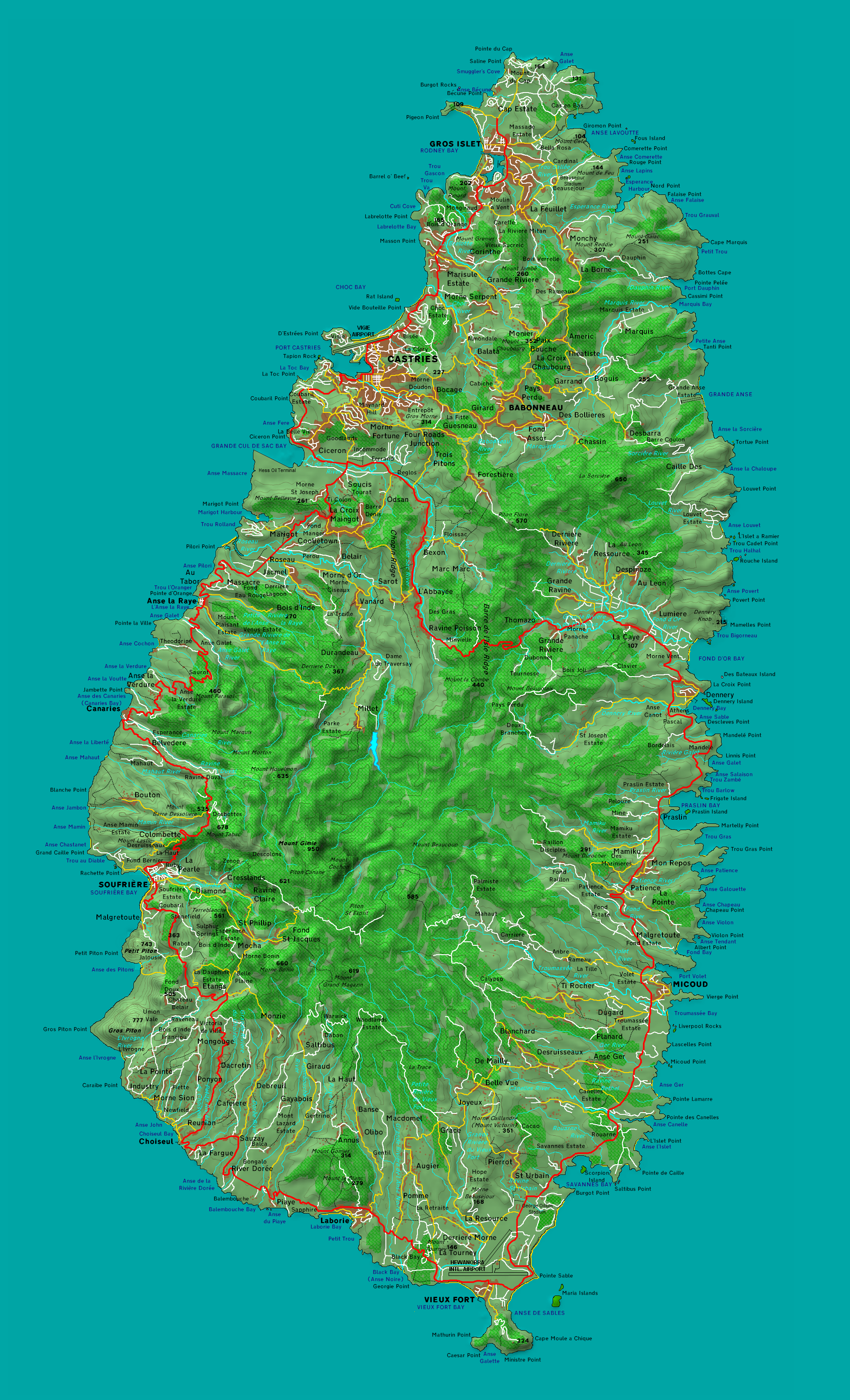
English: Map of Saint Lucia |
| Date | |
| Source | Own work |
| Creator | |
| Geotemporal data | |
| Heading |
 |
| Georeferencing | If inappropriate please set warp_status = skip to hide. |
Licensing
| I, the copyright holder of this work, release this work into the public domain. This applies worldwide. In some countries this may not be legally possible; if so: I grant anyone the right to use this work for any purpose, without any conditions, unless such conditions are required by law. |
| Open this image as an overlay in Google Earth (Google Maps, Bing) | (Help|Source) |
<kml xmlns="http://www.opengis.net/kml/2.2" xmlns:gx="http://www.google.com/kml/ext/2.2" xmlns:kml="http://www.opengis.net/kml/2.2" xmlns:atom="http://www.w3.org/2005/Atom">
<GroundOverlay>
	<name>St Lucia map overlay</name>
	<Icon>
		<href>https://upload.wikimedia.org/wikipedia/commons/d/df/St_Lucia_map.png</href>
		<viewBoundScale>0.75</viewBoundScale>
	</Icon>
	<LatLonBox>
		<north>14.12649897955879</north>
		<south>13.69395641808125</south>
		<east>-60.83880487345446</east>
		<west>-61.10742104586334</west>
	</LatLonBox>
</GroundOverlay>
</kml>
File history
Click on a date/time to view the file as it appeared at that time.
| Date/Time | Thumbnail | Dimensions | User | Comment | |
|---|---|---|---|---|---|
| current | 10:45, 15 April 2010 | | 1,912 × 3,147 (4.21 MB) | Mjr74 | {{Information |Description={{en|1=Map of Saint Lucia}} |Source={{own}} |Author=Mjr74 |Date=2010-04-15 |Permission= |other_versions= }} Category:Geography of Saint Lucia |
File usage
The following 4 pages use this file:
Global file usage
The following other wikis use this file:
- Usage on arz.wikipedia.org
- Usage on es.wikipedia.org
- Usage on fa.wikipedia.org
- Usage on ha.wikipedia.org
- Usage on pt.wikipedia.org
- Usage on ru.wikipedia.org
- Usage on uk.wikipedia.org
- Usage on ur.wikipedia.org
- Usage on vi.wikipedia.org
- Usage on www.wikidata.org