Size of this preview: 450 × 600 pixels. Other resolutions: 180 × 240 pixels | 480 × 640 pixels.
Original file (480 × 640 pixels, file size: 179 KB, MIME type: image/jpeg)
This is a file from the Wikimedia Commons. Information from its description page there is shown below.
Commons is a freely licensed media file repository. You can help.
Commons is a freely licensed media file repository. You can help.
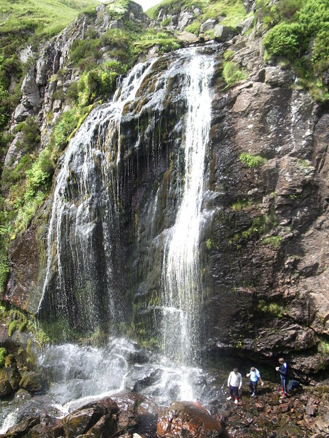
| Description | Spout of Garnock |
| Date | |
| Source | From geograph.org.uk |
| Author | Amon Lhaw |
| Permission (Reusing this file) |
Creative Commons Attribution Share-alike license 2.0 |
| Attribution (required by the license) | Amon Lhaw / Spout of Garnock / |
| Camera location | | View this and other nearby images on: OpenStreetMap |
|---|

|
This image was taken from the Geograph project collection. See this photograph's page on the Geograph website for the photographer's contact details. The copyright on this image is owned by Amon Lhaw and is licensed for reuse under the Creative Commons Attribution-ShareAlike 2.0 license.
|
This file is licensed under the Creative Commons Attribution-Share Alike 2.0 Generic license.
Attribution:
Amon Lhaw
- You are free:
- to share – to copy, distribute and transmit the work
- to remix – to adapt the work
- Under the following conditions:
- attribution – You must give appropriate credit, provide a link to the license, and indicate if changes were made. You may do so in any reasonable manner, but not in any way that suggests the licensor endorses you or your use.
- share alike – If you remix, transform, or build upon the material, you must distribute your contributions under the same or compatible license as the original.
Original upload log
The original description page was here. All following user names refer to en.wikipedia.
- 2007-10-11 23:20 Lastcent 480×640×8 (183038 bytes) *Spout of Garnock, highest waterfall in Ayrshire, Scotland *[https://www.geograph.org.uk/photo/475878 Direct link to image]. The [http://www.geograph.org.uk Geograph] British Isles project aims to collect geographically representative photographs and inf
File history
Click on a date/time to view the file as it appeared at that time.
| Date/Time | Thumbnail | Dimensions | User | Comment | |
|---|---|---|---|---|---|
| current | 10:37, 30 July 2008 | | 480 × 640 (179 KB) | Angusmclellan | {{Information |Description=Spout of Garnock |Source=From [http://www.geograph.org.uk/photo/475878 geograph.org.uk] |Date=2007-06-23 |Author=[http://www.geograph.org.uk/profile/15394 Amon Lhaw] |Permission=Creative Commons Attribution Share-alike license 2 |
File usage
The following 2 pages use this file:
Global file usage
The following other wikis use this file:
- Usage on arz.wikipedia.org
- Usage on br.wikipedia.org
- Usage on ceb.wikipedia.org
- Usage on fr.wikipedia.org
- Usage on gd.wikipedia.org
- Usage on www.wikidata.org