Size of this preview: 773 × 599 pixels. Other resolutions: 310 × 240 pixels | 619 × 480 pixels | 991 × 768 pixels | 1,122 × 870 pixels.
Original file (1,122 × 870 pixels, file size: 330 KB, MIME type: image/jpeg)
This is a file from the Wikimedia Commons. Information from its description page there is shown below.
Commons is a freely licensed media file repository. You can help.
Commons is a freely licensed media file repository. You can help.
Summary
| Description |
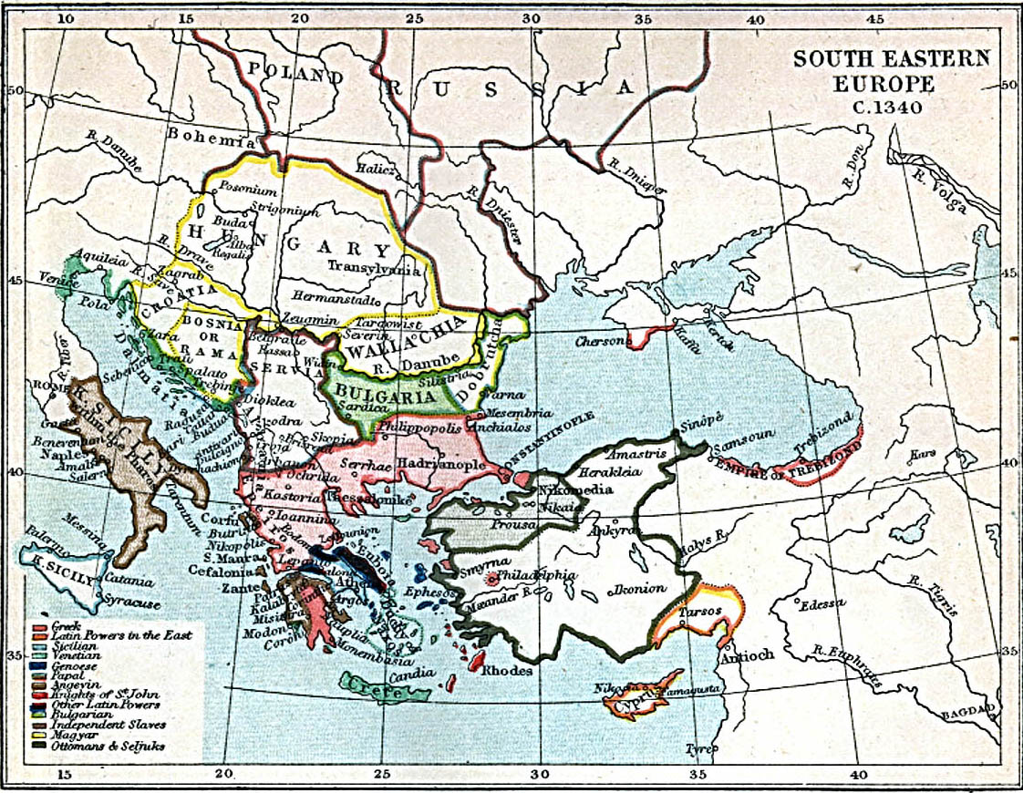
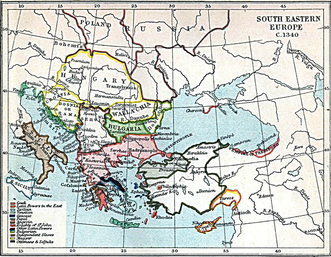
English: Map of south-eastern Europe ca. 1340 AD. |
| Date | |
| Source | Map at the Perry-Castañeda Library Map Collection of the University of Texas |
| Author | J.B. Bury |
Licensing
This media file is in the public domain in the United States. This applies to U.S. works where the copyright has expired, often because its first publication occurred prior to January 1, 1931, and if not then due to lack of notice or renewal. See this page for further explanation.
|
 | |
 |
File history
Click on a date/time to view the file as it appeared at that time.
| Date/Time | Thumbnail | Dimensions | User | Comment | |
|---|---|---|---|---|---|
| current | 12:27, 29 March 2010 | | 1,122 × 870 (330 KB) | Cplakidas | {{Information |Description={{en|1=Map of south-eastern Europe ca. 1340 AD.}} |Source=[http://www.lib.utexas.edu/maps/historical/se_europe_1340.jpg Map] at the [http://www.lib.utexas.edu/maps/ Perry-Castañeda Library Map Collection] of the University of T |
File usage
The following 11 pages use this file:
- Anna Anachoutlou
- Byzantine civil war of 1341–1347
- User:Falcaorib/Armenia, Azerbaijan and Georgia
- User:Falcaorib/Austria-Hungary
- User:Falcaorib/Balkans
- User:Falcaorib/Bulgaria and North Macedonia
- User:Falcaorib/Croatia, Bosnia, Serbia, Yugoslavia and Albania
- User:Falcaorib/Greece and Byzantine Empire
- User:Falcaorib/Medieval Empires (1300-1500 AD)
- User:Falcaorib/Romania and Moldova
- User:Falcaorib/Turkey and Ottoman Empire
Global file usage
The following other wikis use this file:
- Usage on es.wikipedia.org
- Usage on fa.wikipedia.org
- Usage on it.wikipedia.org
- Usage on ja.wikipedia.org
- Usage on pa.wikipedia.org
- Usage on pt.wikipedia.org
- Usage on ru.wikipedia.org
- Usage on sh.wikipedia.org
- Usage on uk.wikipedia.org
- Usage on zh.wikipedia.org