Size of this preview: 525 × 600 pixels. Other resolutions: 210 × 240 pixels | 420 × 480 pixels | 672 × 768 pixels | 896 × 1,024 pixels | 1,867 × 2,133 pixels.
Original file (1,867 × 2,133 pixels, file size: 7.08 MB, MIME type: image/png)
This is a file from the Wikimedia Commons. Information from its description page there is shown below.
Commons is a freely licensed media file repository. You can help.
Commons is a freely licensed media file repository. You can help.
Summary
| Description |
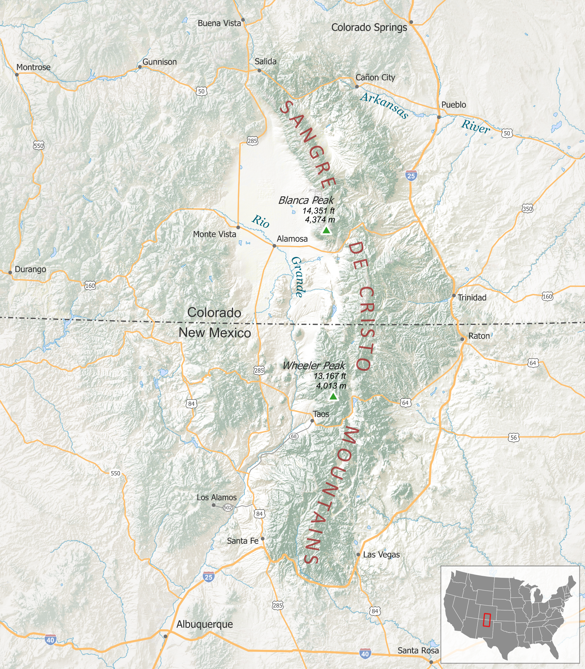
English: Projection:
Main Map - NAD83 UTM Zone 13N Scale - 1:2,000,000 Location Map – North America Albers Data Sources: Land Cover, Highways, Shaded Relief, Cities/Towns, Hydrography – The National Map Small Scale Collection
Peaks – USGS GNIS
State Boundaries – Natural Earth data |
| Date | |
| Source | Unpublished. Provided to me for uploading. |
| Author | Tanner Arrington |
| Permission (Reusing this file) |
|
Licensing
This file is licensed under the Creative Commons Attribution-Share Alike 4.0 International license.
- You are free:
- to share – to copy, distribute and transmit the work
- to remix – to adapt the work
- Under the following conditions:
- attribution – You must give appropriate credit, provide a link to the license, and indicate if changes were made. You may do so in any reasonable manner, but not in any way that suggests the licensor endorses you or your use.
- share alike – If you remix, transform, or build upon the material, you must distribute your contributions under the same or compatible license as the original.
File history
Click on a date/time to view the file as it appeared at that time.
| Date/Time | Thumbnail | Dimensions | User | Comment | |
|---|---|---|---|---|---|
| current | 21:09, 3 September 2015 | | 1,867 × 2,133 (7.08 MB) | Munion | User created page with UploadWizard |
File usage
The following page uses this file:
Global file usage
The following other wikis use this file:
- Usage on de.wikipedia.org
- Usage on fr.wikipedia.org
- Usage on ja.wikipedia.org
- Usage on nl.wikipedia.org