Size of this preview: 960 × 546 pixels. Other resolutions: 330 × 188 pixels | 960 × 546 pixels | 1,280 × 728 pixels.
Original file (1,117 × 635 pixels, file size: 215 KB, MIME type: image/png)
This is a file from the Wikimedia Commons. Information from its description page there is shown below.
Commons is a freely licensed media file repository. You can help.
Commons is a freely licensed media file repository. You can help.
Summary
| Description |
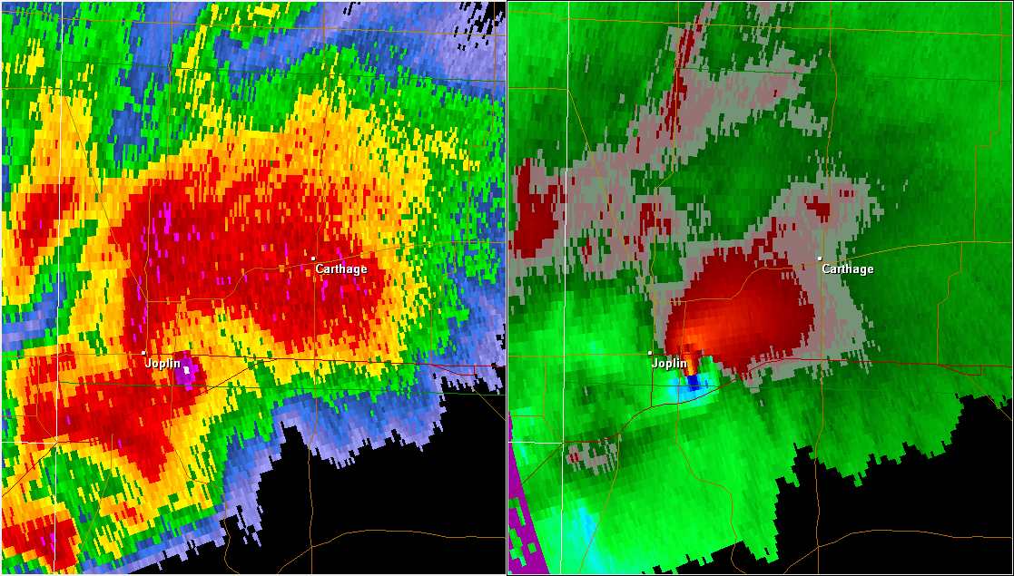
English: A radar image of the supercell that produced the 2011 Joplin tornado. Base reflectivity is on the left and storm relative velocity on the right. The area of high reflectivity just to the right of the Joplin label is debris lofted into the air by the tornado. |
| Date | |
| Source | NWS radar data displayed with GR2Analyst |
| Author | National Weather Service (NWS), Federal Aviation Administration (FAA), and United States Air Force (USAF) - (Gibson Ridge Radar software) |
| Permission (Reusing this file) |
|
Licensing

|
The copyright holder of this file allows anyone to use it for any purpose, provided that the copyright holder is properly attributed. Redistribution, derivative work, commercial use, and all other use is permitted. |
|
|
This image is in the public domain because it is from one or more of the U.S. government’s 159 NEXRAD radars, which are jointly owned and operated by the National Weather Service (NWS), an agency of the National Oceanic and Atmospheric Administration (NOAA) within the United States Department of Commerce, the Federal Aviation Administration (FAA) within the Department of Transportation, and the U.S. Air Force within the Department of Defense.
Thus all NEXRAD images are public domain.
|
  |
File history
Click on a date/time to view the file as it appeared at that time.
| Date/Time | Thumbnail | Dimensions | User | Comment | |
|---|---|---|---|---|---|
| current | 00:16, 7 December 2011 | | 1,117 × 635 (215 KB) | Ks0stm | {{Information |Description ={{en|1=A radar image of the supercell that produced the 2011 Joplin tornado. Base reflectivity is on the left and storm relative velocity on the right. The area of high reflectivity just to the righ |
File usage
The following 5 pages use this file:
Global file usage
The following other wikis use this file:
- Usage on fr.wikipedia.org
- Usage on hu.wikipedia.org
- Usage on pt.wikipedia.org
- Usage on www.wikidata.org