Size of this preview: 638 × 599 pixels. Other resolutions: 256 × 240 pixels | 511 × 480 pixels | 818 × 768 pixels | 1,200 × 1,127 pixels.
Original file (1,200 × 1,127 pixels, file size: 786 KB, MIME type: image/jpeg)
This is a file from the Wikimedia Commons. Information from its description page there is shown below.
Commons is a freely licensed media file repository. You can help.
Commons is a freely licensed media file repository. You can help.
Summary
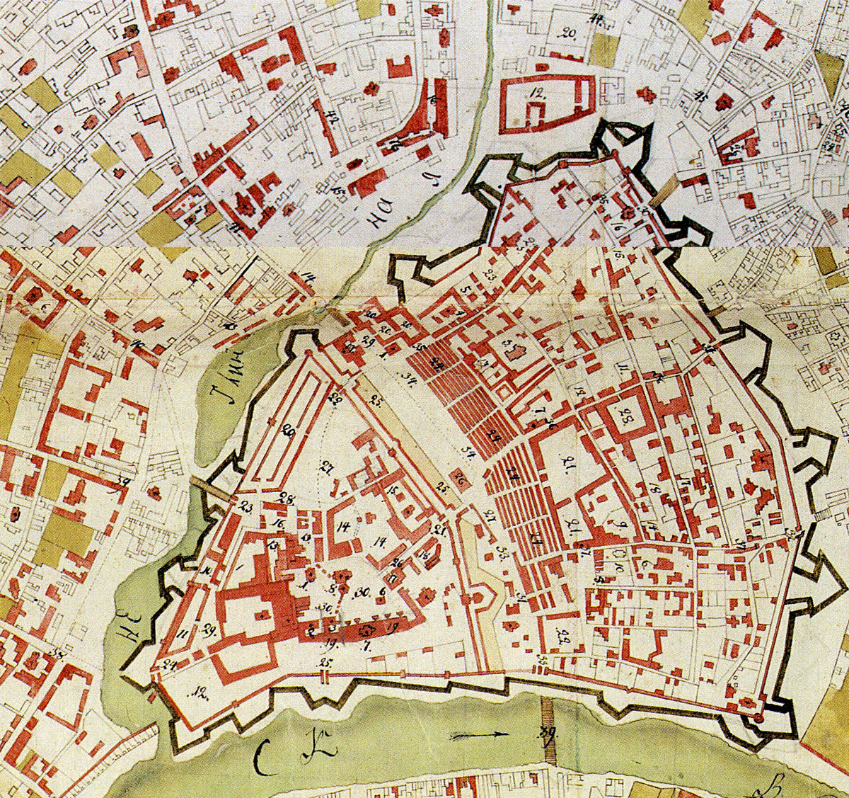
| Description | 1760s map of Moscow Kremlin, Kitai-gorod and Neglinnaya river valley that would later become Central Squares. |
| Date | between 1760 and 1768 |
| Source | Scan from Памятники архитектуры Москвы. Замоскворечье — М.: Искусство, 1994. ISBN 5-210-02548-9 |
| Author | State topographers, edited by Gorikhvostov |
| Permission (Reusing this file) |
PD |
Licensing
|
This work is in the public domain in its country of origin and other countries and areas where the copyright term is the author's life plus 100 years or fewer. | |
| This file has been identified as being free of known restrictions under copyright law, including all related and neighboring rights. | |
File history
Click on a date/time to view the file as it appeared at that time.
| Date/Time | Thumbnail | Dimensions | User | Comment | |
|---|---|---|---|---|---|
| current | 22:01, 1 March 2008 | | 1,200 × 1,127 (786 KB) | NVO | {{Information |Description=1760s map of Moscow Kremlin, Kitai-gorod and Neglinnaya river valley that would later become Central Squares. |Source=Scan from Памятники архитектуры Москвы. Замоскворечье — М.: Иску |
File usage
The following page uses this file:
Global file usage
The following other wikis use this file:
- Usage on bg.wikipedia.org
- Usage on es.wikipedia.org
- Usage on ru.wikipedia.org