
Size of this PNG preview of this SVG file: 600 × 600 pixels. Other resolutions: 240 × 240 pixels | 480 × 480 pixels | 769 × 768 pixels | 1,025 × 1,024 pixels | 2,050 × 2,048 pixels | 2,506 × 2,504 pixels.
Original file (SVG file, nominally 2,506 × 2,504 pixels, file size: 515 KB)
This is a file from the Wikimedia Commons. Information from its description page there is shown below.
Commons is a freely licensed media file repository. You can help.
Commons is a freely licensed media file repository. You can help.
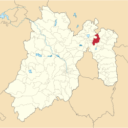
| Description | Mapa de localización del municipio de Tecamac en el Estado de México, México. | ||
| Date | |||
| Source | Own work | ||
| Author | Battroid | ||
| Permission (Reusing this file) |
|
File history
Click on a date/time to view the file as it appeared at that time.
| Date/Time | Thumbnail | Dimensions | User | Comment | |
|---|---|---|---|---|---|
| current | 19:53, 17 February 2013 | | 2,506 × 2,504 (515 KB) | Battroid | {{Information |Description=Mapa de localización del municipio de Tecamac en el Estado de México, México. |Source={{own}} {{Inkscape}} |Date=2013-02-17 |Author= Battroid |Permission={{PD-self}} |other_versions= }} [[Category:SVG ma... |
File usage
The following 2 pages use this file:
Global file usage
The following other wikis use this file:
- Usage on ay.wikipedia.org
- Usage on ca.wikipedia.org
- Usage on de.wikipedia.org
- Usage on eo.wikipedia.org
- Usage on eu.wikipedia.org
- Usage on fa.wikipedia.org
- Usage on fr.wikipedia.org
- Usage on it.wikipedia.org
- Usage on lad.wikipedia.org
- Usage on simple.wikipedia.org
- Usage on sv.wikipedia.org
- Usage on tt.wikipedia.org
- Usage on vi.wikipedia.org
- Usage on www.wikidata.org
- Usage on zh.wikipedia.org