Size of this preview: 445 × 599 pixels. Other resolutions: 178 × 240 pixels | 356 × 480 pixels | 570 × 768 pixels | 760 × 1,024 pixels | 1,400 × 1,885 pixels.
Original file (1,400 × 1,885 pixels, file size: 570 KB, MIME type: image/jpeg)
This is a file from the Wikimedia Commons. Information from its description page there is shown below.
Commons is a freely licensed media file repository. You can help.
Commons is a freely licensed media file repository. You can help.
Summary
| Description |
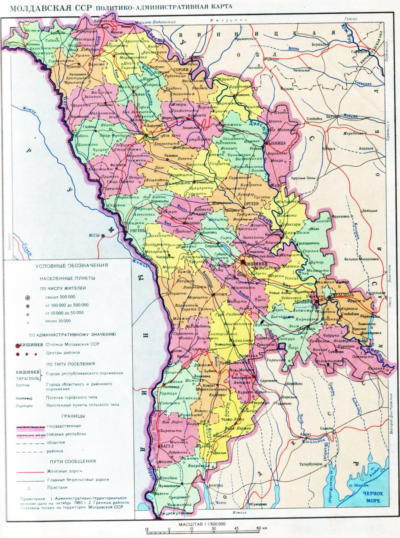
English: Administrative map of the Moldavian SSR.
Русский: Административная карта Молдавской ССР. |
| Date | |
| Source | Atlas of USSR. Moscow, 1983 |
| Author | General Directorate of Geodesy and Cartography under the Council of Ministers of the USSR |
Licensing

|
The copyright holder of this work allows anyone to use it for any purpose including unrestricted redistribution, commercial use, and modification.
Usage notes:
|
File history
Click on a date/time to view the file as it appeared at that time.
| Date/Time | Thumbnail | Dimensions | User | Comment | |
|---|---|---|---|---|---|
| current | 20:39, 9 January 2020 | | 1,400 × 1,885 (570 KB) | Pridnestrovian editor | Brightness / contrast. |
| 16:31, 8 January 2020 |  | 1,400 × 1,885 (766 KB) | Pridnestrovian editor | {{Information |description ={{en|1=Administrative map of the Moldavian SSR.}} {{ru|1=Административная карта Молдавской ССР.}} |date =1983 |source =Atlas of USSR. Moscow, 1983 |author =General Directorate of Geodesy and Cartography under the Council of Ministers of the USSR }} |
File usage
The following page uses this file:
Global file usage
The following other wikis use this file:
- Usage on es.wikipedia.org
- Usage on ha.wikipedia.org
- Usage on it.wikipedia.org
- Usage on ro.wikipedia.org