
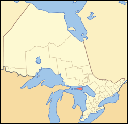
Size of this PNG preview of this SVG file: 340 × 330 pixels. Other resolutions: 247 × 240 pixels | 495 × 480 pixels | 791 × 768 pixels | 1,055 × 1,024 pixels | 2,110 × 2,048 pixels.
Original file (SVG file, nominally 340 × 330 pixels, file size: 84 KB)
This is a file from the Wikimedia Commons. Information from its description page there is shown below.
Commons is a freely licensed media file repository. You can help.
Commons is a freely licensed media file repository. You can help.
Summary
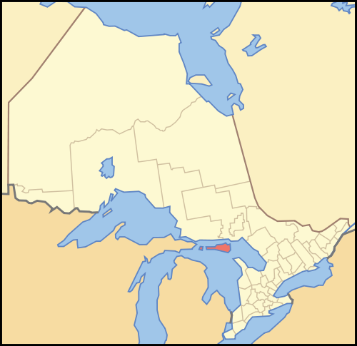
| Description | A map of Ontario highlighting Manitoulin District |
| Date | |
| Source | Crop and trace of Image:Canada (geolocalisation).svg; trace of Image:Ontario subdivisions.PNG. |
| Author | Vidioman |
| Other versions | en:Image:Ontmanid.png |
.svg)
Licensing
| I, the copyright holder of this work, release this work into the public domain. This applies worldwide. In some countries this may not be legally possible; if so: I grant anyone the right to use this work for any purpose, without any conditions, unless such conditions are required by law. |
File history
Click on a date/time to view the file as it appeared at that time.
| Date/Time | Thumbnail | Dimensions | User | Comment | |
|---|---|---|---|---|---|
| current | 14:59, 16 October 2007 | | 340 × 330 (84 KB) | Vidioman | {{Created with Inkscape}} {{Information |Description=A map of Ontario highlighting Manitoulin District |Source=Crop and trace of Image:Canada (geolocalisation).svg; trace of [http://en.wikipedia.org/wiki/Image:Ont |
.svg)
File usage
The following 20 pages use this file:
- Aundeck Omni Kaning First Nation
- Bridal Veil Falls (Manitoulin Island)
- Burpee and Mills
- False Detour Channel
- Goat Island (Ontario)
- Kagawong River
- Lake Manitou
- Lake Mindemoya
- List of townships in Ontario
- Manitoulin District
- Manitoulin Island
- Mindemoya River
- Mississagi Strait
- Sheguiandah First Nation
- Sheshegwaning First Nation
- Sucker Lake (Manitoulin)
- Unorganized Mainland Manitoulin District
- Whitefish River First Nation
- User:Vidioman/Maps
- Template:ManitoulinDistrict-geo-stub
Global file usage
The following other wikis use this file:
- Usage on ceb.wikipedia.org
- Usage on da.wikipedia.org
- Usage on de.wikipedia.org
- Usage on fa.wikipedia.org
- Usage on fr.wikipedia.org
- Usage on fy.wikipedia.org
- Usage on it.wikipedia.org
- Usage on ja.wikipedia.org
- Usage on ko.wikipedia.org
- Usage on nl.wikipedia.org
- Usage on pl.wikipedia.org
- Usage on pl.wikivoyage.org
- Usage on pnb.wikipedia.org
- Usage on ru.wikipedia.org
- Usage on sv.wikipedia.org
- Usage on uk.wikipedia.org
- Usage on ur.wikipedia.org
- Usage on www.wikidata.org
- Usage on zh-yue.wikipedia.org
- Usage on zh.wikipedia.org