Size of this preview: 800 × 551 pixels. Other resolutions: 320 × 221 pixels | 640 × 441 pixels | 1,024 × 706 pixels | 1,280 × 882 pixels | 2,560 × 1,764 pixels | 5,950 × 4,100 pixels.
Original file (5,950 × 4,100 pixels, file size: 4.84 MB, MIME type: image/jpeg)
This is a file from the Wikimedia Commons. Information from its description page there is shown below.
Commons is a freely licensed media file repository. You can help.
Commons is a freely licensed media file repository. You can help.
Summary
| Description |
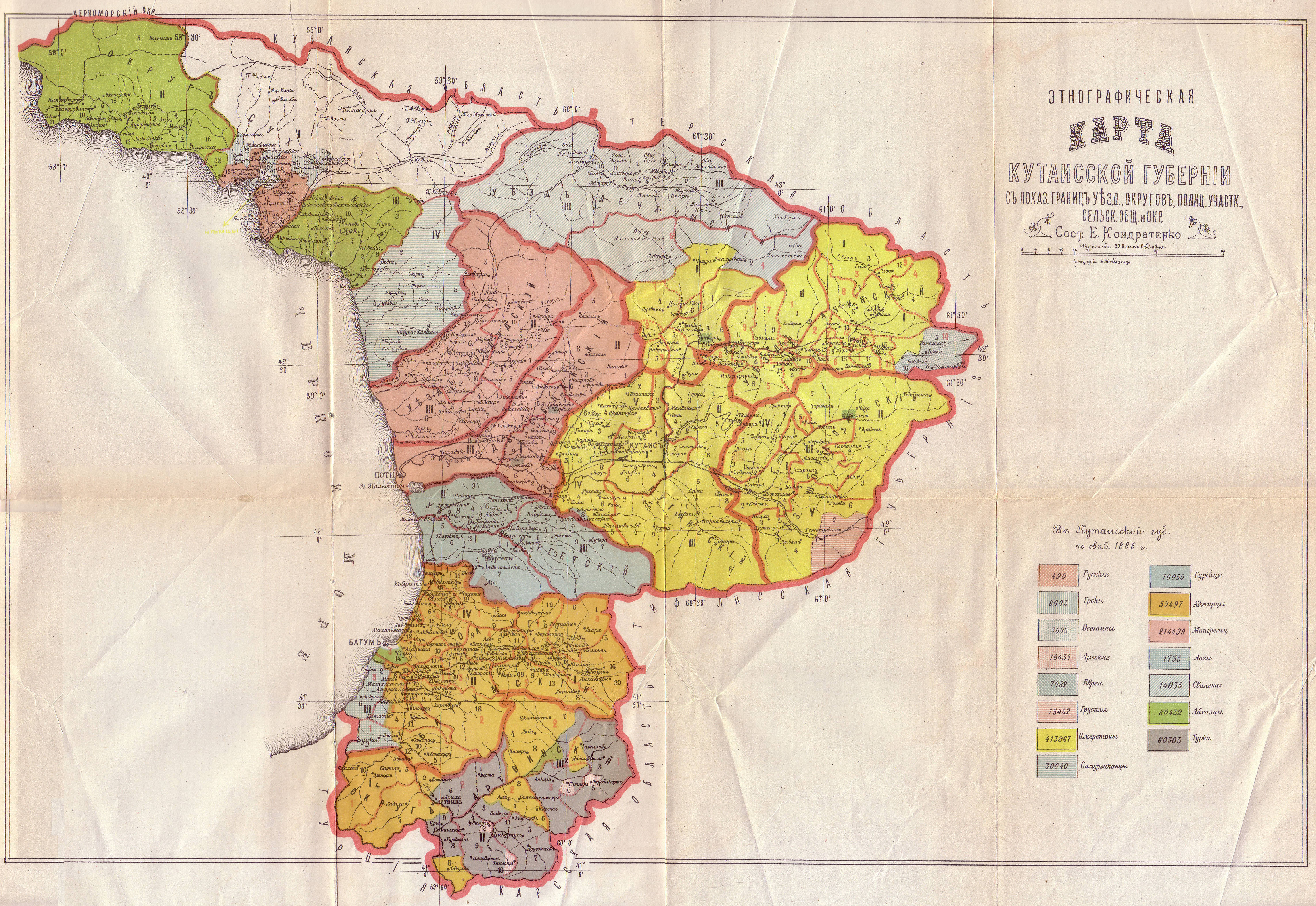
English: Ethnographic map of the Kutais Governorate |
| Date | (1886) |
| Source | Ikalto.com from Кавказскій календарь, Тифлисъ, 1902 (digitalized by libri_rf) |
| Author | E. Kondratenko |
| Permission (Reusing this file) |
Disclaimer |
| Other versions |

Licensing
|
This work is in the public domain in its country of origin and other countries and areas where the copyright term is the author's life plus 70 years or fewer. | |
| This file has been identified as being free of known restrictions under copyright law, including all related and neighboring rights. | |
File history
Click on a date/time to view the file as it appeared at that time.
| Date/Time | Thumbnail | Dimensions | User | Comment | |
|---|---|---|---|---|---|
| current | 12:51, 28 February 2010 | | 5,950 × 4,100 (4.84 MB) | Kober | {{Information |Description={{en|1=Ethnographic map of the Kutais Governorate}} |Source=[http://ikalto.com/index-maps.php Ikalto.com] from Кавказскій календарь, Тифлисъ, 1902 (digitalized by [http://libri-rf.livejournal.com/ libri |
File usage
The following page uses this file:
Global file usage
The following other wikis use this file:
- Usage on es.wikipedia.org
- Usage on he.wikipedia.org
- Usage on ka.wikipedia.org
- Usage on nl.wikipedia.org
- Usage on ru.wikipedia.org
- Usage on tg.wikipedia.org
- Usage on uk.wikipedia.org
- Usage on xmf.wikipedia.org