Size of this preview: 960 × 959 pixels. Other resolutions: 250 × 250 pixels | 500 × 499 pixels | 960 × 959 pixels | 1,280 × 1,278 pixels | 1,920 × 1,917 pixels.
Original file (1,335 × 1,333 pixels, file size: 351 KB, MIME type: image/png)
This is a file from the Wikimedia Commons. Information from its description page there is shown below.
Commons is a freely licensed media file repository. You can help.
Commons is a freely licensed media file repository. You can help.
Summary
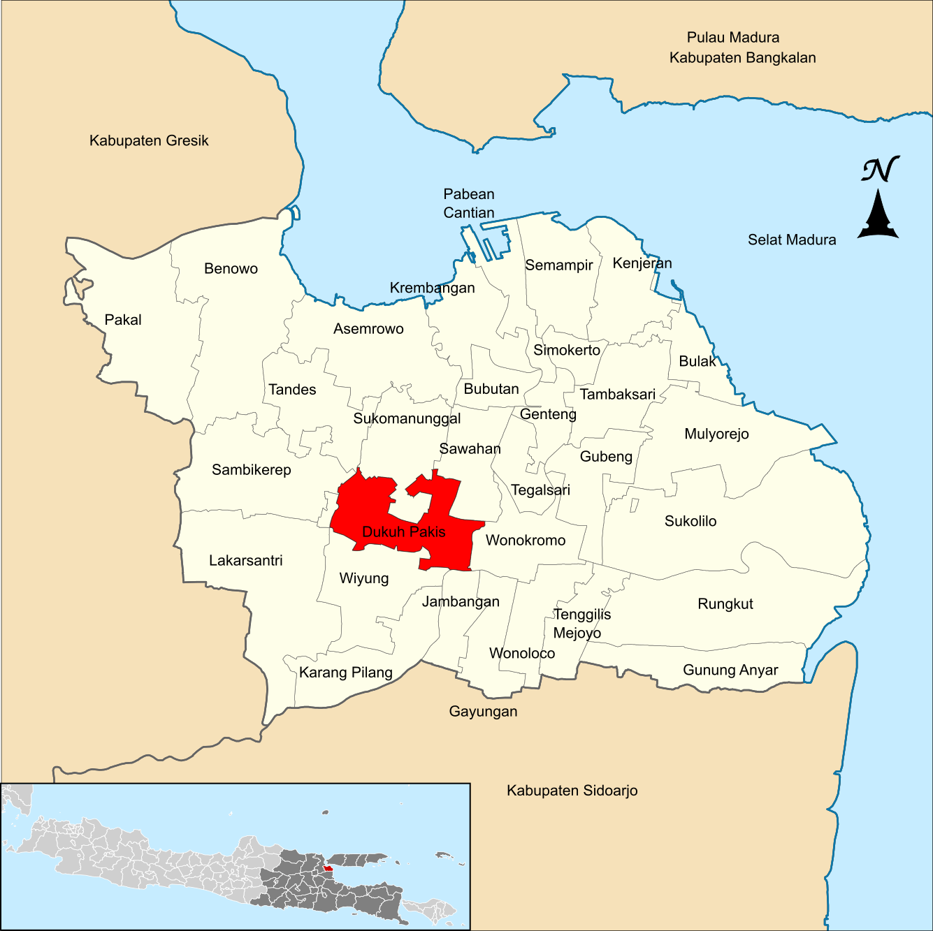
| Description | Localização de Dukuh Pakis na cidade de Surabaia |
| Date | |
| Source | http://id.wikipedia.org/wiki/Berkas:Locator_Kecamatan_Dukuh_Pakis_di_Kota_Surabaya.png |
| Author | Wic2020 |
| Permission (Reusing this file) |
Creative Commons Attribution-ShareAlike 3.0 |
Licensing
This file is licensed under the Creative Commons Attribution-Share Alike 3.0 Unported license.
- You are free:
- to share – to copy, distribute and transmit the work
- to remix – to adapt the work
- Under the following conditions:
- attribution – You must give appropriate credit, provide a link to the license, and indicate if changes were made. You may do so in any reasonable manner, but not in any way that suggests the licensor endorses you or your use.
- share alike – If you remix, transform, or build upon the material, you must distribute your contributions under the same or compatible license as the original.
File history
Click on a date/time to view the file as it appeared at that time.
| Date/Time | Thumbnail | Dimensions | User | Comment | |
|---|---|---|---|---|---|
| current | 01:10, 17 September 2020 | | 1,335 × 1,333 (351 KB) | Angayubagia | Update maps, added more districts based on File:Indonesia Surabaya City location map.svg |
| 22:42, 30 July 2010 |  | 490 × 583 (17 KB) | AaronKrotger | {{Information |Description=Localização de Dukuh Pakis na cidade de Surabaia |Source=http://id.wikipedia.org/wiki/Berkas:Locator_Kecamatan_Dukuh_Pakis_di_Kota_Surabaya.png |Date=2010-07-30 |Author=Wic2020 |Permission=Creative Commons Att |
File usage
The following page uses this file:
Global file usage
The following other wikis use this file:
- Usage on ban.wikipedia.org
- Usage on de.wikipedia.org
- Usage on id.wikipedia.org
- Usage on pt.wikipedia.org
- Usage on www.wikidata.org