
Commons is a freely licensed media file repository. You can help.
Summary
| Description |
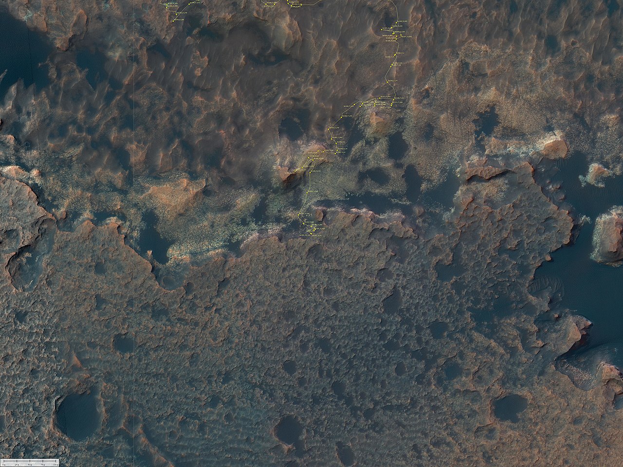
English: Curiosity Rover's Location for Sol 2692
https://mars.nasa.gov/resources/24799/curiosity-rovers-location-for-sol-2692/ March 03, 2020 This map shows the route driven by NASA's Mars rover Curiosity through the 2692 Martian day, or sol, of the rover's mission on Mars (March 3, 2020). Numbering of the dots along the line indicate the sol number of each drive. North is up. From Sol 2691 to Sol 2692, Curiosity had driven a straight line distance of about 5.68 feet (1.73 meters). Since touching down in Bradbury Landing in August 2012, Curiosity has driven 13.62 miles (21.92 kilometers). The base image from the map is from the High Resolution Imaging Science Experiment Camera (HiRISE) in NASA's Mars Reconnaissance Orbiter. |
| Date | |
| Source | https://mars.nasa.gov/system/resources/deepzooms/24799_Curiosity_Location_Sol2692.jpg |
| Author | NASA/JPL-Caltech/Univ. of Arizona |
Licensing

|
The copyright holder of this file, NASA/JPL-Caltech, allows anyone to use it for any purpose, provided that the copyright holder is properly attributed. Redistribution, derivative work, commercial use, and all other use is permitted. |
|
|
| According to JPL's image use policy additional restriction is that no endorsement of any product or service by Caltech, JPL or NASA is claimed or implied.
Caltech's disclaimer: Caltech makes no representations or warranties with respect to ownership of copyrights in the images, and does not represent others who may claim to be authors or owners of copyright of any of the images, and makes no warranties as to the quality of the images. Caltech shall not be responsible for any loss or expenses resulting from the use of the images, and you release and hold Caltech harmless from all liability arising from such use. Usage on the English Wikipedia: On the English Wikipedia you can use the {{JPL Image}} template to display the copyright notice. (See w:Wikipedia:Using JPL images for details) |
File history
Click on a date/time to view the file as it appeared at that time.
| Date/Time | Thumbnail | Dimensions | User | Comment | |
|---|---|---|---|---|---|
| current | 20:58, 15 March 2020 | | 4,800 × 3,600 (2.24 MB) | Drbogdan | Uploaded a work by NASA/JPL-Caltech/Univ. of Arizona from https://mars.nasa.gov/system/resources/deepzooms/24799_Curiosity_Location_Sol2692.jpg with UploadWizard |
File usage
The following page uses this file:
Global file usage
The following other wikis use this file:
- Usage on zh.wikipedia.org