
Size of this PNG preview of this SVG file: 600 × 600 pixels. Other resolutions: 240 × 240 pixels | 480 × 480 pixels | 768 × 768 pixels | 1,024 × 1,024 pixels | 2,048 × 2,048 pixels | 1,333 × 1,333 pixels.
Original file (SVG file, nominally 1,333 × 1,333 pixels, file size: 2.14 MB)
This is a file from the Wikimedia Commons. Information from its description page there is shown below.
Commons is a freely licensed media file repository. You can help.
Commons is a freely licensed media file repository. You can help.
Summary
| Description |
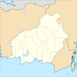
English: Location map of Central Kalimantan, Indonesia
Geographic Coordinate System WGS 1984 (EPSG: 4326) Equirectangular Projection Geographic limits of the map:
|
| Date | |
| Source | Own work |
| Author | Mandamaruta |
| Other versions |
|

Licensing
I, the copyright holder of this work, hereby publish it under the following license:
This file is licensed under the Creative Commons Attribution-Share Alike 4.0 International license.
- You are free:
- to share – to copy, distribute and transmit the work
- to remix – to adapt the work
- Under the following conditions:
- attribution – You must give appropriate credit, provide a link to the license, and indicate if changes were made. You may do so in any reasonable manner, but not in any way that suggests the licensor endorses you or your use.
- share alike – If you remix, transform, or build upon the material, you must distribute your contributions under the same or compatible license as the original.
File history
Click on a date/time to view the file as it appeared at that time.
| Date/Time | Thumbnail | Dimensions | User | Comment | |
|---|---|---|---|---|---|
| current | 16:19, 5 November 2025 | | 1,333 × 1,333 (2.14 MB) | Gabpzxs | Fixed Sembuluh Lake and Sentarum Lake shape. |
| 03:42, 4 October 2025 |  | 1,333 × 1,333 (2.15 MB) | Gabpzxs | Adding the border of North Kalimantan. | |
| 01:45, 6 September 2025 |  | 1,333 × 1,333 (2.14 MB) | Gabpzxs | Fixed Sembuluh Lake shape. | |
| 07:59, 21 December 2017 |  | 1,250 × 1,250 (2.11 MB) | Mandamaruta | User created page with UploadWizard |
File usage
The following 19 pages use this file:
- Al-Istiqlal Great Mosque, Murung Raya
- Ar-Raudhah Great Mosque
- Buntok
- Darussalam Grand Mosque, Palangka Raya
- Kasongan
- Kuala Kapuas
- Kuala Kurun
- Kyai Gede Mosque
- List of regencies and cities in Indonesia
- Muara Teweh
- Pulang Pisau (town)
- Puruk Cahu
- Sabangau National Park
- Tamiang Layang
- Tanjung Puting
- Tjilik Riwut Airport
- Template:Central Kalimantan labelled map
- Module:Location map/data/Indonesia Central Kalimantan
- Module:Location map/data/Indonesia Central Kalimantan/doc
Global file usage
The following other wikis use this file:
- Usage on fr.wikipedia.org
- Usage on id.wikipedia.org
- Daftar kabupaten dan kota di Kalimantan Tengah
- Daftar rumah sakit di Kalimantan Tengah
- Daftar kecamatan dan kelurahan di Kalimantan Tengah
- Pengguna:Ustad abu gosok/bak mandi
- Modul:Location map/data/Indonesia Kalimantan Tengah
- Modul:Location map/data/Indonesia Kalimantan Tengah/doc
- Daftar kabupaten dan kota di Kalimantan Tengah berdasarkan waktu pembentukan
- Modul:Location map/data/Kalimantan Tengah
- Templat:Peta berlabel Kalimantan Tengah
- Templat:Kalimantan Tengah/TOC
- Modul:Location map/data/Indonesia Central Kalimantan
- Modul:Location map/data/Provinsi Kalimantan Tengah
- Modul:Location map/data/Indonesia Provinsi Kalimantan Tengah
- Modul:Location map/data/Central Kalimantan
- Usage on si.wikipedia.org
- Usage on uz.wikipedia.org
- Usage on www.wikidata.org