
Size of this preview: 433 × 213 pixels.
Original file (433 × 213 pixels, file size: 40 KB, MIME type: image/png)
This is a file from the Wikimedia Commons. Information from its description page there is shown below.
Commons is a freely licensed media file repository. You can help.
Commons is a freely licensed media file repository. You can help.
Summary
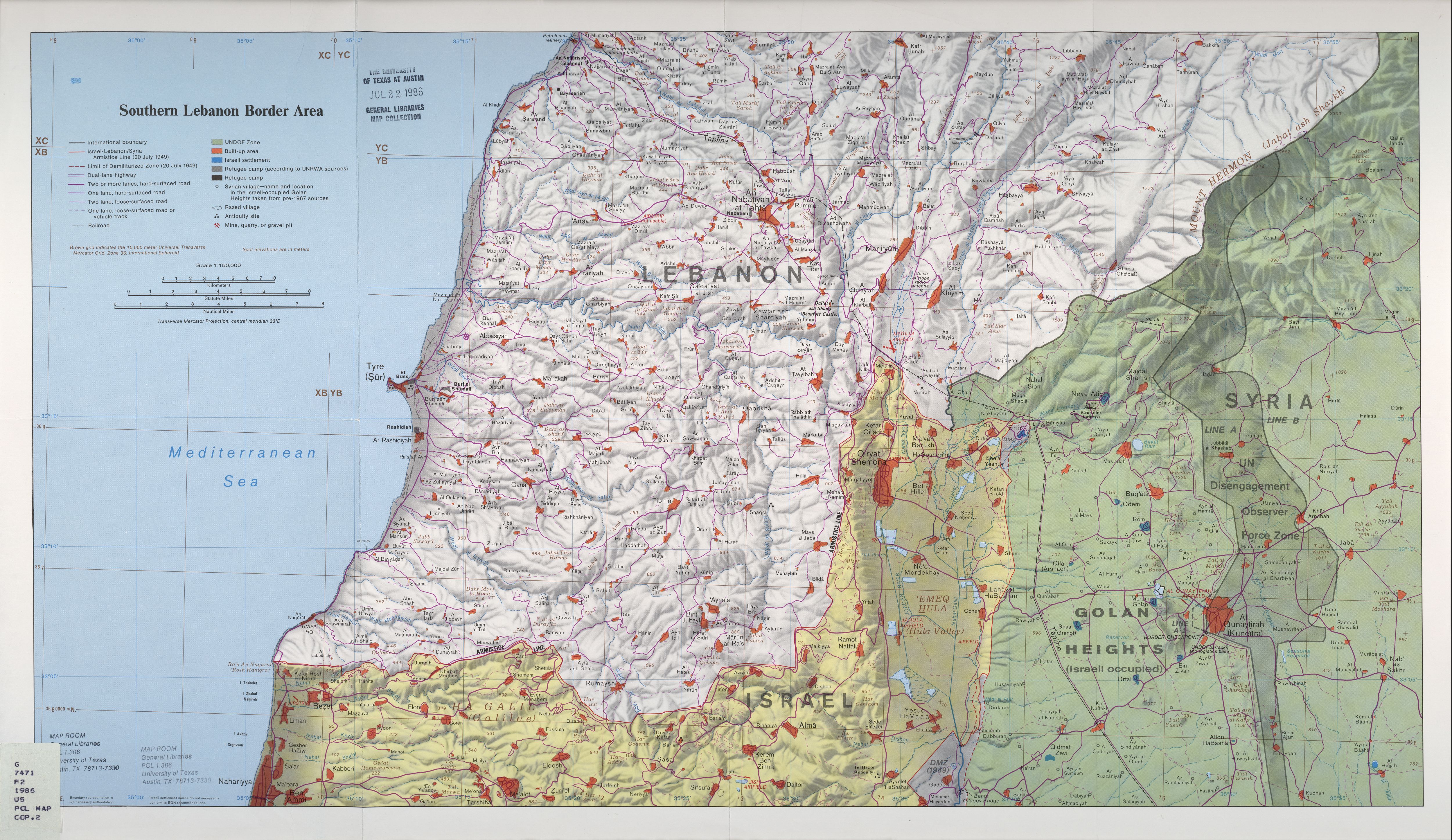
Map of Qana and vicinity illustrating the localities involved in the 2006 Qana airstrike.
Based on http://www.lib.utexas.edu/maps/middle_east_and_asia/lebanon_southern_border_1986.jpg (2.6 Mb) Copy of the original description in the english wikipedia.
Link 2 the picture in the english wikipedia.
Licensing
| This image is a work of a Central Intelligence Agency employee, taken or made as part of that person's official duties. As a Work of the United States Government, this image or media is in the public domain in the United States.
|

|
File history
Click on a date/time to view the file as it appeared at that time.
| Date/Time | Thumbnail | Dimensions | User | Comment | |
|---|---|---|---|---|---|
| current | 11:00, 20 August 2006 | | 433 × 213 (40 KB) | Japan01 | Map of Qana and vicinity illustrating the localities involved in the 2006 Qana airstrike. Based on http://www.lib.utexas.edu/maps/middle_east_and_asia/lebanon_southern_border_1986.jpg (2.6 Mb) {{PD-USGov-CIA}} |
File usage
The following page uses this file:
Global file usage
The following other wikis use this file:
- Usage on de.wikipedia.org
- Usage on www.wikidata.org