
Size of this preview: 960 × 720 pixels. Other resolutions: 330 × 248 pixels | 960 × 720 pixels.
Original file (800 × 600 pixels, file size: 204 KB, MIME type: image/jpeg)

This is a file from the Wikimedia Commons. Information from its description page there is shown below.
Commons is a freely licensed media file repository. You can help.
Commons is a freely licensed media file repository. You can help.
Summary
| Description |
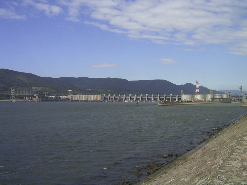
Deutsch: Kraftwerk Eisernes Tor I (Donau); Unterwasserseite mit 400-kV-Freileitungskreuzung der Donau, Blick vom rumänischen Ufer (links Serbien)
English: Iron Gate I Hydroelectric Power Station; view from downstream Romanian side towards the dam (left parts in Serbia), 400 kV overhead power line crossing
Nederlands: IJzeren Poort I Stuwdam |
| Date | before 12 September 2004 (Date, time or both in the file Exif metadata are incorrect/invalid.) |
| Source | Own work |
| Author | Denis Barthel |
| Other versions |
|

| Camera location |  | View this and other nearby images on: OpenStreetMap |  |
|---|


Licensing
Denis Barthel, the copyright holder of this work, hereby publishes it under the following license:

|
Permission is granted to copy, distribute and/or modify this document under the terms of the GNU Free Documentation License, Version 1.2 or any later version published by the Free Software Foundation; with no Invariant Sections, no Front-Cover Texts, and no Back-Cover Texts. A copy of the license is included in the section entitled GNU Free Documentation License. |
  
|
This file is licensed under the Creative Commons Attribution-Share Alike 3.0 Unported license. | |
Attribution:
| ||
| ||
| This licensing tag was added to this file as part of the GFDL licensing update. |
Original upload log
The original description page was here. All following user names refer to nl.wikipedia.

- ? Denisoliver~nlwiki …cf. [1] and [2]
![[2]](https://nl.wikipedia.org/w/index.php?title=Speciaal%3ALogboeken&page=Bestand%3AIJzeren+Poort+Stuwdam.JPG)
File history
Click on a date/time to view the file as it appeared at that time.
| Date/Time | Thumbnail | Dimensions | User | Comment | |
|---|---|---|---|---|---|
| current | 20:05, 17 October 2005 | | 800 × 600 (204 KB) | Julo | {{English}} Iron Gate (Danube) {{Dutch}} IJzeren Poort Stuwdam {{GFDL}} Denis Barthel from nl:wikipedia |
File usage
The following 6 pages use this file:
Global file usage
The following other wikis use this file:
- Usage on ast.wikipedia.org
- Usage on ba.wikipedia.org
- Usage on ca.wikipedia.org
- Usage on de.wikipedia.org
- Usage on el.wikipedia.org
- Usage on es.wikipedia.org
- Usage on fr.wikipedia.org
- Usage on fy.wikipedia.org
- Usage on he.wikipedia.org
- Usage on hr.wikipedia.org
- Usage on hu.wikipedia.org
- Usage on hy.wikipedia.org
- Usage on io.wikipedia.org
- Usage on it.wikipedia.org
- Usage on ja.wikipedia.org
- Usage on kn.wikipedia.org
- Usage on ko.wikipedia.org
- Usage on mk.wikipedia.org
- Usage on nl.wikipedia.org
- Usage on pl.wikipedia.org
- Usage on ro.wikipedia.org
- Usage on ru.wikipedia.org
- Usage on sh.wikipedia.org
- Usage on sl.wikipedia.org
- Usage on sr.wikipedia.org
View more global usage of this file.

