

Size of this preview: 330 × 659 pixels. Other resolutions: 120 × 240 pixels | 250 × 499 pixels | 500 × 998 pixels | 960 × 1,917 pixels | 1,280 × 2,555 pixels | 3,840 × 7,666 pixels.
Original file (4,804 × 9,591 pixels, file size: 33.99 MB, MIME type: image/jpeg)

This is a file from the Wikimedia Commons. Information from its description page there is shown below.
Commons is a freely licensed media file repository. You can help.
Commons is a freely licensed media file repository. You can help.
Summary
| Title |
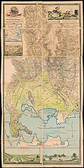
English: Ottoman map of South Epirus, by Halil Ibrahim Efendi, 1896. Ελληνικά: Νότια Ήπειρος, χάρτης του 1896 από τον Χαλίλ Ιμπραχίμ Εφέντη, της Αυτοκρατορικής Σχολής Πολεμικών Τεχνών.  |
|||||||||||||||||||||||
| Description |
English: Ottoman map of the south part of the Vilayet of Ioannina, drawn by Halil Ibrahim Efendi, in 1896. Colour lithography by the Imperial School of Military Art, Istanbul, 1896 (Islamic Year 1314). Nikos D. Karabelas map collection, Actia Nicopolis Foundation, Preveza, Greece.
Ελληνικά: Οθωμανικός χάρτης του νότιου τμήματος του βιλαετίου των Ιωαννίνων με εικονογραφήσεις από διάφορα μέρη (Πέντε Πηγάδια, Γέφυρες Καλογήρων, Πηγές Λούρου) σχεδιασμένος το 1896 από τον Χαλίλ Ιμπραχίμ Εφέντη, της Αυτοκρατορικής Σχολής Πολεμικών Τεχνών. Έγχρωμη λιθογραφία του 1896. Συλλογή χαρτών Νίκου Δ. Καράμπελα, Ίδρυμα Ακτία Νικόπολις, Πρέβεζα |
|||||||||||||||||||||||
| Date | ||||||||||||||||||||||||
| Source |
Αυτοκρατορική Σχολή Πολεμικών Τεχνών, Κωνσταντινούπολη, 1896.
|
|||||||||||||||||||||||
| Creator |
Χαλίλ Ιμπραχίμ Εφέντης |
|||||||||||||||||||||||
| Permission (Reusing this file) |
  This file is licensed under the Creative Commons Attribution 4.0 International license.
| |||||||||||||||||||||||
| Attribution (required by the license) | ||||||||||||||||||||||||
| Geotemporal data | ||||||||||||||||||||||||
| Date depicted | ||||||||||||||||||||||||
| Map location | Epirus, Greece | |||||||||||||||||||||||
| Map type | map | |||||||||||||||||||||||
| Scale | 1/50.000 | |||||||||||||||||||||||
| Heading |
 |
|||||||||||||||||||||||
| Georeferencing | If inappropriate please set warp_status = skip to hide. | |||||||||||||||||||||||
| Bibliographic data | ||||||||||||||||||||||||
| Part of the series |
English: Actia Nicopolis Foundation, Preveza, Greece. Nikos D. Karabelas map collection. Ελληνικά: Ίδρυμα Ακτία Νικόπολις, Πρέβεζα. Συλλογή χαρτών Νίκου Δ. Καράμπελα. |
|||||||||||||||||||||||
| Map sheet | IAN 0269 | |||||||||||||||||||||||
| Language | Old Ottoman | |||||||||||||||||||||||
| Printed by |
Imperial School of Military Art / Αυτοκρατορική Σχολή Πολεμικών Τεχνών |
|||||||||||||||||||||||
| Archival data | ||||||||||||||||||||||||
| Collection |
|
|||||||||||||||||||||||
| Accession number |
IAN_0269 |
|||||||||||||||||||||||
| Dimensions | height: 1,555 mm (61.22 in); width: 750 mm (29.52 in) | |||||||||||||||||||||||
| Medium |
English: Colour lithography. Ελληνικά: Έγχρωμη λιθογραφία. |
|||||||||||||||||||||||
| Other versions |
The second Ottoman edition and a Greek edition can be seen in the following files.  |
|||||||||||||||||||||||




File history
Click on a date/time to view the file as it appeared at that time.
| Date/Time | Thumbnail | Dimensions | User | Comment | |
|---|---|---|---|---|---|
| current | 08:01, 6 February 2019 | | 4,804 × 9,591 (33.99 MB) | Actia Nicopolis | == {{int:filedesc}} == {{Map | title = {{en|1=The Gulf of Arta, by Lieut, W. J. Cooling, H.M.S. Mastiff, 1830. / [Inset map] Prevesa, and the entrance Channel.}} {{el|1=Ο Αμβρακικός κόλπος, χαρτογραφημένος το 1830 από τον υποπλοίαρχο W. J. Cooling, του πλοίου Mastiff του Βασιλικού Ναυτικού της Βρετανίας. / [Ένθετος χάρτης] Η Πρέβεζα και ο Αύλαξ Εισόδου.}} | wiki... |

File usage
The following 2 pages use this file:
Global file usage
The following other wikis use this file:
- Usage on ckb.wikipedia.org
- Usage on el.wikipedia.org
- Usage on ro.wikipedia.org
- Usage on sq.wikipedia.org
