
Size of this preview: 960 × 952 pixels. Other resolutions: 250 × 248 pixels | 500 × 496 pixels | 960 × 952 pixels | 1,280 × 1,269 pixels | 3,840 × 3,808 pixels.
Original file (4,015 × 3,982 pixels, file size: 1.8 MB, MIME type: image/jpeg)

This is a file from the Wikimedia Commons. Information from its description page there is shown below.
Commons is a freely licensed media file repository. You can help.
Commons is a freely licensed media file repository. You can help.
Summary
This file was uploaded by the Digital Public Library of America, and the following item metadata was created by the contributing institution's staff. Note: this data is being maintained by an automated bot, synced with the source data.
| Drawing of Summit Springs battleground | |||||||||||||||||||||
|---|---|---|---|---|---|---|---|---|---|---|---|---|---|---|---|---|---|---|---|---|---|
| Title | Drawing of Summit Springs battleground | ||||||||||||||||||||
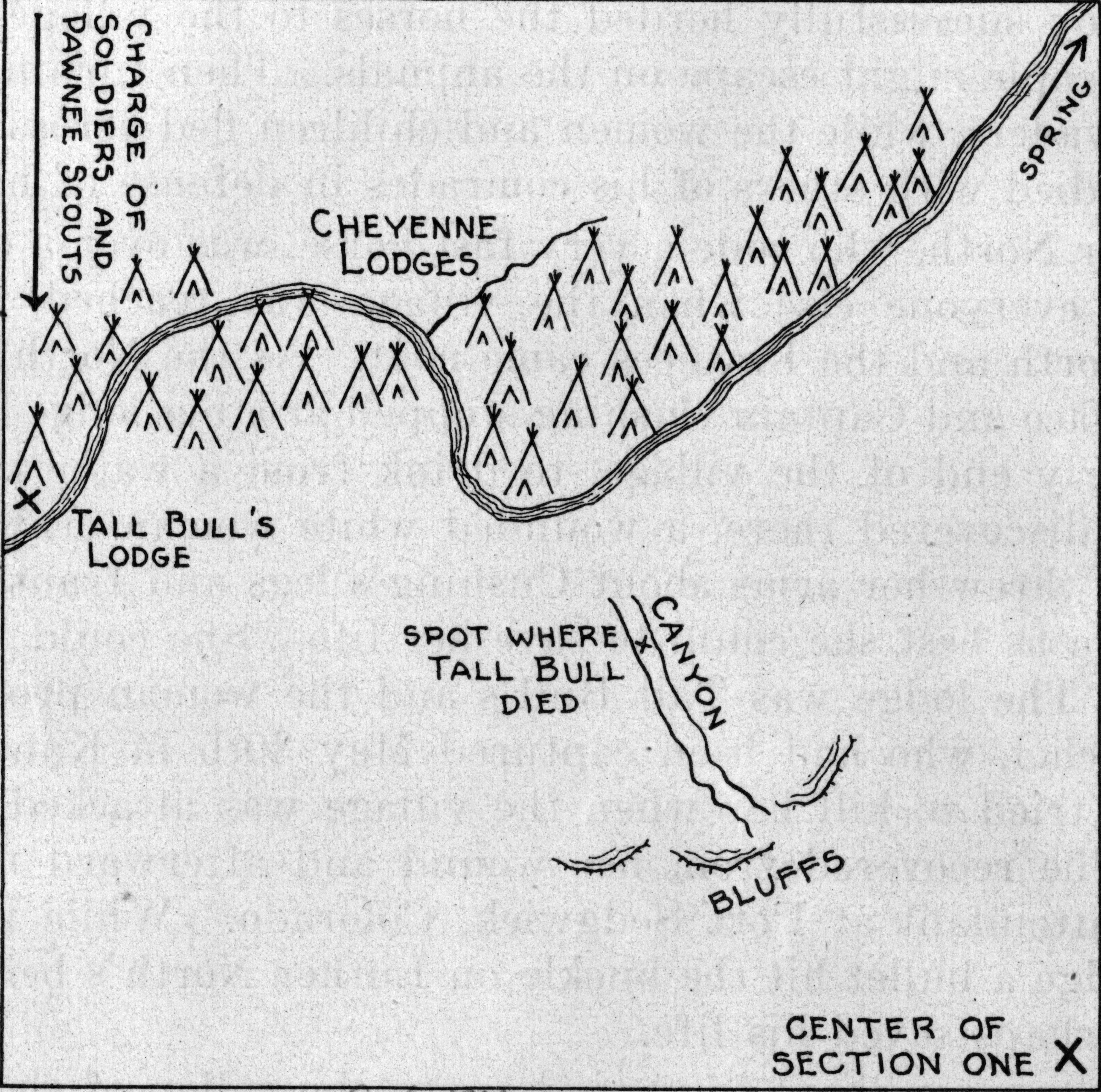
| Description | A map of the area where the Battle of Summit Springs took place. Included are the placements of Native American (Cheyenne) tepees along the stream, the direction from whence came the attack by soldiers and Pawnee scouts, the location of Tall Bull's tepee and place of his death in a canyon, and the bluffs above the canyon. | ||||||||||||||||||||
| Institution |
| ||||||||||||||||||||
| Subject | Indians of North America--War--Maps, Cheyenne Indians--War--Maps, Summit Springs, Battle of, Colo., 1869--Maps | ||||||||||||||||||||
| Source |  Catalog record Catalog record | ||||||||||||||||||||
| DPLA ID | 51a802cd566b0d245a34a481f67b571e | ||||||||||||||||||||
| Partnership |  This file was contributed to Wikimedia Commons by Denver Public Library as part of a cooperation project. The donation was facilitated by the Digital Public Library of America, via its partner Plains to Peaks Collective.  | ||||||||||||||||||||
| Permission | Copyright determination made by "Denver Public Library (Q69470198)" using RightsStatements.org
| ||||||||||||||||||||





File history
Click on a date/time to view the file as it appeared at that time.
| Date/Time | Thumbnail | Dimensions | User | Comment | |
|---|---|---|---|---|---|
| current | 13:27, 18 December 2020 | | 4,015 × 3,982 (1.8 MB) | DPLA bot | Uploading DPLA ID 51a802cd566b0d245a34a481f67b571e |
File usage
The following page uses this file:
