Size of this preview: 960 × 1,093 pixels. Other resolutions: 250 × 285 pixels | 500 × 569 pixels | 960 × 1,093 pixels | 1,920 × 2,187 pixels | 3,840 × 4,374 pixels.
Original file (4,390 × 5,000 pixels, file size: 5.51 MB, MIME type: image/png)
This is a file from the Wikimedia Commons. Information from its description page there is shown below.
Commons is a freely licensed media file repository. You can help.
Commons is a freely licensed media file repository. You can help.
Summary
| Description |
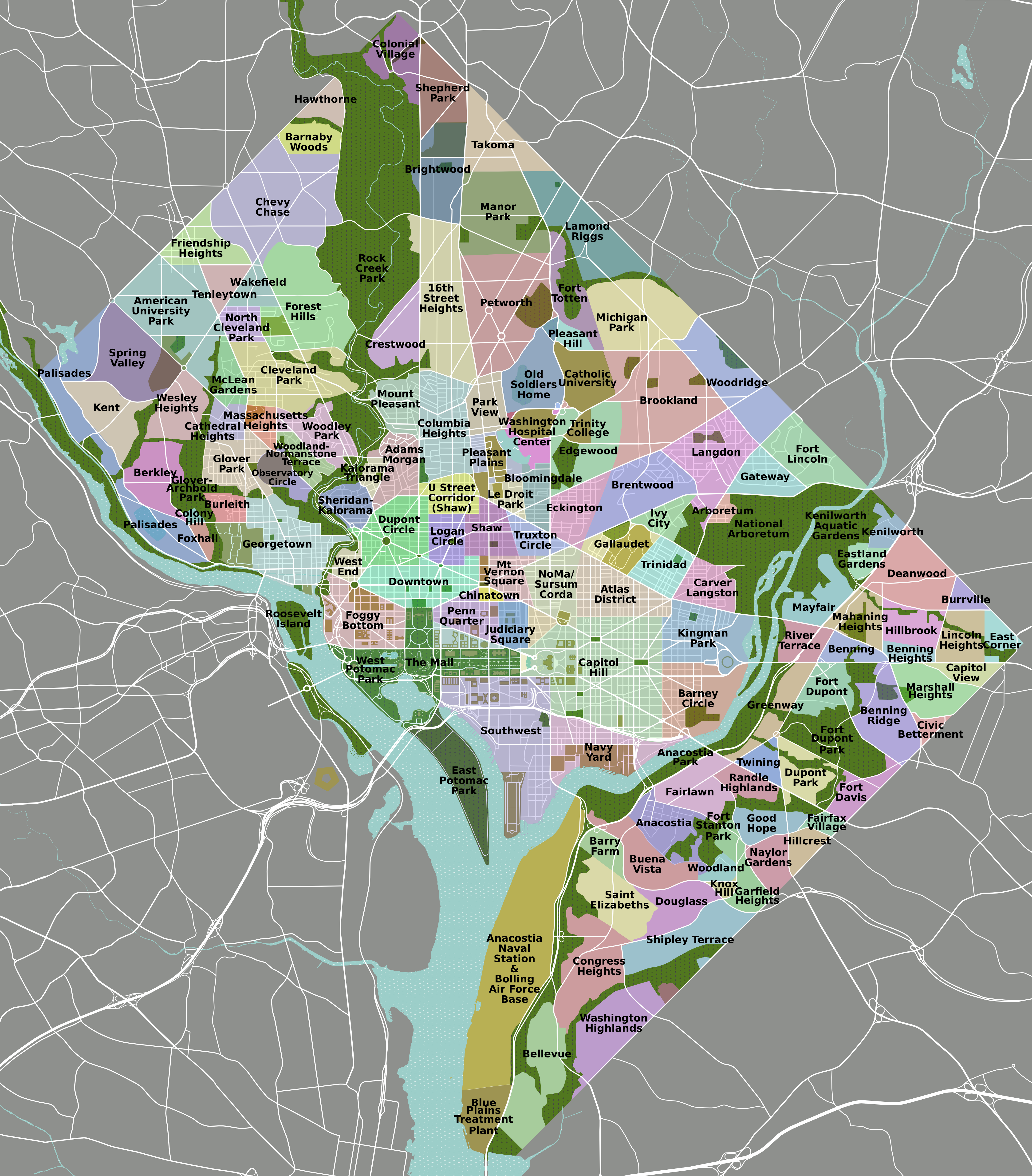
English: DC neighborhoods map, high resolution |
| Source | self-made, tracing done from PD satellite imagery |
| Author | Peterfitzgerald |
| Permission (Reusing this file) |
CC-by 3.0 |
| Other versions | File:DC neighborhoods map.png, SVG available on Wikitravel Shared, although it is not the current version, as Shared has a 8MB filesize limit... |
This image is of too high resolution to display properly on Wikimedia wikis (it appears), but I have uploaded it nonetheless, because I get a lot of requests for a it at a commercially usable resolution.
Licensing
I, the copyright holder of this work, hereby publish it under the following license:
This file is licensed under the Creative Commons Attribution 3.0 Unported license.
- You are free:
- to share – to copy, distribute and transmit the work
- to remix – to adapt the work
- Under the following conditions:
- attribution – You must give appropriate credit, provide a link to the license, and indicate if changes were made. You may do so in any reasonable manner, but not in any way that suggests the licensor endorses you or your use.
File history
Click on a date/time to view the file as it appeared at that time.
| Date/Time | Thumbnail | Dimensions | User | Comment | |
|---|---|---|---|---|---|
| current | 02:24, 2 September 2011 | | 4,390 × 5,000 (5.51 MB) | Peterfitzgerald | minor change |
| 02:13, 2 September 2011 |  | 4,390 × 5,000 (5.5 MB) | Peterfitzgerald | Lots of corrections and refinements | |
| 17:00, 6 January 2010 |  | 4,390 × 5,000 (5.4 MB) | Peterfitzgerald | {{Information |Description={{en|1=DC neighborhoods map, high resolution}} |Source=self-made, tracing done from PD satellite imagery |Author=Peterfitzgerald |Date= |Permission=CC-by 3.0 |other_versions=[[:File:DC neighborhoods map. |
File usage
The following 4 pages use this file:
Global file usage
The following other wikis use this file:
- Usage on incubator.wikimedia.org
- Usage on is.wikipedia.org
- Usage on lo.wikipedia.org
- Usage on mn.wikipedia.org
- Usage on mt.wikipedia.org
- Usage on simple.wikipedia.org
- Usage on si.wikipedia.org
- Usage on vep.wikipedia.org
- Usage on www.wikidata.org