Size of this preview: 415 × 422 pixels. Other resolution: 236 × 240 pixels.
Original file (415 × 422 pixels, file size: 14 KB, MIME type: image/png)
This is a file from the Wikimedia Commons. Information from its description page there is shown below.
Commons is a freely licensed media file repository. You can help.
Commons is a freely licensed media file repository. You can help.
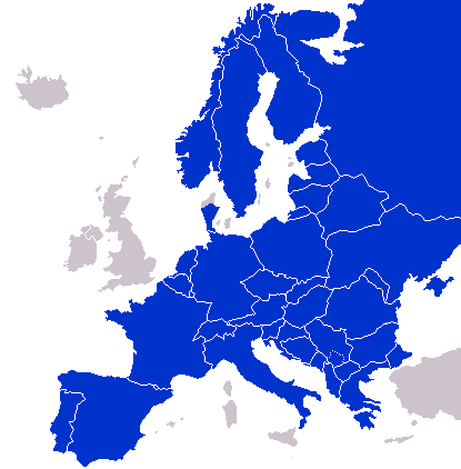
A map of Continental Europe.
| I, the copyright holder of this work, release this work into the public domain. This applies worldwide. In some countries this may not be legally possible; if so: I grant anyone the right to use this work for any purpose, without any conditions, unless such conditions are required by law. |
derivative works
Derivative works of this file: Kontinentet.png

|
File:Continental Europe map.svg is a vector version of this file. It should be used in place of this PNG file when not inferior.
File:Continental-Europe-map.png → File:Continental Europe map.svg
For more information, see Help:SVG. |
 |
File history
Click on a date/time to view the file as it appeared at that time.
| Date/Time | Thumbnail | Dimensions | User | Comment | |
|---|---|---|---|---|---|
| current | 20:40, 25 August 2025 | | 415 × 422 (14 KB) | Ruach Chayim | Reverted to version as of 10:18, 27 September 2008 (UTC) Kosovo is neutral |
| 22:33, 6 January 2025 |  | 415 × 422 (10 KB) | FireBreathMan | Reverted to version as of 10:06, 16 September 2008 (UTC) | |
| 01:47, 8 September 2023 |  | 415 × 422 (12 KB) | Sariyr | Exit Vendsyssel-Thy (Denmark) | |
| 08:06, 18 July 2009 |  | 415 × 422 (14 KB) | Hoshie | redid Kosovo/Montenegro borders based on Cradel's older map; anti-alasing has been removed. | |
| 10:18, 27 September 2008 |  | 415 × 422 (14 KB) | Hoshie | readded Kosovo in a different way. See talk. | |
| 03:18, 25 September 2008 |  | 415 × 422 (14 KB) | Hoshie | added Montenegro and fix the tripoint between Albania, Serbia/Kosovo and Montenegro | |
| 15:40, 16 September 2008 |  | 415 × 422 (10 KB) | Tocino | Reverted to version as of 00:00, 16 September 2008 | |
| 10:06, 16 September 2008 |  | 415 × 422 (10 KB) | Cradel | Reverted to version as of 20:45, 15 September 2008 | |
| 00:00, 16 September 2008 |  | 415 × 422 (10 KB) | Tocino | Reverted to version as of 17:25, 15 September 2008 | |
| 20:45, 15 September 2008 |  | 415 × 422 (10 KB) | Cradel | Reverted to version as of 11:56, 14 September 2008 |
File usage
The following page uses this file:
Global file usage
The following other wikis use this file:
- Usage on de.wikipedia.org
- Usage on pl.wikipedia.org