Size of this preview: 413 × 599 pixels. Other resolutions: 165 × 240 pixels | 590 × 856 pixels.
Original file (590 × 856 pixels, file size: 216 KB, MIME type: image/jpeg)
This is a file from the Wikimedia Commons. Information from its description page there is shown below.
Commons is a freely licensed media file repository. You can help.
Commons is a freely licensed media file repository. You can help.
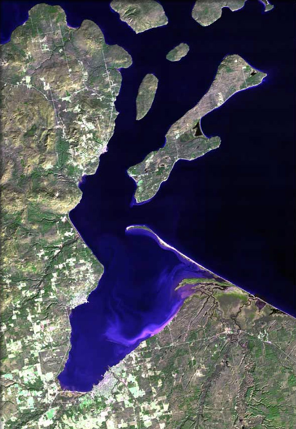
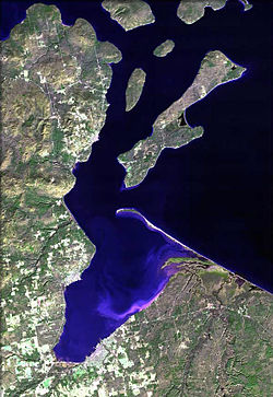
| Description | The raw satellite imagery shown in these images was obtain from NASA and/or the US Geological Survey. Post-processing and production by www.terraprints.com |
| Date | |
| Source | www.terraprints.com |
| Author | http://www.terraprints.com |
| Other versions |
.jpg)
This file is licensed under the Creative Commons Attribution 2.5 Generic license.
- You are free:
- to share – to copy, distribute and transmit the work
- to remix – to adapt the work
- Under the following conditions:
- attribution – You must give appropriate credit, provide a link to the license, and indicate if changes were made. You may do so in any reasonable manner, but not in any way that suggests the licensor endorses you or your use.
File history
Click on a date/time to view the file as it appeared at that time.
| Date/Time | Thumbnail | Dimensions | User | Comment | |
|---|---|---|---|---|---|
| current | 14:14, 7 April 2011 | | 590 × 856 (216 KB) | Ras67 | cropped |
| 18:30, 25 October 2006 |  | 669 × 1,000 (92 KB) | Terraprints | {{Information |Description=The raw satellite imagery shown in these images was obtain from NASA and/or the US Geological Survey. Post-processing and production by http://www.terraprints.com |Source=http://www.terraprints.com |Date=20061025 |Author=http:// |
File usage
The following 25 pages use this file:
- Antelope (shipwreck)
- Apostle Islands
- Apostle Islands Sled Dog Race
- Applefest (Bayfield, Wisconsin)
- Ashland, Wisconsin
- Ashland (town), Wisconsin
- Bayfield, Wisconsin
- Bayfield (town), Wisconsin
- Birch, Ashland County, Wisconsin
- Birch Hill, Wisconsin
- Book Across the Bay
- Chequamegon Bay
- Diaperville, Wisconsin
- Franks Field, Wisconsin
- New Odanah, Wisconsin
- Odanah, Wisconsin
- PS City of Ashland
- Pureair, Wisconsin
- Red Cliff, Wisconsin
- Salmo, Wisconsin
- Sanborn, Wisconsin
- Washburn, Bayfield County, Wisconsin
- Washburn, Wisconsin
- User:DNOVAK25/sandbox
- Template:Chequamegon Bay
Global file usage
The following other wikis use this file:
- Usage on ar.wikipedia.org
- Usage on ceb.wikipedia.org
- Usage on en.wikiquote.org
- Usage on es.wikipedia.org
- Usage on fr.wikipedia.org
- Usage on www.wikidata.org