
Size of this PNG preview of this SVG file: 550 × 550 pixels. Other resolutions: 240 × 240 pixels | 480 × 480 pixels | 768 × 768 pixels | 1,024 × 1,024 pixels | 2,048 × 2,048 pixels.
Original file (SVG file, nominally 550 × 550 pixels, file size: 1.46 MB)
This is a file from the Wikimedia Commons. Information from its description page there is shown below.
Commons is a freely licensed media file repository. You can help.
Commons is a freely licensed media file repository. You can help.
Summary
| Description | |
| Date | |
| Source | Own work |
| Author | Addicted04 |
-
 Argentina
 -
 Asia
Asia -
 Australia
 -
 Brazil
 -
 Canada
 -
 Chile
Chile -
 European Union
 -
 East Asia
 -
 Europe
 -
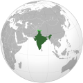 India
India -
 Indonesia
 -
 Iran
Iran -
 Japan
Japan -
 Malaysia
 -
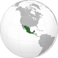 Mexico
 -
 Mongolia
 -
 North Korea
 -
 Paraguay
 -
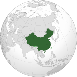
 People's Republic of China
 -
 Philippines
 -
 Russia
 -
 South America
 -
 South Korea
 -
 Union of Soviet Socialist Republics
 -
 United States
.svg)
.svg)
.svg)
.svg)
.svg)
.svg)

.svg)
.svg)
.svg)
.svg)
.svg)
.svg)
.svg)
.svg)
.svg)
.svg)
.svg)
.svg)
.svg)
_-_Crimea_disputed.svg)
.svg)
.svg)
.svg)
.svg)
Licensing
I, the copyright holder of this work, hereby publish it under the following license:
This file is licensed under the Creative Commons Attribution-Share Alike 3.0 Unported license.
- You are free:
- to share – to copy, distribute and transmit the work
- to remix – to adapt the work
- Under the following conditions:
- attribution – You must give appropriate credit, provide a link to the license, and indicate if changes were made. You may do so in any reasonable manner, but not in any way that suggests the licensor endorses you or your use.
- share alike – If you remix, transform, or build upon the material, you must distribute your contributions under the same or compatible license as the original.
| Annotations | This image is annotated: View the annotations at Commons |
File history
Click on a date/time to view the file as it appeared at that time.
| Date/Time | Thumbnail | Dimensions | User | Comment | |
|---|---|---|---|---|---|
| current | 04:51, 11 December 2025 | | 550 × 550 (1.46 MB) | NeoSyria | + bhutan disputes |
| 23:46, 15 July 2025 |  | 550 × 550 (1.46 MB) | Bokmanrocks01 | Reverted to version as of 19:37, 12 July 2025 (UTC) Return to lighter borders. As this is a map of China, there's no need to have stronger lines for other countries | |
| 06:46, 14 July 2025 |  | 792 × 792 (2.89 MB) | Addicted04 | Aksai Chin removed like in the last version. The map is a new map. | |
| 19:37, 12 July 2025 |  | 550 × 550 (1.46 MB) | Deathying | The Aksai Chin is Chinese-administered territory. Reverted to version as of 13:41, 3 June 2024 (UTC) | |
| 18:37, 11 July 2025 |  | 792 × 792 (2.89 MB) | Addicted04 | New map, Arunachal Pradesh, Aksai Chin, Taiwan | |
| 13:41, 3 June 2024 |  | 550 × 550 (1.46 MB) | NCG2GCN | Reverted to version as of 06:04, 11 February 2020 (UTC) The Chinese government has never given up its claim to the disputed area. (Google Translate) | |
| 18:39, 31 May 2024 |  | 720 × 722 (334 KB) | Rk5988 | Reverted to version as of 15:44, 25 July 2019 (UTC) | |
| 06:04, 11 February 2020 |  | 550 × 550 (1.46 MB) | 芄蘭 | Reverted to version as of 14:28, 31 July 2019 (UTC) | |
| 13:02, 10 February 2020 |  | 720 × 722 (334 KB) | Abhishek65628 | Reverted to version as of 15:44, 25 July 2019 (UTC) | |
| 14:28, 31 July 2019 |  | 550 × 550 (1.46 MB) | The Account 1 | Reverted to version as of 22:59, 22 October 2011 (UTC) China still claims Arunachal Pradesh |
File usage
The following 22 pages use this file:
- Borders of China
- China
- China and weapons of mass destruction
- Chinglish
- Istanbul Process
- LGBTQ rights in China
- List of Intangible Cultural Heritage elements in China
- List of companies of China
- List of sovereign states and dependent territories in Asia
- List of sovereign states and dependent territories in Eurasia
- Nuclear weapons of China
- Outline of China
- Talk:India/Archive 56
- Talk:Russia/Archive 16
- User:1aWIKIAL1,/sandbox
- User:DukeTheos/sandbox
- User:Falcaorib/Mongolia, China and Taiwan
- User:Lazz R/CountryGuide
- User:Shephard 96/sandbox
- Wikipedia:Templates for discussion/Log/2012 February 27
- Wikipedia talk:Manual of Style/China- and Chinese-related articles/Archive 7
- File talk:India (orthographic projection).svg
.svg)
Global file usage
The following other wikis use this file:
- Usage on am.wikipedia.org
- Usage on ar.wikipedia.org
- الصين
- مستخدم:جار الله/قائمة صور مقالات العلاقات الثنائية
- العلاقات الأنغولية الصينية
- العلاقات الصينية الإرترية
- العلاقات الألمانية الصينية
- العلاقات الصينية الليختنشتانية
- العلاقات الصينية البوليفية
- العلاقات الصينية الموزمبيقية
- العلاقات الصينية البلجيكية
- العلاقات الصينية الإثيوبية
- العلاقات الصينية البيلاروسية
- العلاقات الصينية الطاجيكية
- العلاقات الصينية الروسية منذ عام 1991
- العلاقات الصينية الرومانية
- العلاقات الصينية الغامبية
- العلاقات الصينية القبرصية
- العلاقات الصينية السيراليونية
- العلاقات الصينية النيبالية
- العلاقات الصينية الليبيرية
- العلاقات التشيكية الصينية
- العلاقات الصينية الميانمارية
- العلاقات الصينية الزيمبابوية
- العلاقات الصينية البالاوية
- العلاقات الصينية المالية
- العلاقات الصينية النيجيرية
- العلاقات الصينية الفانواتية
- العلاقات الصينية الغابونية
- العلاقات الصينية البنمية
- العلاقات الصينية الكوبية
- العلاقات الصينية الجورجية
- العلاقات التونسية الصينية
- العلاقات الصينية الهندية
- العلاقات الصينية الإيطالية
- العلاقات الصينية الناوروية
- العلاقات الأسترالية الصينية
- العلاقات الزامبية الصينية
- العلاقات الصينية الفيجية
- العلاقات الصينية المارشالية
- العلاقات الأذربيجانية الصينية
- العلاقات الصينية الكونغوية
- العلاقات الصينية الدومينيكانية
- العلاقات البرازيلية الصينية
- العلاقات الصينية الغرينادية
- العلاقات الصينية الكازاخستانية
- العلاقات الصينية الكوستاريكية
- العلاقات الصينية الصربية
- العلاقات الأرمنية الصينية
- العلاقات الصينية الهندوراسية
- العلاقات الصينية الإسواتينية
View more global usage of this file.