
Size of this preview: 500 × 714 pixels. Other resolutions: 250 × 357 pixels | 500 × 714 pixels | 960 × 1,370 pixels | 1,920 × 2,740 pixels.
Original file (1,648 × 2,352 pixels, file size: 2.2 MB, MIME type: image/png)
This is a file from the Wikimedia Commons. Information from its description page there is shown below.
Commons is a freely licensed media file repository. You can help.
Commons is a freely licensed media file repository. You can help.
| Description |
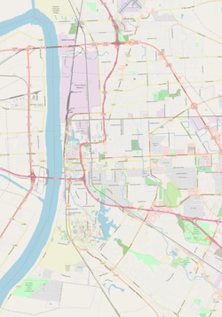
Map of Baton Rouge, Louisiana This map of Baton Rouge, Louisiana was created from OpenStreetMap project data, collected by the community. This map may be incomplete, and may contain errors. Don't rely solely on it for navigation. |
|||||||||
| Date | ||||||||||
| Source | You may find a page on the OpenStreetMap wiki page for Baton Rouge, Louisiana | |||||||||
| Creator |
OpenStreetMap contributors OpenStreetMap contributors |
|||||||||
| Permission (Reusing this file) |
OpenStreetMap data is available under the Open Database License (details). Map tiles are licensed under the Creative Commons Attribution-ShareAlike 2.0 license (CC-BY-SA 2.0).
This file is licensed under the Creative Commons Attribution-Share Alike 2.0 Generic license.
|
|||||||||
| Geotemporal data | ||||||||||
| Bounding box |
|
|||||||||
| Georeferencing | If inappropriate please set warp_status = skip to hide. | |||||||||
File history
Click on a date/time to view the file as it appeared at that time.
| Date/Time | Thumbnail | Dimensions | User | Comment | |
|---|---|---|---|---|---|
| current | 12:18, 7 May 2018 | | 1,648 × 2,352 (2.2 MB) | ProprioMe OW | {{Information |description ={{en|1=Map of Baton Rouge}} |source =OpenStreetMap |author =OpenStreetMap |date =2018-05-07 }} |
File usage
The following 16 pages use this file:
- Baton Rouge Magnet High School
- Baton Rouge National Cemetery
- City Park Golf Course
- Edmund Kirby Smith Hall
- LSU Campus Mounds
- Landolt Astronomical Observatory
- Magnolia Cemetery (Baton Rouge, Louisiana)
- Magnolia Mound Plantation House
- McKinley High School (Louisiana)
- Mount Hope Plantation House
- Prince Hall Masonic Temple (Baton Rouge, Louisiana)
- Reiley-Reeves House
- Roger Hadfield Ogden Honors College
- Module:Location map/data/Baton Rouge
- Module:Location map/data/USA Louisiana Baton Rouge
- Module:Location map/data/USA Louisiana Baton Rouge/doc
Global file usage
The following other wikis use this file:
- Usage on eo.wikipedia.org
- Usage on fr.wikipedia.org
- Usage on si.wikipedia.org