
Size of this PNG preview of this SVG file: 960 × 960 pixels. Other resolutions: 250 × 250 pixels | 500 × 500 pixels | 960 × 960 pixels | 1,280 × 1,280 pixels | 3,840 × 3,840 pixels.
Original file (SVG file, nominally 600 × 600 pixels, file size: 559 KB)
This is a file from the Wikimedia Commons. Information from its description page there is shown below.
Commons is a freely licensed media file repository. You can help.
Commons is a freely licensed media file repository. You can help.
Summary
| Description |
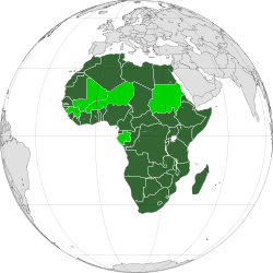
English: Map of the African Union with suspended states highlighted in light green |
||
| Date | |||
| Source | Own work | ||
| Author | Heraldry | ||
| Permission (Reusing this file) |
|
||
| Other versions |
|
||
| SVG development |

.svg)
.svg)
.svg)
.svg)
.svg)
.svg)
.svg)
.svg)
.svg)
.svg)
.svg)
.svg)
.svg)
.svg)
.svg)
.svg)
.svg)
.svg)
.svg)
.svg)
Licensing
I, the copyright holder of this work, hereby publish it under the following license:

|
Permission is granted to copy, distribute and/or modify this document under the terms of the GNU Free Documentation License, Version 1.2 or any later version published by the Free Software Foundation; with no Invariant Sections, no Front-Cover Texts, and no Back-Cover Texts. A copy of the license is included in the section entitled GNU Free Documentation License. |
| This file is licensed under the Creative Commons Attribution-Share Alike 3.0 Unported license. | ||
| ||
| This licensing tag was added to this file as part of the GFDL licensing update. |
File history
Click on a date/time to view the file as it appeared at that time.
.svg&useskin=minerva&dir=prev)
.svg&useskin=minerva&offset=20220131140902)
.svg&useskin=minerva&offset=&limit=20)
.svg&useskin=minerva&offset=&limit=50)
.svg&useskin=minerva&offset=&limit=100)
.svg&useskin=minerva&offset=&limit=250)
.svg&useskin=minerva&offset=&limit=500)
| Date/Time | Thumbnail | Dimensions | User | Comment | |
|---|---|---|---|---|---|
| current | 23:10, 15 September 2025 | | 600 × 600 (559 KB) | Danlaycock | update gabon |
| 15:18, 30 March 2025 |  | 600 × 600 (559 KB) | M.Bitton | Cleaner version of the stable map | |
| 17:21, 7 February 2025 |  | 549 × 549 (100 KB) | M.Bitton | Reverted to version as of 21:19, 12 September 2023 (UTC): obvious sock of Trantrongnam~conmonswiki | |
| 13:20, 7 February 2025 |  | 541 × 541 (239 KB) | Lukalovescats2 | Added Morrocco | |
| 13:19, 7 February 2025 |  | 550 × 550 (318 KB) | Lukalovescats2 | Removed disputed teritory | |
| 21:19, 12 September 2023 |  | 549 × 549 (100 KB) | Cherkash | Gabon suspended | |
| 15:27, 24 August 2023 |  | 549 × 549 (111 KB) | Bilykralik16 | Niger suspended | |
| 20:15, 23 August 2023 |  | 549 × 549 (110 KB) | - - Wiki Libre - - | Reverted to version as of 14:09, 31 January 2022 (UTC) | |
| 20:11, 23 August 2023 |  | 824 × 824 (296 KB) | - - Wiki Libre - - | ||
| 14:09, 31 January 2022 |  | 549 × 549 (110 KB) | Yunsu11 | fixes(?) |
File usage
The following 6 pages use this file:
Global file usage
The following other wikis use this file:
- Usage on af.wikipedia.org
- Usage on ar.wikipedia.org
- الاتحاد الإفريقي
- علم الاتحاد الإفريقي
- منظمة الوحدة الإفريقية
- الولايات المتحدة الإفريقية
- مستخدم:عمرو/الاتحاد الأفريقي
- البنوك المركزية والعملات في إفريقيا
- لجنة حكماء إفريقيا
- بنك التنمية الإفريقي
- مفوضية الاتحاد الإفريقي
- رئيس مفوضية الاتحاد الإفريقي
- الميثاق الإفريقي لحقوق الإنسان والشعوب
- البرلمان الإفريقي
- مهمة الاتحاد الإفريقي في السودان
- الاتحاد النقدي الإفريقي
- المجموعة الاقتصادية الإفريقية
- نشيد الاتحاد الإفريقي
- شعار الاتحاد الإفريقي
- مجلس السلام والأمن الإفريقي
- يوم إفريقيا
- المحكمة الإفريقية لحقوق الإنسان والشعوب
- نيباد
- الأمين العام لمنظمة الوحدة الإفريقية
- قالب:قالب الاتحاد الإفريقي
- رئيس منظمة الوحدة الإفريقية
- رئيس الاتحاد الإفريقي
- أقاليم الاتحاد الإفريقي
- بعثة الاتحاد الإفريقي في بوروندي
- محكمة العدل الإفريقية
- اللجنة الإفريقية لحقوق الإنسان والشعوب
- وحدة إفريقية
- مجموعة الدار البيضاء
- منطقة التجارة الحرة الإفريقية
- العملية المشتركة للاتحاد الإفريقي والأمم المتحدة في دارفور
- البنك المركزي الإفريقي
- بنك الاستثمار الإفريقي
- صندوق النقد الإفريقي
- قائمة الدول الأعضاء في الاتحاد الإفريقي
- إعلان سرت
- المحكمة الإفريقية للعدل وحقوق الإنسان
- انتخابات رئيس مفوضية الاتحاد الإفريقي 2025
- Usage on ary.wikipedia.org
- Usage on az.wikipedia.org
- Usage on ba.wikipedia.org
- Usage on be.wikipedia.org
- Usage on bn.wikipedia.org
- Usage on bs.wikipedia.org
- Usage on btm.wikipedia.org
- Usage on cs.wikipedia.org
- Usage on diq.wikipedia.org
View more global usage of this file.
.svg)
.svg)