
Abbottabad[a] is a city in the Hazara Division of Khyber Pakhtunkhwa, Pakistan. It is the headquarters of Abbottabad District and Abbottabad Tehsil. According to the 2023 census, Abbottabad had a population of 234,395. The city is located about 120 km (75 mi) north of the Islamabad–Rawalpindi area and 150 km (95 mi) east of Peshawar, at an elevation of about 1,256 m (4,121 ft).
Abbottabad
ایبٹ آباد | |
|---|---|
City | |
From top: Abbottabad city view; Pakistan Military Academy and Ayub Medical College; Shimla Hill and Ilyasi Masjid | |
  Abbottabad Location within Khyber Pakhtunkhwa  Abbottabad Location within Pakistan  Abbottabad Location within Asia | |
| Coordinates: 34°9′21″N 73°13′10″E / 34.15583°N 73.21944°E | |
| Country |  Pakistan Pakistan |
| Province |  Khyber Pakhtunkhwa Khyber Pakhtunkhwa |
| Division | Hazara |
| District | Abbottabad |
| Tehsil | Abbottabad |
| Founded | 1853 |
| Founded by | James Abbott |
| Named after | James Abbott |
| Government | |
| • Body | District Government |
| • Mayor | Shuja Nabi (PTI) |
| • Deputy Commissioner | Capt. (R) Sarmad Saleem Ikram |
| Elevation | 1,256 m (4,121 ft) |
| Population | |
• City | 234,395 |
| • Rank | 5th in Khyber Pakhtunkhwa |
| Abbottabad Cantonment: 159,683 Abbottabad Municipal Committee: 74,712 | |
| Demonym | Abbottabadi |
| Time zone | UTC+5 (PKT) |
| Calling code | 0992 |
| Website | abbotabad |


Abbottabad was founded in 1853 during British rule and was named after James Abbott, the first deputy commissioner of Hazara. It developed as a cantonment and administrative centre in the colonial period, later becoming part of the North-West Frontier Province and then Khyber Pakhtunkhwa. Parts of the city are administered as Abbottabad Cantonment, while the wider urban area also includes municipal administration.
The city is associated with education, healthcare, tourism and military institutions. It is home to institutions such as Ayub Medical College and the Abbottabad campus of COMSATS University Islamabad, while the Pakistan Military Academy is located at nearby Kakul. Abbottabad also serves as a market and transit centre for surrounding areas of the Hazara region and as a base for travel to nearby hill stations and destinations in northern Pakistan, including the Galyat region and the Kaghan Valley.
Etymology
The name Abbottabad combines the name of the city's founder, James Abbott, with the Persian-derived suffix ābād, meaning an inhabited place, settlement or town.[2] The name therefore means "Abbott's town". Abbottabad is one of two Pakistani cities commonly cited as being named after British army officers, the other being Jacobabad.[2]
History
Early history and founding
Before the colonial era, the area now occupied by Abbottabad formed part of rural Hazara. From the mid-18th to the early 19th centuries, the area was under the Durrani Empire, and it came under the Sikh Empire in 1820 when the region was conquered by forces led by Hari Singh Nalwa.[3] Haripur, founded by Nalwa in 1822, became the capital of Hazara before the establishment of Abbottabad.[4]
Following the Second Anglo-Sikh War, the East India Company annexed the Punjab region up to Peshawar. James Abbott, a British officer in the Bengal Army, served as deputy commissioner of Hazara from 1847 to 1853.[5] In January 1853, during his tenure, Abbott founded the town that became Abbottabad. The name, meaning Abbott's town, was adopted at the suggestion of Herbert Edwardes, another East India Company officer and administrator.[6]

Abbottabad replaced Haripur as the headquarters of Hazara District and developed as an administrative and military centre.[7] During this period, Hazara and much of what is now Khyber Pakhtunkhwa formed part of British India's Punjab Province.[8] Abbott later wrote the poem Abbottabad, which expressed his attachment to the town before his departure from India. A marble version of the poem is displayed in Lady Garden Park.[9]
British period
After the Indian Rebellion of 1857, the province passed from East India Company rule to the direct rule of the British Crown, and Abbottabad remained a military cantonment. During the rebellion, the 4th Sikhs, who had been stationed at Abbottabad, marched towards Ludhiana to prevent rebels from Jullundur crossing the Sutlej.[10] In 1867, following conflict in the Black Mountain area, the Khan of Agror was taken into British custody and sent to Abbottabad.[11]
The town and cantonment grew during the later 19th century. The 1881 census recorded a population of 4,189 people living in 918 houses, with about two-thirds of the population in the cantonment and about one-third in the civil station.[12] Abbottabad also served as a base for military activity connected with the Black Mountain expeditions of 1888 and 1891.[13]
On 9 November 1901, Lord Curzon, the British governor-general of India, established the North-West Frontier Province from the north-western districts of the Punjab, making Abbottabad part of the new province. In the early 20th century, Abbottabad was a military cantonment and sanatorium, and served as the headquarters of a brigade in the Second Division of the Northern Army Corps.[14] The garrison included Frontier Force infantry, Gurkha battalions and mountain batteries.[15]
In 1901, the population of Abbottabad town and cantonment was 7,764. It rose to 11,506 by 1911.[16] Public institutions recorded in the early 20th century included Anglo-Vernacular schools and a government dispensary.[15] On 24 August 1945, Jawaharlal Nehru, later the first prime minister of India, addressed a public meeting in Abbottabad after hearing of the death of Subhas Chandra Bose.[17]
Post-independence
Before the partition of British India, a referendum was held in the North-West Frontier Province to decide whether the province would join India or Pakistan; the result was in favour of joining Pakistan. After independence in 1947, the Pakistan Military Academy was established at Kakul, near Abbottabad, for the training of Pakistan Army officers.[18] In June 1948, the British Red Cross opened a hospital in Abbottabad to treat people injured during the conflict in Kashmir.[19]
In 1955, Abbottabad and the rest of the North-West Frontier Province became part of West Pakistan under the One Unit Scheme. The province was restored in 1970 under the Legal Framework Order, 1970, and Hazara later became a division with Abbottabad as its headquarters. The North-West Frontier Province was renamed Khyber Pakhtunkhwa in 2010 after the Eighteenth Amendment to the Constitution of Pakistan.
Recent history
Abbottabad was affected by the 2005 Kashmir earthquake. Most of the city survived, but many older buildings were destroyed or damaged, and the city received people displaced from Azad Kashmir after the earthquake.[20][21] In 2009 and 2010, Abbottabad also received internally displaced people from Swat District and Waziristan during military operations against militants.[21]
On 25 January 2011, Indonesian militant Umar Patek, a member of Jemaah Islamiyah, was arrested in Abbottabad. He was wanted in connection with the Christmas Eve 2000 Indonesia bombings and the 2002 Bali bombings.[22][23]
On 2 May 2011, Abbottabad gained international attention when United States forces killed Osama bin Laden in his compound in the city during the Abbottabad raid.[24][25] Pakistani authorities demolished the compound in February 2012.[26]
Demographics
Population
According to the 2023 census, Abbottabad had a population of 234,395, consisting of 159,683 people in Abbottabad Cantonment and 74,712 people in Abbottabad Municipal Committee.[1] The same census listed Nawan Shehr and Murree Gallies Cantonment as separate urban localities in Abbottabad District.[1]
Historical census figures show growth from 4,189 people in 1881. The population decreased between 1891 and 1901, and increased notably by 1941 during World War II. Historical figures are affected by changes in administrative boundaries and census definitions.
| Year | Pop. | ±% p.a. |
|---|---|---|
| 1881 | 4,189 | — |
| 1891 | 10,163 | +9.27% |
| 1901 | 7,764 | −2.66% |
| 1911 | 11,506 | +4.01% |
| 1921 | 13,620 | +1.70% |
| 1931 | 16,165 | +1.73% |
| 1941 | 27,424 | +5.43% |
| 1951 | 27,602 | +0.06% |
| 1961 | 31,036 | +1.18% |
| 1972 | 46,719 | +3.79% |
| 1981 | 65,996 | +3.91% |
| 1998 | 106,101 | +2.83% |
| 2017 | 207,989 | +3.61% |
| 2023 | 234,395 | +2.01% |
| Sources:[27][12][16][28][29][1] | ||
Religion
The 2023 census religion tables are published by district, tehsil and rural–urban classification rather than by each individual urban locality. In urban Abbottabad Tehsil, Islam was the largest reported religion in 2023, followed by Christianity.[30]
| Religious groups in Abbottabad City (1881−2023) | |||||||||||||||||||||
|---|---|---|---|---|---|---|---|---|---|---|---|---|---|---|---|---|---|---|---|---|---|
| Religious group |
1881[31][32][33] | 1891[34][35][36] | 1901[37][38] | 1911[39][40] | 1921[41][42] | 1931[43] | 1941[44] | 1951[45][46] | 2017[47] | 2023[48] | |||||||||||
| Pop. | % | Pop. | % | Pop. | % | Pop. | % | Pop. | % | Pop. | % | Pop. | % | Pop. | % | Pop. | % | Pop. | % | ||
Hinduism  [b] [b] |
2,151 | 51.35% | 5,170 | 50.87% | 4,438 | 57.16% | 6,828 | 59.34% | 7,346 | 53.94% | 7,753 | 47.96% | 11,886 | 43.34% | 2 | 0.01% | 57 | 0.02% | 50 | 0.02% | |
Islam  [c] [c] |
1,649 | 39.37% | 3,298 | 32.45% | 2,904 | 37.4% | 3,729 | 32.41% | 5,007 | 36.76% | 7,026 | 43.46% | 12,192 | 44.46% | 27,488 | 99.59% | 243,665 | 99.18% | 252,038 | 99.03% | |
Sikhism  |
306 | 7.3% | 1,504 | 14.8% | 329 | 4.24% | 785 | 6.82% | 879 | 6.45% | 1,039 | 6.43% | 2,680 | 9.77% | N/a | N/a | N/a | N/a | 18 | 0.01% | |
Christianity  |
N/a | N/a | 188 | 1.85% | 93 | 1.2% | 164 | 1.43% | 388 | 2.85% | 346 | 2.14% | 298 | 1.09% | N/a | N/a | 1,811 | 0.74% | 2,370 | 0.93% | |
Jainism  |
0 | 0% | 3 | 0.03% | 0 | 0% | 0 | 0% | 0 | 0% | 0 | 0% | N/a | N/a | N/a | N/a | N/a | N/a | N/a | N/a | |
Zoroastrianism  |
N/a | N/a | 0 | 0% | 0 | 0% | 0 | 0% | 0 | 0% | 1 | 0.01% | 0 | 0% | N/a | N/a | N/a | N/a | 2 | 0% | |
Ahmadiyya  |
N/a | N/a | N/a | N/a | N/a | N/a | N/a | N/a | N/a | N/a | N/a | N/a | N/a | N/a | N/a | N/a | 45 | 0.02% | 6 | 0% | |
| Others | 83 | 1.98% | 0 | 0% | 0 | 0% | 0 | 0% | 0 | 0% | 0 | 0% | 368 | 1.34% | 112 | 0.41% | 92 | 0.04% | 34 | 0.01% | |
| Total population | 4,189 | 100% | 10,163 | 100% | 7,764 | 100% | 11,506 | 100% | 13,620 | 100% | 16,165 | 100% | 27,424 | 100% | 27,602 | 100% | 245,670 | 100% | 254,518 | 100% | |
| 1881-1951: Data for the entirety of the town of Abbottabad, which included Abbottabad Municipality and Abbottabad Cantonment. 2017–2023: Urban population of Abbottabad Tehsil. | |||||||||||||||||||||
Languages
- Hindko (75.4%)
- Pashto (14.1%)
- Urdu (5.28%)
- Punjabi (2.60%)
- Kohistani (0.86%)
- Others (1.79%)
According to the 2023 census, Hindko was the most commonly reported mother tongue in urban Abbottabad Tehsil, spoken by 75.39% of the population. Pashto was reported by 14.08%, Urdu by 5.28%, Punjabi by 2.60%, Kohistani by 0.86% and other languages of Pakistan by 1.79%.[49]
Geography
Abbottabad is located in the Hazara Division of Khyber Pakhtunkhwa, northern Pakistan. The city lies north of the Islamabad–Rawalpindi metropolitan area and east of Peshawar, in the hill country between the plains of the Indus River and the mountain routes leading towards northern Pakistan and Kashmir.[7] It is situated at an elevation of about 1,256 m (4,121 ft) on a plateau at the southern end of the Rash, or Orash, Plain.[7][50]
A 2024 sustainable mobility study described Abbottabad as lying in the Orash Valley at about 1,250 m (4,100 ft) above sea level, in the foothills of the Hindu Kush and Karakoram ranges.[51] The city lies on road routes connecting the plains of the Indus River, the Kashmir region and northern Pakistan. Havelian, about 16 km (9.9 mi) south of Abbottabad, is the nearest railhead.[7]
The surrounding district contains mountainous and forested terrain. A 2004 strategy prepared by IUCN Pakistan and the Government of the North-West Frontier Province reported that forests covered about 20% of Abbottabad District and accounted for 5.4% of the province's forest resources, although the district made up 1.8% of the province's land area.[52] The same strategy identified soil erosion and watershed management as environmental concerns in the district, and recorded seven sub-watersheds, of which three were then covered by regular watershed programmes.[52] These figures refer to Abbottabad District rather than only the municipal city.
Climate
Abbottabad has a humid subtropical climate under the Köppen climate classification. Climate-Data.org gives Abbottabad an average annual temperature of 15.9 °C (60.6 °F) and average annual rainfall of 1,532 mm (60.3 in).[53] Average temperatures are lowest in January and highest in June. Rainfall occurs throughout the year, with the highest monthly totals in July and August during the summer monsoon period.[53]
| Climate data for Abbottabad | |||||||||||||
|---|---|---|---|---|---|---|---|---|---|---|---|---|---|
| Month | Jan | Feb | Mar | Apr | May | Jun | Jul | Aug | Sep | Oct | Nov | Dec | Year |
| Mean daily maximum °C (°F) | 11.6 (52.9) |
13.0 (55.4) |
17.9 (64.2) |
22.9 (73.2) |
27.8 (82.0) |
29.9 (85.8) |
27.9 (82.2) |
26.8 (80.2) |
26.1 (79.0) |
23.1 (73.6) |
18.2 (64.8) |
14.4 (57.9) |
21.6 (70.9) |
| Daily mean °C (°F) | 5.3 (41.5) |
7.1 (44.8) |
11.8 (53.2) |
16.8 (62.2) |
21.4 (70.5) |
24.2 (75.6) |
23.9 (75.0) |
23.0 (73.4) |
21.2 (70.2) |
17.0 (62.6) |
11.8 (53.2) |
7.5 (45.5) |
15.9 (60.6) |
| Mean daily minimum °C (°F) | −1.3 (29.7) |
0.4 (32.7) |
4.4 (39.9) |
9.0 (48.2) |
13.4 (56.1) |
17.2 (63.0) |
19.5 (67.1) |
18.8 (65.8) |
15.6 (60.1) |
10.2 (50.4) |
4.8 (40.6) |
0.3 (32.5) |
9.4 (48.8) |
| Average rainfall mm (inches) | 109 (4.3) |
185 (7.3) |
209 (8.2) |
149 (5.9) |
91 (3.6) |
95 (3.7) |
237 (9.3) |
201 (7.9) |
96 (3.8) |
47 (1.9) |
47 (1.9) |
66 (2.6) |
1,532 (60.4) |
| Source: Climate-Data.org[53] | |||||||||||||
Economy
Abbottabad functions as a market centre for Abbottabad District.[7] Its local economy is closely linked with services, education, tourism and its role as an administrative centre. At the district level, the Khyber Pakhtunkhwa Board of Investment and Trade identifies hospitality and tourism, education, mining and mineral development as sectors in which Abbottabad District has comparative advantages.[54]
Tourism forms an important part of the local economy. A working paper by the Pakistan Institute of Development Economics described tourism as a major component of Abbottabad city's economy and noted that the city also serves as a transit point for other destinations in northern Pakistan.[55] The same study reported that tourism-related activity was associated with local pressures including traffic congestion, price fluctuations, littering and noise pollution.[55]
In the wider district, economic activity includes subsistence agriculture, livestock and poultry rearing, forestry-related livelihoods, mining and small-scale industry. A fact sheet prepared in connection with IUCN's environmental fiscal reform work in Abbottabad described subsistence agriculture as the mainstay of the district economy, with additional household income from backyard poultry and livestock rearing.[56] The same source stated that mining in the district was limited, despite identified mineral deposits, and was mainly dominated by soapstone and limestone.[56] These descriptions refer to Abbottabad District rather than only the municipal city.
Government and administration
Abbottabad is the administrative centre of Abbottabad District and hosts several divisional and district offices. The district administration lists the offices of the Commissioner of Hazara Division, the Deputy Inspector General of Hazara Division, the Station Commander, the Military Estate Officer, the Deputy Commissioner of Abbottabad and the District Police Officer among government offices working in the district.[57]
District administration in Abbottabad is organised under the Khyber Pakhtunkhwa local government framework. According to an audit report by the Auditor General of Pakistan, district government activities are managed through the office of the Deputy Commissioner and district officers, including officers for education, health, agriculture, fisheries, population welfare, sports, livestock and dairy development, cooperation and social welfare.[58]
Abbottabad District is divided into four tehsils: Abbottabad, Havelian, Lower Tanawal and Lora.[58] Tehsil municipal administrations are managed by tehsil municipal officers, assisted by officers for finance, regulation and infrastructure.[58] Their functions include preparing local development plans, managing municipal services and infrastructure, exercising control over land use and zoning, regulating markets and services, issuing licences and permits, collecting local taxes and organising cultural and recreational events.[58]
Parts of Abbottabad are administered separately as Abbottabad Cantonment. The 2023 census counted Abbottabad Cantonment and Abbottabad Municipal Committee as separate urban localities.[59] Cantonments in Pakistan are administered under the cantonment system; the Cantonments Act, 1924 provides for a cantonment board and an executive officer for every cantonment.[60]
Municipal water and sanitation services are also handled through a separate public service company. A performance audit report by the Auditor General of Pakistan states that the Water and Sanitation Services Company Abbottabad was established by the Government of Khyber Pakhtunkhwa in April 2017, with water supply functions transferred from tehsil municipal administrations to the company through a services and asset management agreement.[61]
Tourism
Abbottabad has long been associated with summer tourism because of its hill-station setting and its location on routes into northern Pakistan. Encyclopaedia Britannica describes Abbottabad as a hill station and a summer resort, and identifies it as a gateway to the Kaghan Valley.[7] The Khyber Pakhtunkhwa Culture and Tourism Authority describes the city as a summer resort in a spacious valley about 1,250 m (4,100 ft) above sea level.[62]
The city also serves as a base for travel to nearby hill stations and natural areas in Abbottabad District and the wider Galyat region. A travel guide published by the Pakistan Tourism Development Corporation describes Abbottabad as a base for trips to the Kaghan Valley and the Gallies, and lists Shimla Hill and Ilyasi Masjid among places to visit in Abbottabad city.[63] The same guide identifies Harnoi as a picnic spot about 10 km (6.2 mi) northeast of Abbottabad on the main Nathia Gali road.[63]
Nathia Gali can be approached from both Murree and Abbottabad, and is about 38 km (24 mi) from each.[63] Ayubia National Park, located in Abbottabad District, was declared a national park on 17 January 1984 and covers about 3,375 ha (8,340 acres).[64] Other nearby destinations include Thandiani, which KP Tourism describes as a hill resort about 30 km (19 mi) east of Abbottabad at an altitude of about 2,800 m (9,200 ft).[62]
The wider Galyat area includes several trekking routes. The Galyat brochure lists routes including Nathia Gali to Mushkpuri, Dungagali to Ayubia, and Nathia Gali to Miranjani.[63]
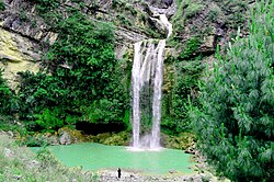
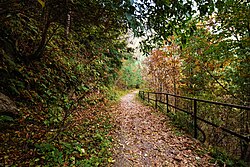 Pipeline Track in Ayubia National Park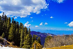


Abbottabad's road links also connect it with long-distance tourist routes into northern Pakistan. The Karakoram Highway connects Islamabad with Kashgar in Xinjiang, China, and passes through or near the Hindu Kush and Karakoram ranges.[65] As a result, Abbottabad is often used as a transit point for travel towards the mountain valleys and towns of northern Pakistan.
Tourism in Abbottabad District is seasonal. A working paper by the Pakistan Institute of Development Economics identified June to August as peak tourist months in the district, with March to May and September to October treated as normal tourist months and November to February as a lower-tourism period.[55] The same study reported that tourism-related activity was associated with local pressures including traffic congestion, price increases, littering and noise pollution.[55]
Culture and landmarks

Abbottabad's cultural landscape includes colonial-era civic buildings, religious sites, public gardens and museum collections associated with the wider Hazara region. The district administration lists several historical, archaeological and tourist attractions in Abbottabad, including Abbott House, St. Luke's Church, the Catholic Church, the Old Tehsil Building and Abbott Museum.[66]
St. Luke's Church is one of the city's main surviving colonial-era religious buildings. The church was built in 1864 during British rule and was originally established to serve British officials in the Indian subcontinent.[67] The church has retained features from its early period, including stained-glass windows, old locks, a pipe organ and memorial plaques.[67]
Lady Garden Park is another colonial-era landmark associated with the city's early history. A marble plaque in the park contains the poem Abbottabad, written by James Abbott, after whom the city is named.[68]
Abbottabad also has museum collections connected with the archaeology and ethnology of the Hazara region. The Hazara University Department of Archaeology states that it runs Abbott Museum in Abbottabad and Hazara University Museum, and that the museums contain archaeological and ethnological materials acquired through explorations, excavations, purchases and donations.[69] The Directorate General of Archaeology and Museums, Khyber Pakhtunkhwa also lists Abbottabad Museum among the museums managed by the provincial archaeology department.[70]
Ilyasi Masjid in Nawan Shehr is a religious and cultural landmark of Abbottabad. The mosque was built around 1927–1932 and is located near a natural stream at the foot of a hill.[71] Visit Silk Road describes it as a historical place in Nawan Shehr and states that it was built on a mountain spring in 1932.[72]
Education

Abbottabad has a concentration of school-level, higher-education and professional institutions in the Hazara Division. The district administration describes the city as a "city of schools and colleges" because of its public and private schools, colleges and universities.[73] The University of Engineering & Technology, Peshawar has also described Abbottabad as having gained fame as a city of schools and colleges.[74]
At the district level, a report by the Auditor General of Pakistan recorded 1,317 primary, 165 middle, 123 secondary and 30 higher secondary schools in Abbottabad District, and gave the district literacy rate as 56.6%.[58] The same report recorded enrolment of 135,494 students in boys' government schools and 118,258 students in girls' government schools in the district.[58] These figures refer to Abbottabad District rather than only the municipal city.
School-level institutions in and around Abbottabad include Army Burn Hall College, Abbottabad Public School, Pakistan International Public School and College and Army Public School and College, PMA Kakul campus.[74][75][76][77]
The city includes several higher-education and professional institutions. COMSATS University Islamabad operates an Abbottabad campus; the Higher Education Commission lists Abbottabad among the university's campuses.[78] The University of Engineering & Technology, Peshawar operates an Abbottabad Campus, which was inaugurated in October 2002 in the former premises of Ayub Medical College.[74] The campus lists departments and programmes in fields including electronics engineering, architecture, city and regional planning, computer science and software engineering.[74]
Ayub Medical College, a public medical college in Abbottabad, opened its first academic year on 15 May 1979 and later moved to its Mansehra Road campus in 1990.[79] The Pakistan Medical and Dental Council lists Abbottabad International Medical College, Frontier Medical College and Women Medical College among private medical colleges in Abbottabad.[80]
Pakistan Military Academy is located at Kakul, about 8 km (5.0 mi) northeast of Abbottabad, and provides officer training for the Pakistan Army.[7]
Healthcare
Abbottabad is a healthcare centre for the Hazara Division and surrounding areas of northern Pakistan. Public health services in Abbottabad District include primary and secondary facilities administered through district health authorities. A report by the Auditor General of Pakistan for audit year 2021–22 recorded 108 health facilities across the district, including 54 basic health units, 42 civil dispensaries, five rural health centres and three tehsil headquarters or Category-D hospitals.[81] The same report stated that the Department of Health used an Independent Monitoring Unit to monitor health facility performance through field-based data collection and district monitoring officers.[81] These figures refer to Abbottabad District rather than only the municipal city.
Ayub Medical and Teaching Institution, Abbottabad is a major tertiary care teaching hospital associated with Ayub Medical College. The hospital began working in 1995 and reached 1,000-bed status in 1998.[82] Its services include outpatient and inpatient care, general and specialised wards, accident and emergency care, intensive and cardiac care units, operation theatres, delivery suites, pharmacy, radiology and imaging, physiotherapy, blood bank and laboratory services.[82] The institution states that its catchment area includes the Hazara Division, Gilgit-Baltistan and Azad Kashmir.[82]
During the COVID-19 pandemic, a study of healthcare workers in hospitals of Abbottabad found that the pandemic negatively affected their quality of life.[83] In December 2020, a data from the National Command and Operation Centre, reported that Abbottabad had recorded the highest COVID-19 positivity ratio in Pakistan on reported dates that month.[84]
Sports
Cricket is one of the main organised sports associated with Abbottabad. Abbottabad Cricket Stadium, is listed by the Pakistan Cricket Board as a first-class cricket ground.[85] The ground has been used for domestic cricket; the PCB's 2024–25 Quaid-e-Azam Trophy schedule included matches at Abbottabad Cricket Stadium.[86]
Abbottabad has been represented in Pakistan's domestic cricket structure by regional teams. The Pakistan Cricket Board listed Abbottabad Region among the teams in the 2024–25 Quaid-e-Azam Trophy.[87] The former Abbottabad Falcons also appeared in national domestic cricket records, including Twenty20 and List A cricket competitions.[88]
The city also has facilities for field hockey. In 2021, the Government of Khyber Pakhtunkhwa had approved funds for reconstruction of Abbottabad Hockey Stadium, including installation of AstroTurf, floodlights, a sprinkler system, spectator stands and other improvements.[89]
Transport

Abbottabad is connected by road with the plains of the Indus River and the Kashmir region, and by rail through nearby Havelian.[7] Its position on routes between central Pakistan and the northern highlands has made the city an important transport point for movement towards northern Pakistan and areas along the Karakoram Highway.[90]
The Karakoram Highway is the principal interregional road corridor associated with Abbottabad. The highway connects Kashgar in Xinjiang, China, with Islamabad, Pakistan, and passes through or near the Hindu Kush and Karakoram mountain ranges.[65] A 2024 sustainable mobility study identified the Karakoram Highway as the main corridor for the first phase of a proposed bus rapid transit line in Abbottabad.[90]
A 2024 sustainable urban mobility factsheet reported that walking accounted for 64% of trips in the Abbottabad urban area, followed by informal public transport at 16%, formal public transport at 5%, private cars at 6%, private motorcycles or two-wheelers at 5%, and other modes at 4%.[90] The same source identified major urban mobility issues in the city, including vehicle inflows linked to tourism, commercial traffic passing through the city, limited alternative routes and parking areas, weak facilities for non-motorised transport, road-safety problems and vehicle-related air pollution.[90]
The nearest railway station is Havelian railway station in Havelian, about 16 km (9.9 mi) south of Abbottabad, which connects the area with Peshawar through the Pakistan Railways network.[7]
Notes
- ↑ /ˈæbətəbɑːd/ AB-ə-tə-bahd; Urdu and Hindko: ایبٹ آباد, romanised: aibṭabād, pronounced [ɛːbʈəˈbaːd]
- ↑ 1931-1941: Including Ad-Dharmis
- ↑ 1951: Including 3,316 Muhajirs.
References
- 1 2 3 4 Table 2: Urban Localities by Population Size and Their Population by Sex, Annual Growth Rate and Household Size, Census-2023, Khyber Pakhtunkhwa (PDF) (Report). Pakistan Bureau of Statistics. Retrieved 17 May 2026.
- 1 2 "Abbott's Abode". Language Log. University of Pennsylvania. 17 July 2011. Retrieved 6 December 2025.
- ↑ Gazetteer of the Hazara District, 1883–84. Punjab Government. 1884.
- ↑ Imperial Gazetteer of India. Vol. 13. Oxford: Clarendon Press. 1908. p. 55. Retrieved 6 December 2025.
- ↑ "Miscellaneous letters and papers of General Sir James Abbott (1807–96), Bengal Artillery 1823, Deputy Commissioner, Hazara 1847–53, including news of Hazara after Abbott left". The National Archives. Retrieved 6 December 2025.
- ↑ Allen, Charles (2001). Soldier Sahibs: The Men Who Made the North-West Frontier. London: Abacus. ISBN 9780349114569.
- 1 2 3 4 5 6 7 8 9 "Abbottabad". Encyclopaedia Britannica. Retrieved 17 May 2026.
- ↑ Maclagan, E. D. (1892). Census of India, 1891: The Punjab and its Feudatories. Imperial Tables and Supplementary Returns for the British Territory. Vol. 20, part 2. Calcutta: Government of India. Retrieved 5 December 2025.
- ↑ "The mystery behind Sir James Abbott's bizarre tribute to Abbottabad". The Express Tribune. 17 July 2019. Retrieved 10 December 2025.
- ↑ Roberts, Frederick Sleigh (1897). Forty-one Years in India: From Subaltern to Commander-in-Chief. Project Gutenberg. Retrieved 6 December 2025.
- ↑ Wylly, H. C. (1912). From the Black Mountain to Waziristan. Project Gutenberg. Retrieved 6 December 2025.
- 1 2 The Imperial Gazetteer of India (PDF). Vol. 1 (2nd ed.). Oxford: Clarendon Press. 1908. p. 51. Retrieved 5 December 2025.
- ↑ Wylly, H. C. (1912). From the Black Mountain to Waziristan. Project Gutenberg. Retrieved 6 December 2025.
- ↑ Abbottabad – Encyclopædia Britannica Eleventh Edition
- 1 2 "Abbottabad Town – Imperial Gazetteer of India, v. 5, p. 1". Digital South Asia Library. Archived from the original on 7 June 2011. Retrieved 17 December 2021.
- 1 2 "The Panjab, North-West Frontier Province, and Kashmir". Project Gutenberg. Retrieved 2 May 2011.
- ↑ "Important Speeches of Jawaharlal Nehru" (PDF). Internet Archive. The Indian Printing Works, Lahore. Retrieved 28 October 2025.
- ↑ "Pakistan Military Academy – Cadets Training". Pakistan Army. 25 January 1948. Archived from the original on 7 May 2011. Retrieved 17 December 2021.
- ↑ "Partition of India and Pakistan 1947 – British Red Cross". British Red Cross. Archived from the original on 21 March 2012. Retrieved 2 May 2011.
- ↑ "Doctor's diary". BBC News. 14 October 2005. Retrieved 17 December 2021.
- 1 2 "Hopes for bumper tourist season in Abbottabad". Dawn. 15 May 2011. Retrieved 17 December 2021.
- ↑ "Bali bombing suspect Umar Patek 'arrested in Pakistan'". BBC News. 30 September 2011. Retrieved 17 December 2021.
- ↑ "Militant's road ends in Pakistan". Dawn. 15 April 2011. Archived from the original on 15 April 2011. Retrieved 17 December 2021.
- ↑ Meckler, Laura; Entous, Adam; Hussain, Zahid (1 May 2011). "U.S. Forces Kill Osama bin Laden". The Wall Street Journal. Retrieved 17 December 2021.
- ↑ Adams, Richard; Walsh, Declan; MacAskill, Ewen (2 May 2011). "Osama bin Laden is dead, Obama announces". The Guardian. Archived from the original on 2 May 2011. Retrieved 17 December 2021.
- ↑ Ahmad, Jibran (26 February 2012). "Pakistan completes demolition of bin Laden compound". Reuters. Retrieved 17 May 2026.
- ↑ "Population by administrative units 1951-1998" (PDF). Pakistan Bureau of Statistics.
- ↑ "1891 Punjab Census (Parts I, II, III)" (PDF). Internet Archive. Retrieved 17 May 2026.
- ↑ Census of India, 1921, Vol. XVIII: North-West Frontier Province, Part II (Tables), Hazara District Town Tables
- ↑ Table 9: Population by Sex, Religion and Rural/Urban, Census-2023, Khyber Pakhtunkhwa (PDF) (Report). Pakistan Bureau of Statistics. Retrieved 17 May 2026.
- ↑ "Census of India, 1881 Report on the Census of the Panjáb Taken on the 17th of February 1881, vol. I." 1881. JSTOR saoa.crl.25057656. Retrieved 28 May 2026.
- ↑ "Census of India, 1881 Report on the Census of the Panjáb Taken on the 17th of February 1881, vol. II". 1881. p. 520. JSTOR saoa.crl.25057657. Retrieved 28 May 2026.
- ↑ "Census of India, 1881 Report on the Census of the Panjáb Taken on the 17th of February 1881, vol. III". 1881. p. 250. JSTOR saoa.crl.25057658. Retrieved 28 May 2026.
- ↑ "Census of India, 1891. General tables for British provinces and feudatory states". 1891. p. 68. JSTOR saoa.crl.25318666. Retrieved 28 May 2026.
- ↑ Maclagan, E. D. (1891). "The Punjab and its feudatories, part II--Imperial Tables and Supplementary Returns for the British Territory". Retrieved 28 May 2026.
- ↑ Maclagan, E. D. (1891). "The Punjab and its feudatories, part III--Imperial Tables and Supplementary Returns for the Native States". Retrieved 28 May 2026.
- ↑ "Census of India 1901. Vol. 1A, India. Pt. 2, Tables". 1901. p. 44. JSTOR saoa.crl.25352838. Retrieved 28 May 2026.
- ↑ "Census of India 1901. [Vol. 17A]. Imperial tables, I-VIII, X-XV, XVII and XVIII for the Punjab, with the native states under the political control of the Punjab Government, and for the North-west Frontier Province". 1901. p. 26. JSTOR saoa.crl.25363739. Retrieved 28 May 2026.
- ↑ Edward Albert Gait, Sir; India Census Commissioner (1911). "Census of India, 1911. Vol. 1., Pt. 2, Tables". Calcutta, Supt. Govt. Print., India, 1913. p. 23. JSTOR saoa.crl.25393779. Retrieved 28 May 2026.
- ↑ "Census of India 1911. Vol. 13, North-west Frontier Province : part I, Report; part II, Tables". 1911. p. 302. JSTOR saoa.crl.25394102. Retrieved 28 May 2026.
- ↑ "Census of India 1921. Vol. 1, India. Pt. 2, Tables". 1921. p. 25. JSTOR saoa.crl.25394121. Retrieved 28 May 2026.
- ↑ "Census of India 1921. Vol. 14, North-west Frontier Province : part I, Report; part II, Tables". 1921. p. 340. JSTOR saoa.crl.25430163. Retrieved 28 May 2026.
- ↑ Mallam, G. L.; Dundas, A. D. F. (1931). "Census of India, 1931, vol. XV. North-west frontier province. Part I-Report. Part II-Tables". Peshawar, Printed by the manager, Government stationery and printing, 1933. p. 257. JSTOR saoa.crl.25793233. Retrieved 28 May 2026.
- ↑ India Census Commissioner (1941). "Census of India, 1941. Vol. 10, North-West Frontier Province". p. 19. JSTOR saoa.crl.28215543. Retrieved 28 May 2026.
- ↑ "Census of Pakistan, 1951 Population According to Religion Table 6". Census Digital Library. Retrieved 28 May 2026.
- ↑ "North-West Frontier Province, Report & Tables, Vol-4 Pakistan - Census 1951". Census Digital Library. Retrieved 28 May 2026.
- ↑ "Final Results of Census-2017 Table-9 Population by sex, religion and rural/urban". Pakistan Bureau of Statistics. Retrieved 28 May 2026.
- ↑ "7th Population and Housing Census - Detailed Results Table-9 Population by sex, religion and rural/urban". Pakistan Bureau of Statistics. Retrieved 28 May 2026.
- ↑ Table 11: Population by Mother Tongue, Sex and Rural/Urban, Census-2023, Khyber Pakhtunkhwa (PDF) (Report). Pakistan Bureau of Statistics. Retrieved 17 May 2026.
- ↑ Imperial Gazetteer of India: Provincial Series, North-West Frontier Province. Calcutta: Superintendent of Government Printing. 1908. p. 139. Retrieved 17 May 2026.
- ↑ "Making Abbottabad an integrated city focused on sustainable mobility development". MobiliseYourCity. 11 March 2024. Retrieved 17 May 2026.
- 1 2 IUCN Pakistan (2004). Abbottabad: An Integrated Development Vision (Abbottabad Strategy for Sustainable Development) (PDF). Karachi: IUCN Pakistan and Government of the North-West Frontier Province. ISBN 969-8141-71-5. Retrieved 17 May 2026.
- 1 2 3 "Climate: Abbottabad". Climate-Data.org. Retrieved 17 May 2026.
- ↑ "Abbottabad District". Khyber Pakhtunkhwa Board of Investment and Trade. Retrieved 17 May 2026.
- 1 2 3 4 Shujahi, Ayesha; Hussain, Anwar (2016). Economic and Environmental Costs of Tourism: Evidence from District Abbottabad (PDF) (Report). Department of Environmental Economics Working Paper. Islamabad: Pakistan Institute of Development Economics. Retrieved 17 May 2026.
- 1 2 Environmental Fiscal Reform in Abbottabad: Poverty Alleviation and Environmental Conservation (PDF) (Report). International Union for Conservation of Nature Pakistan. Retrieved 17 May 2026.
- ↑ "Departments". District Administration Abbottabad. Government of Khyber Pakhtunkhwa. Retrieved 17 May 2026.
- 1 2 3 4 5 6 Audit Report on the Accounts of District Government Abbottabad, Audit Year 2021-22 (PDF) (Report). Auditor General of Pakistan. 7 September 2021. Retrieved 17 May 2026.
- ↑ Table 2: Urban Localities by Population Size and Their Population by Sex, Annual Growth Rate and Household Size, Census-2023, Khyber Pakhtunkhwa (PDF) (Report). Pakistan Bureau of Statistics. Retrieved 17 May 2026.
- ↑ The Cantonments Act, 1924 (PDF) (Report). Ministry of Defence, Government of Pakistan. Retrieved 17 May 2026.
- ↑ Performance Audit Report on Effectiveness of Water and Sanitation Services Company Abbottabad (PDF) (Report). Auditor General of Pakistan. Retrieved 17 May 2026.
- 1 2 "Abbottabad". KP Tourism. Khyber Pakhtunkhwa Culture and Tourism Authority. Retrieved 17 May 2026.
- 1 2 3 4 "Galyat Brochure" (PDF). Pakistan Tourism Development Corporation. Retrieved 17 May 2026.
- ↑ "National Parks". Khyber Pakhtunkhwa Wildlife Department. Retrieved 17 May 2026.
- 1 2 "Karakoram Highway". Encyclopaedia Britannica. Retrieved 17 May 2026.
- ↑ "Attractions". District Administration Abbottabad. Government of Khyber Pakhtunkhwa. Retrieved 17 May 2026.
- 1 2 Jabeen, Yusra (2 May 2024). "In scenic Abbottabad, an old church tells a tale of religious unity, colonial heritage". Arab News. Retrieved 17 May 2026.
- ↑ Khan, Turyal Azam (17 October 2019). "The mystery behind Sir James Abbott's bizarre tribute to Abbottabad". The Express Tribune. Retrieved 17 May 2026.
- ↑ "Department of Archaeology". Hazara University. Retrieved 17 May 2026.
- ↑ "Museums". Directorate General of Archaeology and Museums, Khyber Pakhtunkhwa. Retrieved 17 May 2026.
- ↑ "Ilyasi Mosque: A Pearl in Abbottabad". Youlin Magazine. 1 August 2019. Retrieved 17 May 2026.
- ↑ "Ilyasi Masjid". Visit Silk Road. Retrieved 17 May 2026.
- ↑ "Education Department". District Administration Abbottabad. Government of Khyber Pakhtunkhwa. Retrieved 17 May 2026.
- 1 2 3 4 "Abbottabad Campus". University of Engineering & Technology, Peshawar. Retrieved 17 May 2026.
- ↑ "Introduction". Army Burn Hall College for Boys. Retrieved 17 May 2026.
- ↑ "About PIPS". Pakistan International Public School and College. Retrieved 17 May 2026.
- ↑ List of Army Public Schools and Colleges (PDF) (Report). Army Public Schools and Colleges System Secretariat. Retrieved 17 May 2026.
- ↑ "COMSATS University, Islamabad". Higher Education Commission. Retrieved 17 May 2026.
- ↑ "About". Ayub Medical College. Retrieved 17 May 2026.
- ↑ "Private Medical Colleges". Pakistan Medical and Dental Council. Retrieved 17 May 2026.
- 1 2 Audit Report on the Accounts of District Government Abbottabad, Audit Year 2021-22 (PDF) (Report). Auditor General of Pakistan. 7 September 2021. Retrieved 17 May 2026.
- 1 2 3 "About Us". Ayub Teaching Hospital. Ayub Medical and Teaching Institution Abbottabad. Retrieved 17 May 2026.
- ↑ Noor-ul-Huda; Arshad, Saamia; Lodhi, Fahad Saqib; Rabbani, Unaib; Anis, Salwa; Minhaj-bin-Misbah (2021). "Impact of the COVID-19 pandemic on quality of life of health care workers in Pakistan". Journal of Ayub Medical College Abbottabad. 33 (4, Suppl. 1): 778–787. PMID 35077626.
- ↑ Junaidi, Ikram (28 December 2020). "Abbottabad sees highest Covid-19 positivity ratio, again". Dawn. Retrieved 17 May 2026.
- ↑ "First Class Grounds". Pakistan Cricket Board. Retrieved 17 May 2026.
- ↑ "Quaid-e-Azam Trophy 2024/25". Pakistan Cricket Board. Retrieved 17 May 2026.
- ↑ "Quaid-e-Azam Trophy 2024/25 Teams". Pakistan Cricket Board. Retrieved 17 May 2026.
- ↑ "Abbottabad Falcons FC+LA+T20 matches team series results". ESPNcricinfo. Retrieved 17 May 2026.
- ↑ "Rs115.2m for Abbottabad stadium approved". Dawn. 28 January 2021. Retrieved 17 May 2026.
- 1 2 3 4 Abbottabad, Pakistan (PDF) (Report). MobiliseYourCity. March 2024. Retrieved 17 May 2026.


